Team:
Nohelia Gonzalez
Han Jin Yang
Ekaterina Levkina
Saad Saheen
The aim of the texture analysis was to be able to automatically identify different types of vegetation, bare lands, agricultural areas, among others from the 3d model generated.
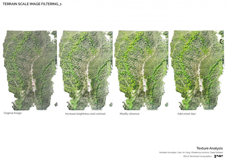
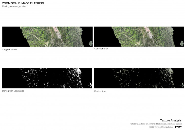
Different filters were applied to the aerial image in order to increase the differentiation between the textures and colors on the image.
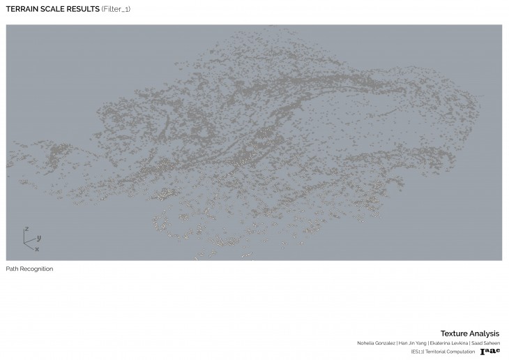
By using a grasshopper script, we were able to choose a color and build a mesh out of the areas with similar shade (controlled by a threshold). However the filters previously applied were not enough to make a recognizable difference and the resulting mesh was not able to cluster valuable information.
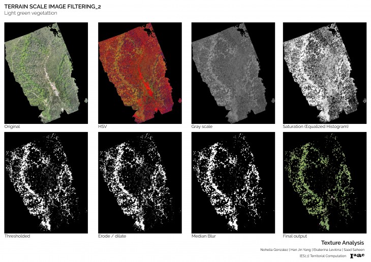
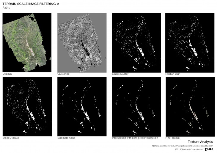
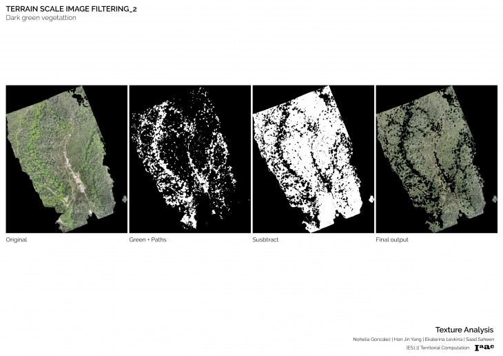
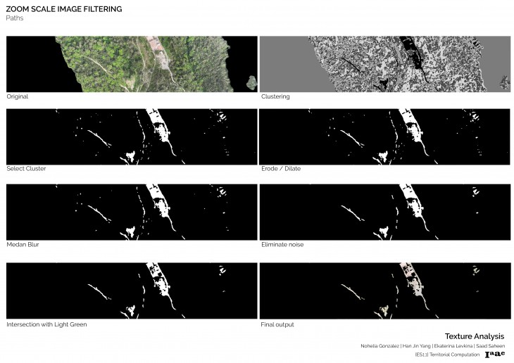
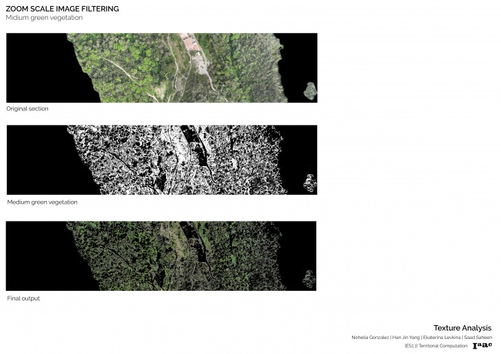
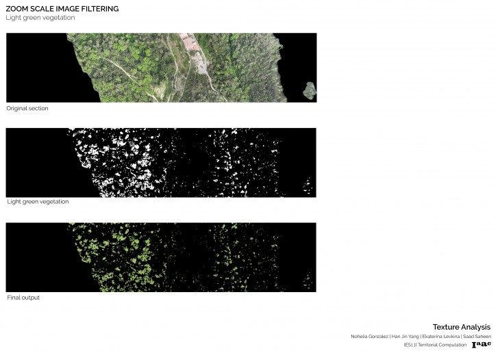
We moved forward to a more specific image processing algorithm by using the OpenCV framework. We realized that the different types of vegetation were more easily differentiated in the HSV (Hue, saturation, value) color space than in the original RGB space. Therefore, we transformed the image to the HSV space and, applying a equalization of its histogram, we were able to use a thresholding operator to successfully identify the vegetation. Some postprocessing filters were used to remove noisy points (e.g. erosion, dilation and blur). In order to identify the paths, we applied a clustering algorithm that aggregates pixels with the same colors and applied the aforementioned postprocessing techniques to remove noisy blobs.
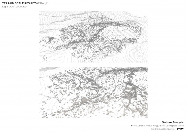
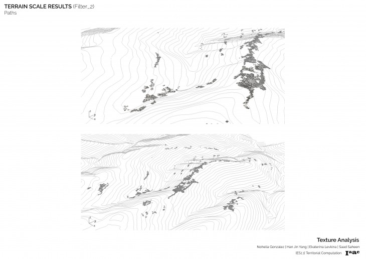
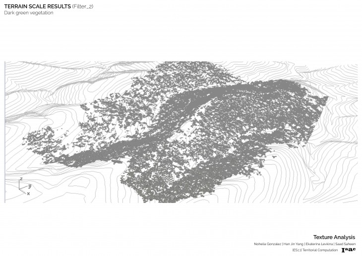
In a big scale we were able to identify 2 vegetation colors and paths.
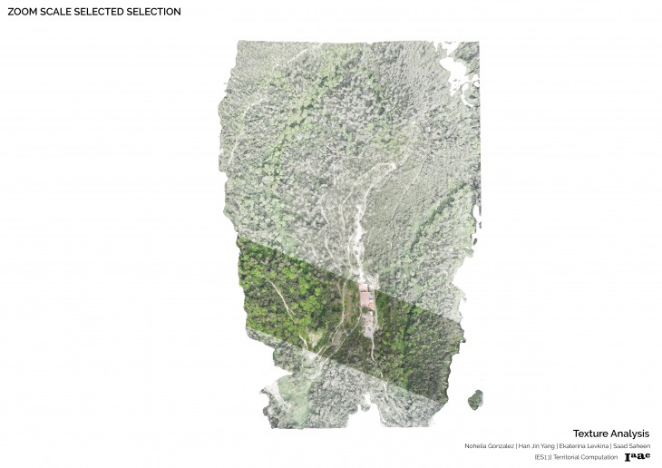
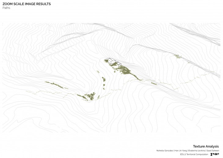
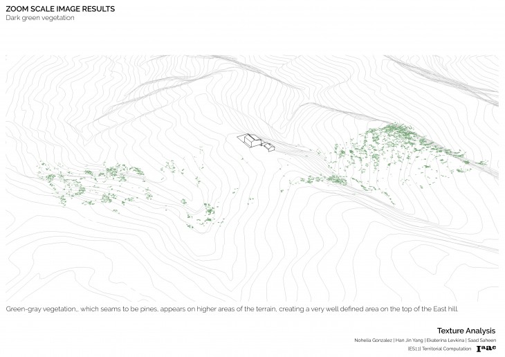
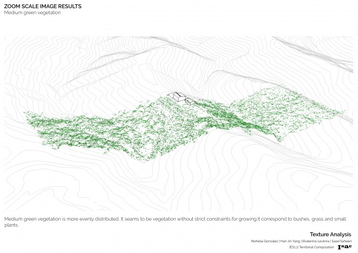
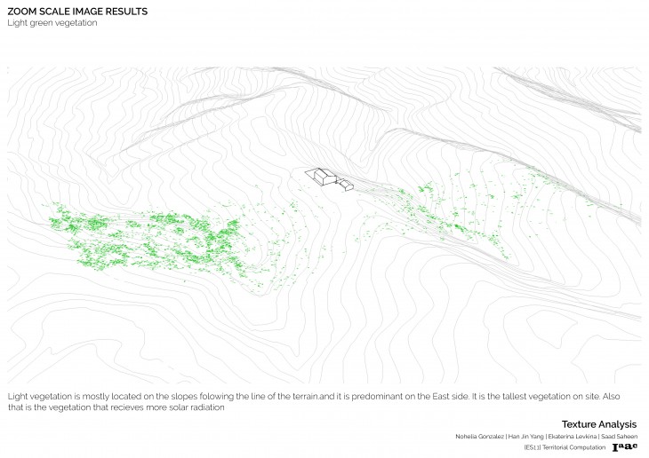
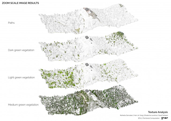
We chose an area for filtering in a higher resolution and from this one we were able to find 3 vegetation colors and the paths. Bare land areas were not automatically found.
Finally, the results were displayed on a particle-like mesh and projected on the original one.

