A Sustainable Legacy
Metro in Quito Worth It?
Metro in the city of Quito
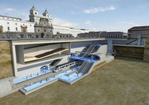
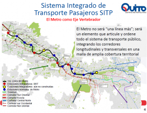
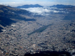
The project for building a metro in the city of Quito has being developing and changing for the last years but with an uncertain outcome, so it is worth it? First I would like to talk a little bit about Quito; the city is located in the Andes region at two thousand meters height, it’s restricted by two mountains so the growth of the city has been in a linear pattern so the all the city traffic flows in a linear way. The Projects value it’s estimated to cost around three thousand million dollars.
So a city like Quito really needs a metro, we already have a mass transport called Trole that it’s not working properly for a lot of factors, such poor design and planning and the most part for a lack of maintenance and implementation, The Metro project has to overcome a lot of technical issues including the preservation of the Historical center of the city that is more than four hundred years all and its at risk of being destroyed if the planning it’s not correct. How this massive project will affect and improve the way of life for the inhabitants of Quito, the first part of the project will be the construction of one line that will cover a longitude of 23 km across the city with 16 stations located in important spots of the city.
The city is lacking of basic implementations and services such as hospitals and cultural places urban places like parks and plazas, for me is not the moment for building and investing so much money in a project that is not Profitable and it’s not going to improve in a significant way the life quality of the inhabitants, and also the project its being used as a façade for a political platform in a very corrupt country that doesn’t care if the planning its done correctly but it’s an opportunity to divert funds, the same thing happened with the new airport of the city that was budgeted In three hundred millions and end up costing around seven hundred and the worst of all, the new airport doesn’t meet the city needs and its already obsolete. We can expect the same thing it’s going to happen with this new massive project. First improving and solving the existing issues of the already implemented mass transport with a relative small amount of the original budget, and with the rest start investing in different urban scales projects focusing on renewable energies and the directly interaction with pedestrians, and step by step ending our need of using car by providing alternative ways of transport ,this not only will benefit and solve all the movement and connections issue of the city but also in a way with the pass of time this it’s going to change the behavior of the people.
All these different projects will also serve as a catapult to boost the local economy by creating iconic places for recreation and commerce in strategically selected places to reduce the necessity of moving and buying goods from outer places but instead trying to produce and satisfied all the requisites of the site locally. Architecture should be a way of solving issues by improving the quality of life of the people living in a certain place by providing and satisfying all the needs with future proof elements that are capable of adapting to all the environmental changes and be self-sufficient or at least take advantage of all the resources in a efficient manner, I don’t think that the metro project is a viable solutions for the city, I think that Latin America cities should learn from all the mistakes that first world countries have already confront and lived , for example Barcelona it’s a city that’s been learning from a long process of changing to reach the great final outcome that these city is living now a days with a great urban infrastructure and a high standard of living by thinking first on the persons and their needs instead of the cars.
By way of introduction, I would like to point out that the gap between cities and rural areas have been increased more than ever before because of the rapid economic development in these day and age. So personally, I think a right policy, an investment program as well as good design strongly play an important role to shape current urban realities.
First of all, if urban and rural areas unplanned or disconnected, thereby leading to a lack of or poor urban infrastructure and social engineering, environmental pollution and landscape degradation. Additionally, the quality of life of city dwellers is improved, many people in rural areas tend to move to the cities to seek a better life with higher level of amenity. Consequently, the cities are not adequate space to cover a great number of people to live in, which results in the deterioration in the standard of living, for example, the services of health care are affected due to the annually overloaded hospitals. Furthermore, this problematic issue lays strain on the environment. Because of the proliferation of population in the cities, an enormous amount of waste are dumped into the environment everyday that leads to the heavy pollution. Last but not least, that the standard of living in cities outpaces that in the countryside gives rise to the discontent and social unrest. It inevitably widens the gap between the rich and the poor in society. For example, the underprivileged in remote regions are deprived of access to basic entertainment like theater or farmers in rural areas have to make ends meet everyday, however, rare still stuck in the vicious cycle of poverty.
On the other hand, A good urban design can meaningfully effected to the relationship between cities and rural areas such as improve the quality of life in the countryside, not only the quality of public transport services but also the public awareness should be raised offering a good health service to prolong life and encouraging people to retire in the countryside should also be considered, that helps attract more people to live in the rural areas.
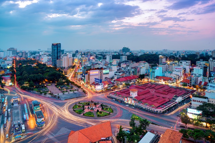
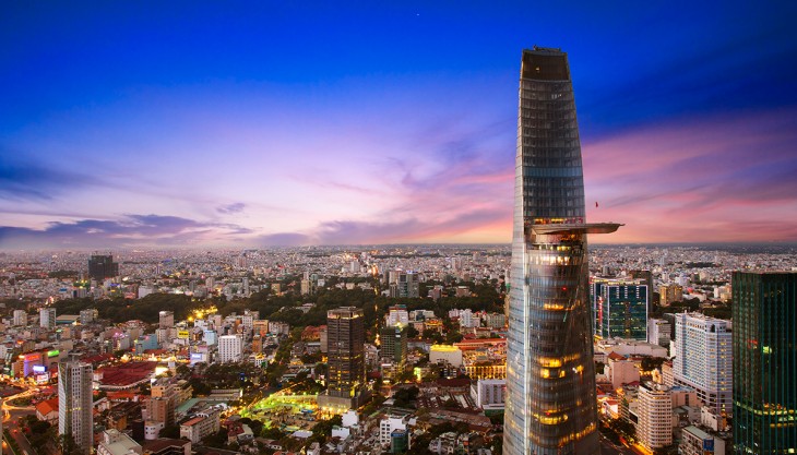
Regarding to an example of the economic performance of country has been effected to urban design, I would like to present Ho Chi Minh city which locate in southern area in Vietnam.
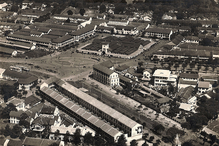
Over 100 years ago, Ho Chi Minh city was planning very regulated, similar to chess board with unique accents such as Notre Dame Cathedral, Central Post Office, Opera House and Ben Thanh. The building density, green, area roads are reached “golden ratio”. But this concept of “golden ratio” is gone, replaced by “golden land”. Little development occurred from 1975 to 1986 in Vietnam’s a stagnant, post-war economy, almost vacant land, villas, offices in the center also become a land of gold and often land high-rise building with “economic efficiency”.
To be more specific, there are many important events and changes in the population and built with a population of 5 million people on the day the war ended in 1975. Ho Chi Minh city quickly turned into a political headquarters, a commercial center and a huge military base. There are a lot of urban infrastructure, modern high-rise buildings, industrial and commercial buildings, major ports and most of the palace, the former head of France was reserved. A new feature of Saigon is a massive apartment building, especially Thanh Da apartment building complete apartment-style housing, with certain markets, schools, health clinics, cinemas, playgrounds, gardens, internal roads. Numerous large hospital birth as Cho Ray. Many hospitals especially by the United States Congress building in Cholon. Especially important is the Saigon is equipped modern infrastructure: highways, bridges, airports, harbor international standards, system utilities and new sewers.
The development of the city almost frozen for 15 to 1975, but after opening, since 1990, is experiencing an “urban explosion” a second time (after the first outbreak in decades 1960), had a positive impact and made it to become one of the most of dynamic and populous city in Southeast Asia. In 1990, a hug investment from foreign countries has quickly created a new face for the city. Twenty years ago, many large-scale urban projects such as Saigon South, buildings downtown, the release of Thi Nghe canal, East-West Highway, Tan Tao Industrial Park, the Thu Thiem project, Hung Temple, Ga aviation Tan Son Nhat international, the Saigon River bridges, the subway system is clear and will change the face of the open city.
Saigon South Urban which is foreign investment in the construction aims to create a new urban area next to the central business district. the master plan designed by the company’s largest US SOM (Skidmore, Owings & Merrill) implementation has won the honor of the AIA (American Association of Architects) in 1997 and was rated as a plan the most complete city put into the ocean and connected to Mekong Delta. This new urban area has become a typical pattern for modern urban development in Vietnam.
However, the most significated project is a renovation of Nhieu Loc-Thi Nghe canal, as it relates to a million people living in the locality urban districts, people who were residing in the polluted canals with the lowest incomes. This is a great achievement of the new government in the past because the former Saigon government was unable to do so.
Recently, the city has selected the company’s plans for urban planning consultant Sasaki US targets built on 770 hectares of land Thu Thiem district successfully brought the “century mark”. This is an architectural-urban scale, ambitious other cities, focusing the business district, houses, squares, recreation, tourism resorts urban nature Europe territory, is expected to connect with the old downtown Saigon and belt by 5 bridge, a tunnel. Nikken Sekkei plan to renovate and expand the center of trade-finance and heritage city is booted, connect with new urban area of Thu Thiem district.
Currently there are 15 industrial parks and export processing new (Tan Thuan, Linh Trung, Tan Tao) accounted for 6000 hectares with 980 enterprises. Especially the high-tech zones, software District 9, Quang Trung, the National University of Ho Chi Minh City in Thu Duc is another highlight of the city towards the knowledge society in the future.
The stock market in Vietnam first appeared here at the center of finance and other services in the triangular trade-finance avenues Ham Nghi, Ben Chuong Duong, Nguyen Hue. The shopping centers, supermarkets large bustling trade is a new face of the city today.
Compared to the old city center of Saigon by the French planning in the 19th century, the center of Ho Chi Minh City today showing strides of a municipality under 500 thousand people to a city nearly 8 million people, with 930 ha east bank of the Saigon River – including District 1 and part of three neighboring counties (District 3, District 4, and Binh Thanh), 657 hectares west bank of the Saigon River – including Thu Thiem District 2.
Plan of the existing center expansion will affect a lot to the economic and social life of the people. The total area of building floor space will increase, while the population remains, which means the rate per capita m2 area will increase, but the price of real estate is very expensive area. So take into account the priority right to build a new community in the periphery or in the Thu Thiem have good quality of life, with good transport links to the District 1, to facilitate people displaced workers out there with decent housing, more affordable with new jobs. Besides still convenient for those who still hold jobs in their current center.
In addition, construction area of downtown adding to serve the people of the city and visitors. So the first step to build traffic priority multicenter connect people everywhere can go downtown to work, study and entertainment in a convenient manner.
The development of high-rise buildings in the city. Ho Chi Minh City, Hanoi and Vietnam’s cities have been spontaneous, unplanned. So not only did not bring stimulate economic development in urban areas, but also for traffic congestion, flooding, lack of electricity and water in the center of increasingly worse.
One solution is to identify high-rise high-rise core area for each urban center and the fashion avenue of tall buildings, combined with efficient public transport system.
In Ho Chi Minh City, we should identify the core area of tall center for the whole area is located in the East and West sides of the border according to the Le Loi – Ton Duc Thang extended to Thu Thiem Bridge – Axis detour supply Thu Thiem – Ham Nghi extended to Thu Thiem bridge – Le Loi. Core area storey complex will include the tallest building in the Thu Thiem and the lower boundary of District 1. From core high-rise buildings will be reduced in height, creating an overall shape urban center cone.
Expanding the main center
Oriented development of Ho Chi Minh City in 2025, the city will be urban dynamic pace of economic development and sustainability; the dynamic economic region of the country’s leading centers of regional economic and Asia; the financial trade center, world-class services, the center of high technology industry with a high degree of specialization; and is the center of culture, education, health care quality. Today, with a population of over 7 million people, Ho Chi Minh City are in overload. Dealing with risks, in the development orientation to 2025, the city determined the development of urban space will follow a multi-center, the development of satellite towns around to reduce population pressures. The main downtown (nuclear) sector continued to expand into the current and the Thu Thiem New Urban Area.
According to determine which city will bind to Ho Chi Minh City metropolitan area (including Ho Chi Minh City and Tay Ninh provinces 7, Binh Phuoc, Binh Duong, Dong Nai and Ba Ria-Vung Tau, Long An and Tien Giang); simultaneously expanding in four directions, built satellite towns. The model developed in the form of the HCMC focus – multi-polar with the center pole radius of 15 km and 4 development. The center include: HCMC urban nucleus, the independent satellite towns are defined radius of 30km from the center of Ho Chi Minh City Urban nuclear (including Bien Hoa City, Dau Tp.Thu ), the satellite towns dependent (new urban Nhon Trach new urban Tam Phuoc (new urban airports), and the new urban Hiep Phuoc, Cu, Duc Hoa, Long Thanh Trang Bom, An Lac, Nha Be, Can Gio Di An – Thuan An urban and vicinity (including grade 3 -4 outer ring 3 as Dau, Eternal, Tan Uyen, Phuoc, Hau Nghia, Ben Luc, Giuoc).
Along with the urban nucleus, satellite urban areas are identified in four directions. Specific developments in Northeast associated with Di An District (Pacific) and Bien Hoa (Dong Nai), including the District 2, 9 and Thu Duc. This is considered the gateway to the direction of travel of the city and North Central provinces, as well as the main development directions for Thu Thiem New Urban Area, a new center attached to the existing center is District 1, 3 . Therefore, this new urban areas will be prioritized significant investment in infrastructure, technology and major projects have been implemented: tunnel, Thu Thiem, Phu My Bridge Avenue East – West … along with the existing transport routes as inter 25B, Hanoi Highway …, thereby creating a framework for infrastructure, help this region have more motivation to develop.
Some projects bridges connecting HCMC with Nhon Trach (Dong Nai) is also being considered. The kernel of this area may include the high-tech park 872ha scale, the National University of 800ha and a number of other functional areas to form the urban areas – science – technology in District 9 and Thu Duc . Motivation most significant development, this area is Long Thanh International Airport. The airport is about 40km from Ho Chi Minh City, is expected to build on the land with an area of 5.000ha (6 times the area of Tan Son Nhat airport), is designed with the technical system consists of four runways and four station, meet the transport 70 million passengers / year. This will be the largest airport in the region in the future.
As predicted, 2025 Ho Chi Minh City has 10 million people and will be a dynamic metropolitan world class. Development of urban space taking into account the connections with the neighboring urban areas, the development of the region which made urban appearance has changed towards more modern. Planning to expand and develop the city in four directions, built satellite towns such is considered both reasonable and flexible medium, surely solve the overcrowding of the population, while meeting the HCMC development needs of a modern metropolitan regional level as well as the world.
City Development Planning in 2025 reflected the expectations and great determination from those who have the responsibility of the City. Currently, the city is developing many new urban areas. As time moves along with science and frugal, the appearance of a city that harmoniously combines the traditional with the modern, promote good character of the nation will gradually perfect, is worthy attractive to the investors, the dynamic economic center of the country.
São Paulo Bicycle Lanes: Union between private and public Sector
It is a common understanding today that the public transport needs to be the majority of the kinds of transportation in a city. In a first moment a metro line or the renewal of an old infrastructure of public buses may appear expensive, but through the long therm, they represent a lower impact on the environment, demands lower maintenance and promote a more civic city.
Slums – A problem or solution?
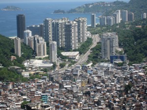
“There are two cities within one..(one) part has all the benefits of urban living, and the other part, the slums and squatter settlements, where the poor often live under worse conditions than their rural relatives.” Anna Tibaijuka

