Students: Shruthi Bassapa (India), Giorgio Badalacchi Moncada (Colombia), Fernando Barba Castillo (Mexico)
For the introductory Video click on this link: http://vimeo.com/36774820
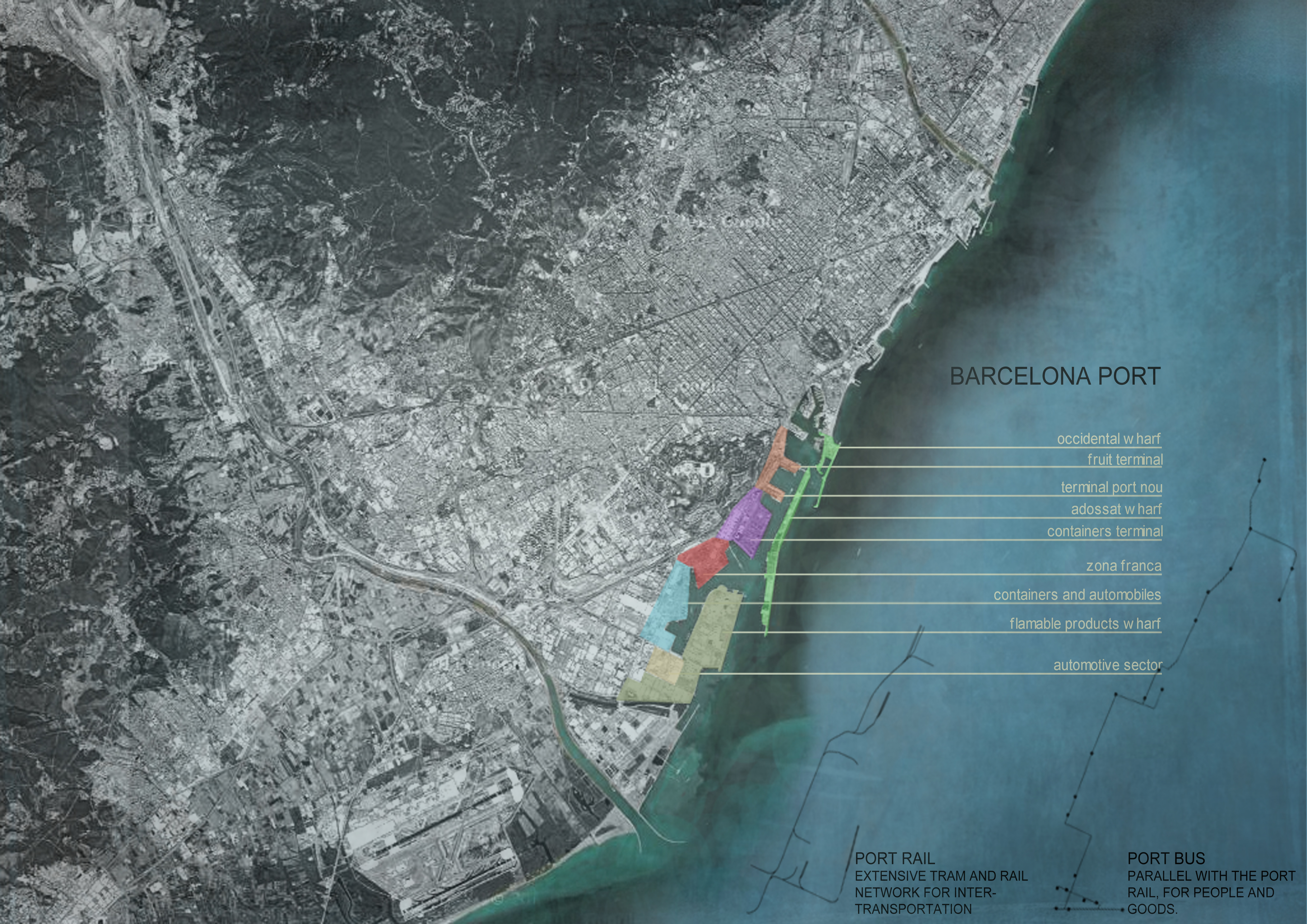
Barcelona is a coastal city and the city has always had a love-hate relationship with the water. Its geographic location and proximity to the rest of Europe has long been a feature exploited over time for various reasons of power, war and trade. Although Barcelona has always had a natural harbour, heavy winds wrecking ships caused great concern amongst the city’s citizens and the first wharf was constructed in 1477 so that maritime commerce could continue and grow.Subsequent additions to the port have gradually been done over time and from 110 hectares in 1868, Port de Barcelona currently covers 1062 hectares and this is all set to grow to 1200 hectares by the year 2050.
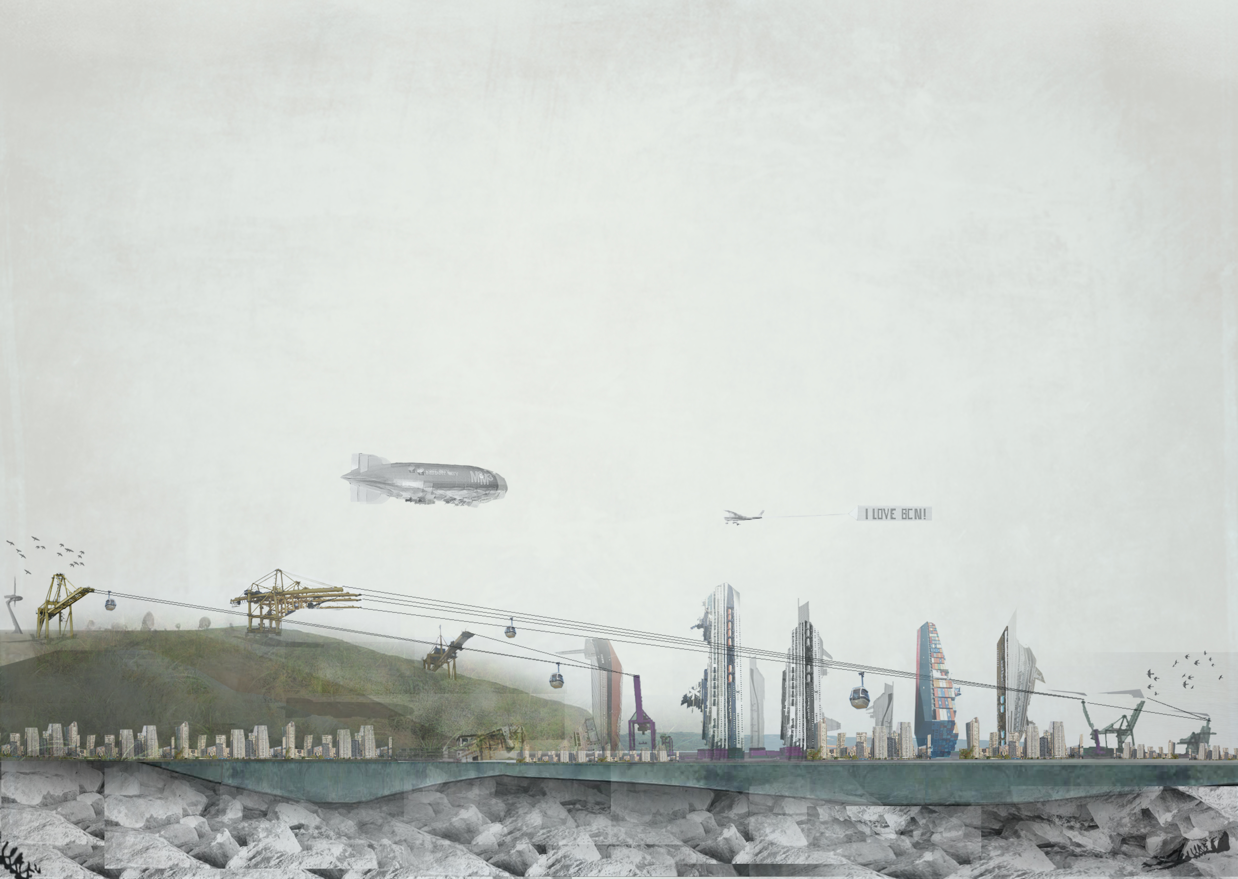
Land was reclaimed from the south and south-west for the first expansion. Seamen and fisherman set up their homes in this new area. The eastern portion too was expanded over time. So what is the city’s relationship with the port? How did a port with close ties to the city and its people slowly become an isolated island? The port today is like a ghost city that works like a well-oiled machine no doubt. With a well-laid out multi-modal transportation network of trams, rail lines, trucks and short sea voyages, the port today is all set to handle large volumes of commerce and traffic. But in the process it has also faded from public memory as the constant that keeps the city going.
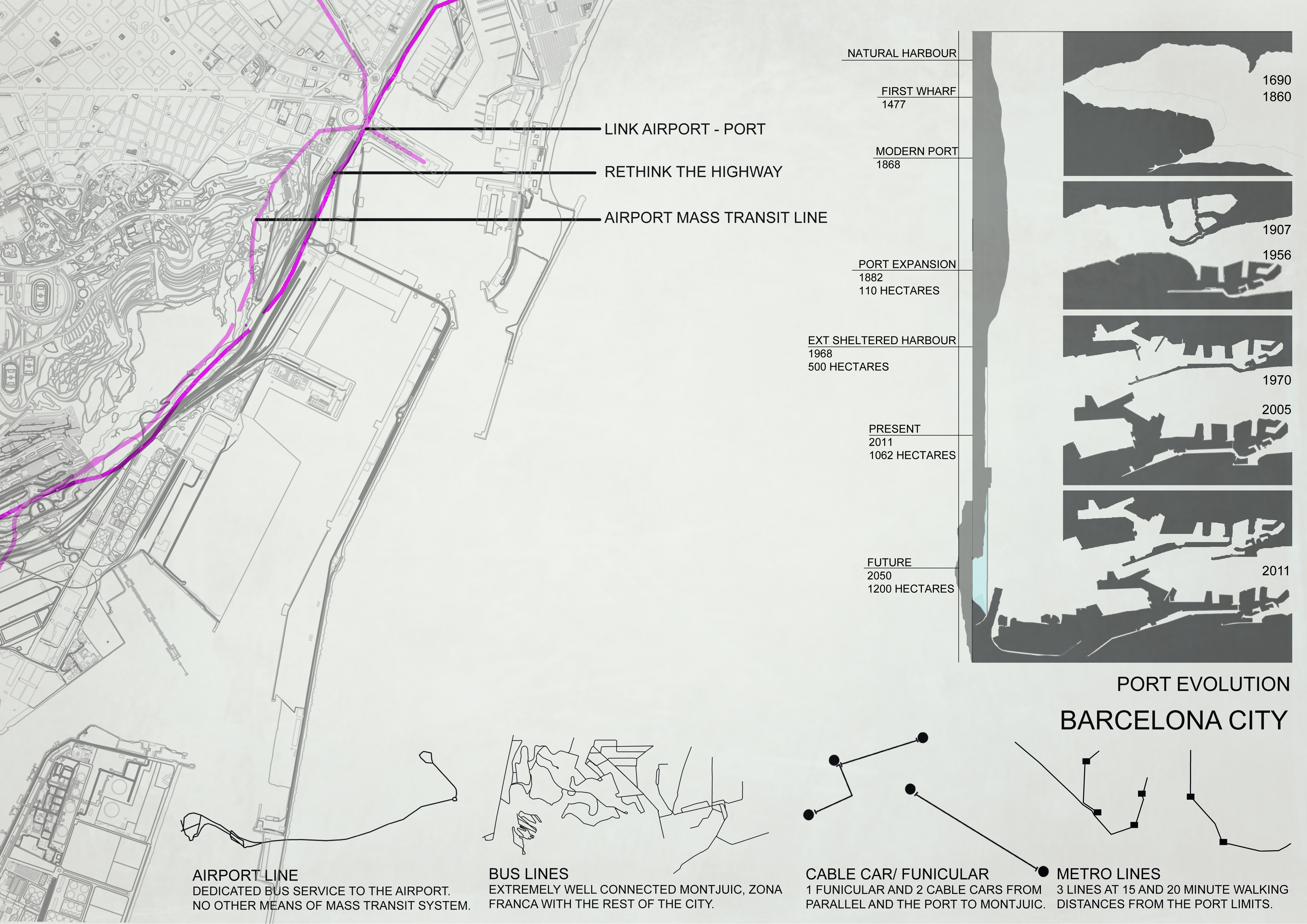
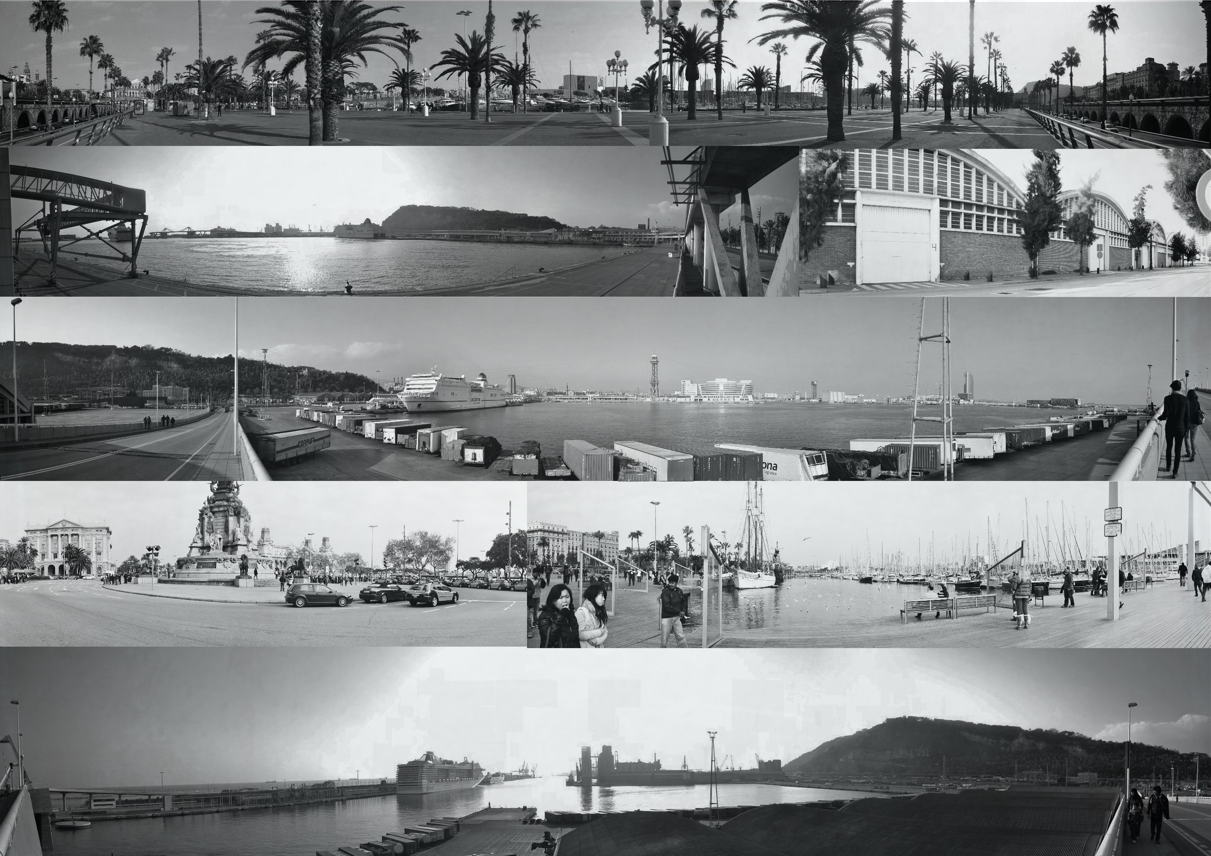
If the port has distanced itself due to reasons of logistics, safety etc, how has the city distanced itself from the port and the water itself? Within visual range, yet completely cut off, the city, the port and its vicinity are kept at a distance. Lines are drawn, and borders defined. The Ronda Littoral keeps the Montjuic away, the implied restriction keeps the people away. Except for the sea-gulls, there is nobody who could go near the port, let alone through it. The Port of Rotterdam seems to be an exception where people are encouraged to visit the port, with adherence to protocol of course.
Is there a possibility of bringing these seemingly disparate entities together? After all each needs the other for its survival. What could be the implications of bridging this invisible gap? Could the city benefit from an architectural intervention that opened up new possibilities of activities and experiences? Could the port shake its ghost tag off? Could the port and city come together as one space but with a multitude of opportunities?
As Peter Cook says in his foreword to Re-Envisioning Landscape/ Architecture, “There is even a search for peace without escape – difficult for one to imagine amongst the chatter of an old city.”
CONCEPT DEVELOPMENT
From Perceived Reality to developing the Invisible City, there were many factors to be considered. The factors that make the port unique and understanding what the city need’s, were the basic starting point.
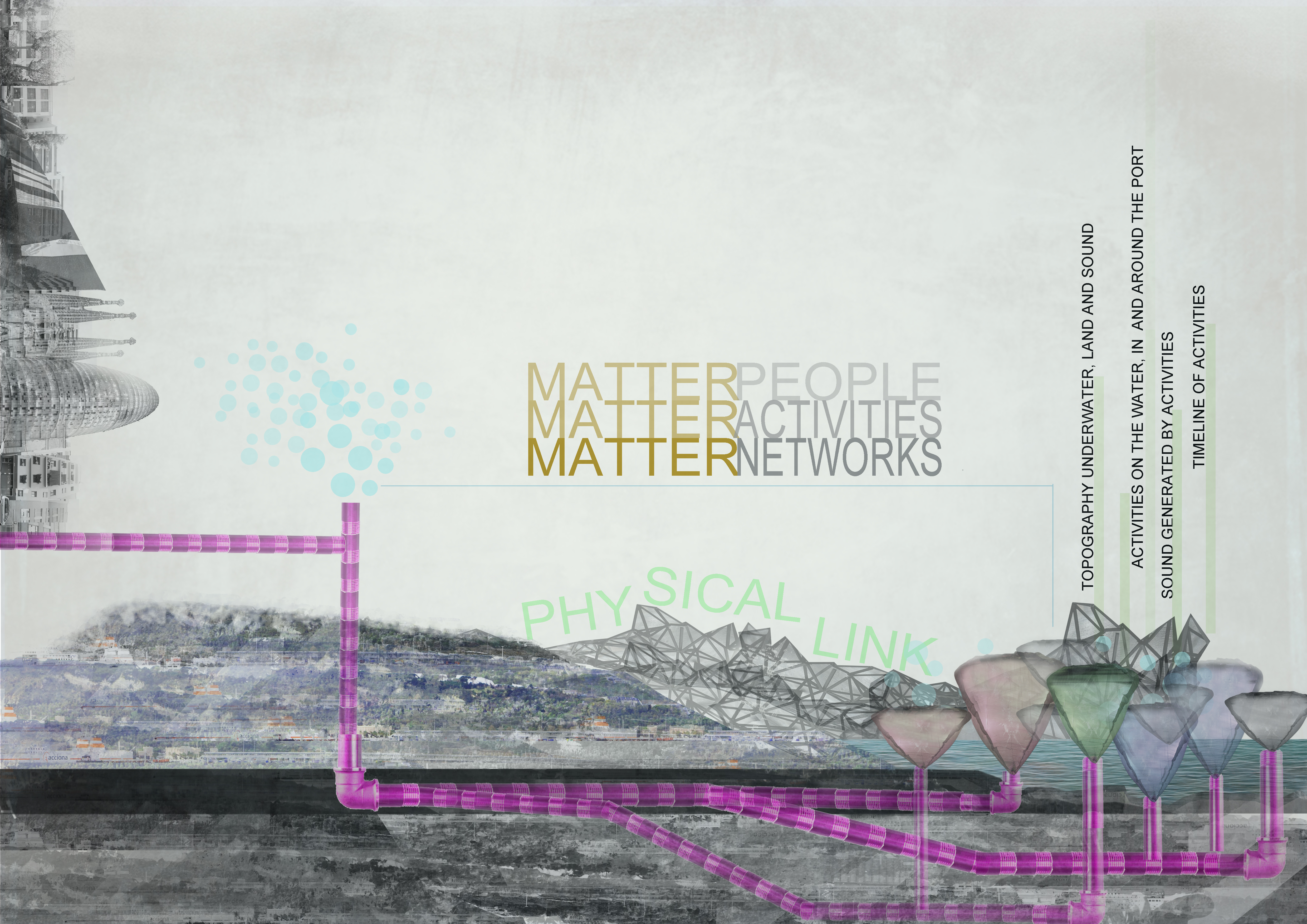
Four primary elements were of great importance;
- Activities
- Sounds generated by said activities
- Timeline of activities
- The Topography of water, land and sound
The more we studied each of these, underlying connections between these factors started to emerge. All these elements are closely linked to the other. Therein lay an opportunity of intervention.
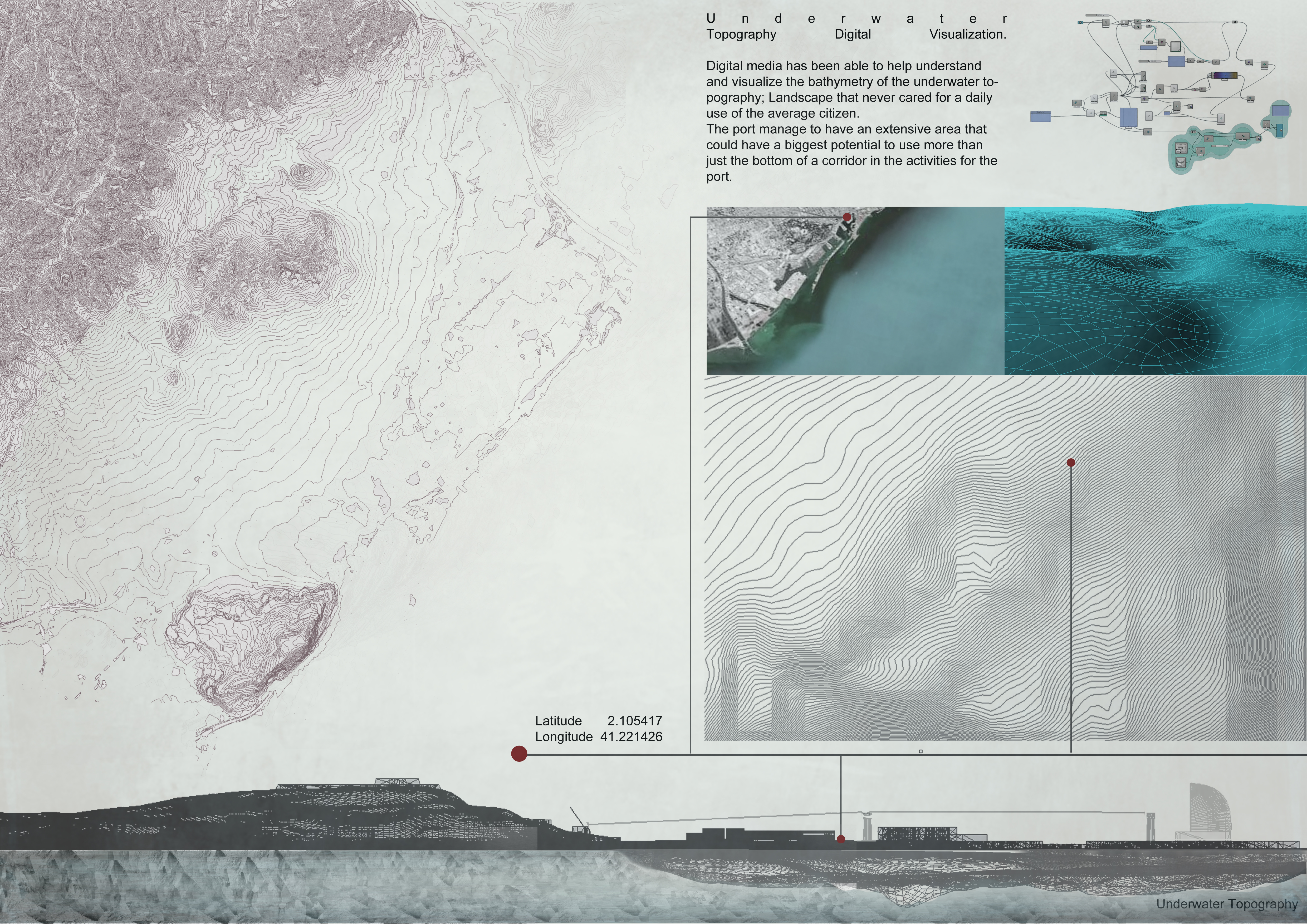
TOPOGRAPHY
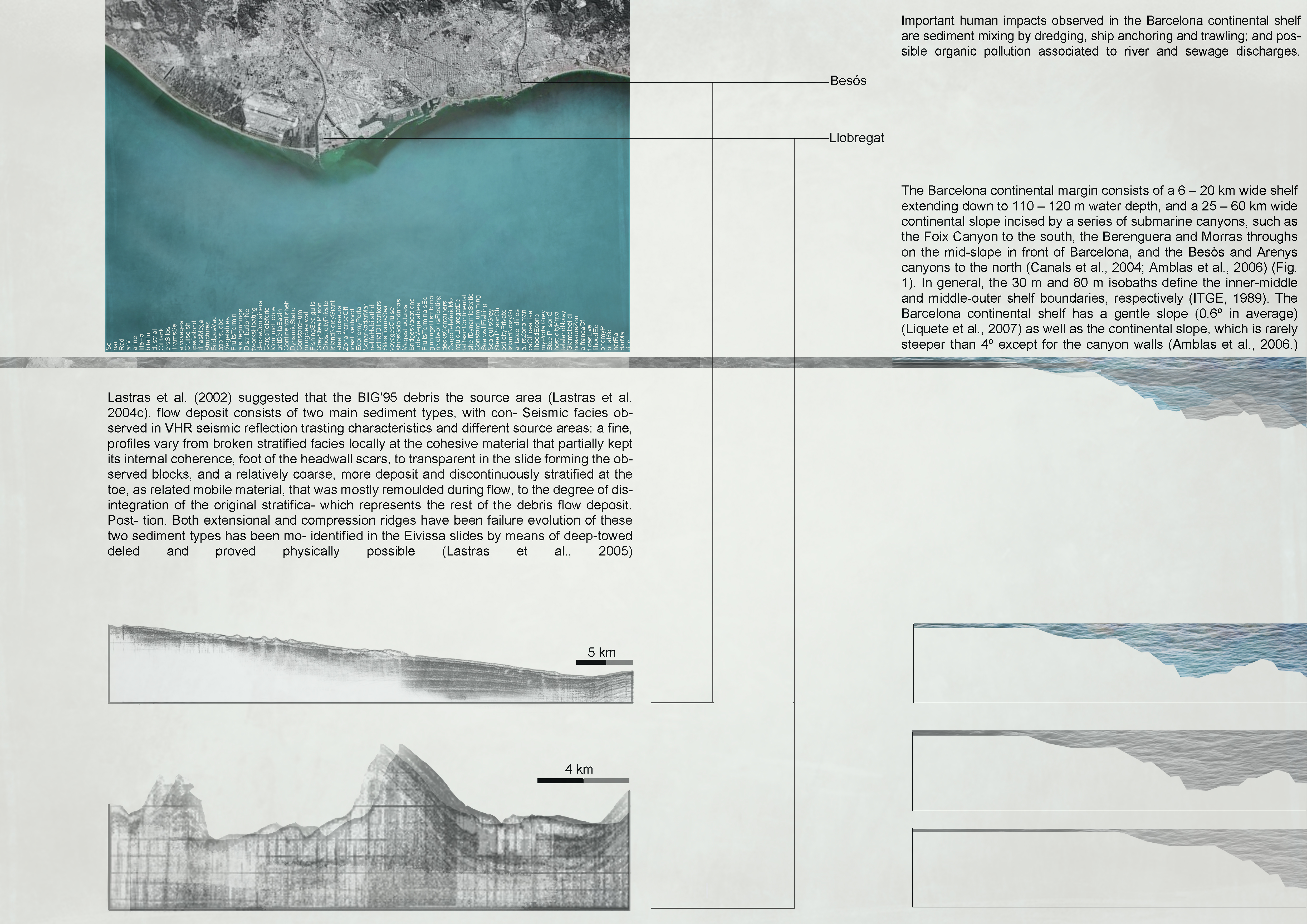
We are exploring topography in 3 different mediums – water, land and sound. The physical state of all these factors are directly influenced and changed by human activity.The topography of the sea is not all one flat line. It is made up of different parts with the continental shelf closest to the shoreline. The continental shelf is also the region with the richest marine life, aquatic plant life because of better sunlight penetration.
In the Barcelona deltaic region, the shelf consists of a 6-20km shelf extending to a water depth of 110-120m, and a 25-60km wide continental slope incised by a series of submarine canyons. Periodic expansion of the port and land reclaiming from the sea hardens the natural shoreline and its impact has been well documented in several research papers. The long term effects of expansion of this nature means that we are destroying an entire ecosystem within the vicinity of the city. According to latest studies, human settlement activities and port expansion have resulted in 1. Intensive disturbing of the oceanic sediment layers upto 85m depth 2. surface mixed layer has been detected at least down to 150m depth, Which only reiterates the importance of treating land and water as depletable resources that need to be sensitively used.
All human activities generate sounds. How we experience these sounds depends on the physical context of built spaces, built and natural topography.Sound is propagated as waves, longitudinal waves and only in the presence of a fluid medium like air or water or a solid. In fact, sound waves are multiplied 4-5 times in water, and sound waves die with resistance and distance. And that every activity, big or small has a characteristic sound that could be read as simple data of decibels.This means that manipulating activity could manipulate the sound generated. And that sound behaves differently in different environments. And when overlaid with the timeline, the map generated would not just be a true to form, real time mapping of activities itself but also generate a readable, easy to understand graph of sound levels, that are unique to a specific geography.
The challenge now was to bring all these together to create possibilities in a tangible, physical manner.

For the sound video click on this link http://vimeo.com/38743834
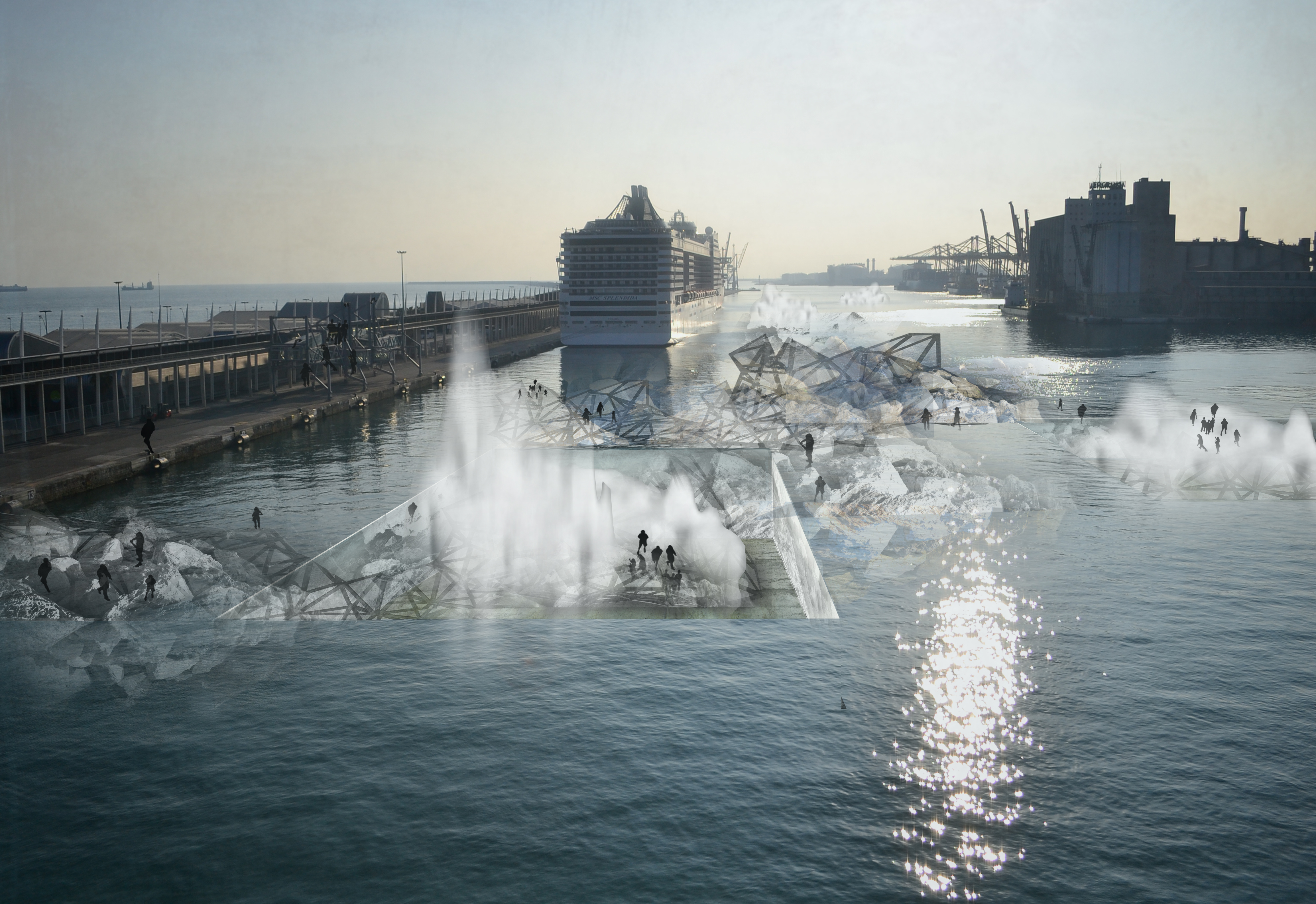
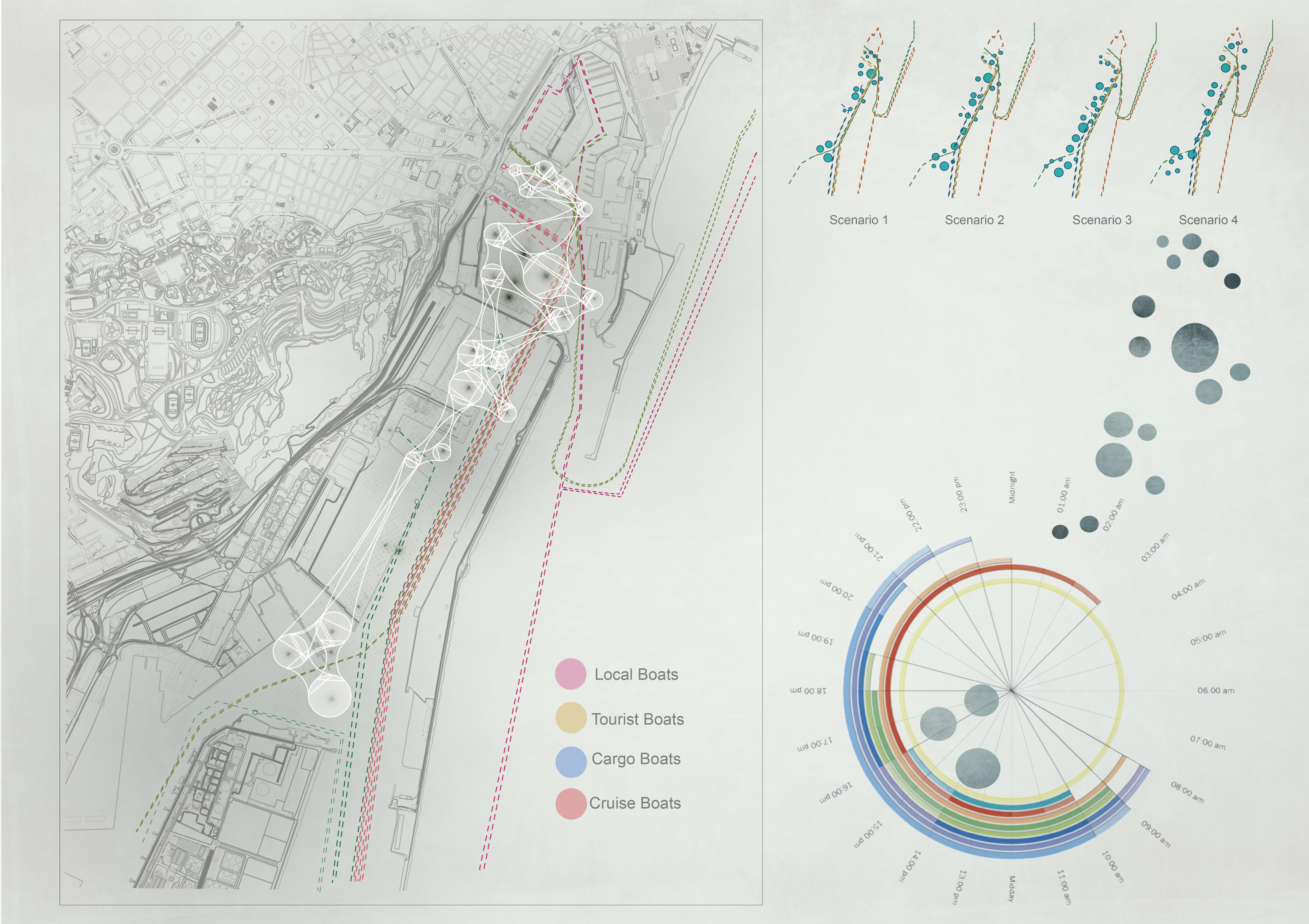
Mapping of the port activities on the water allowed us to generate a map of travel lines of cruise ships, cargo ships, container ships and short sea voyage ships. The maps were also mapped alongside timelines through the day, week and through the year. What emerged was not only a map of lines, but also a map of spots with no active activities. A map of blindspots. These blindspots are ideal locations for an on-water, architectural intervention that could link the port, the water, and the city. What is also interesting to note is that these blindspots are constantly changing, depending on the on sea activities. This allowed us room to play with the flexibility of the space within the physical constraints of the port functions itself.
The possibilities that open up with such a flexible, dynamic, ever changing physical space is limited only to imagination. The way we see it, these blind spots would be a starting point to create an experiential programme that allow for ‘n’ number of activities. These platforms would be an organic, real-time response to a lull on the sea. But how do we activate these systems? With sound! By building a database of sound and all-year ship movement, we build a set of parameters of defined ranges that allow us to create and build a physical space that would interact with other blind spots, create an inter-network to create large platforms or drift and shrink to allow for more intimate activities.

DESIGN APPROACH & CONCLUSION
We believe that architectural interventions can be a powerful tool to address immediate needs of a community, or to start a chain of positive reactions that can contribute in subtle yet strong ways. The sound responsive fluid platforms are a temporal yet permanent design response that allows for people to experience a space hitherto off limits to them. Building on experiential memory, the same space allows for different experiences throughout the year as the activator parameters change according to predefined factors.
Although the intervention is mainly focussed on the water surface, the focus is to continue adding layers of design and simplicity. New can and should build on the old. A design programme of planned and spontaneous activities and events are first defined. Sound thus produced also depends on the number of people. The fluid platforms will be programmed to organically respond and thus cater to specific necessities of activity and numbers.
Architecture today need not necessarily be a problem finding and problem solving exercise. What if we looked at the city as a potential hotbed of opportunities waiting to be explored? Imagination when coupled with technology and a pragmatic restraint can result in endless possibilities that need not be limited to mere computer existence. What is the limit of imagination? How far can we go? We are hoping to trigger this chain reaction of possibilities in the port and therefore the city.