Each year the temperature of the deep layer of the Western Mediterranean increases by 0.002ºC, and its salt levels increase by 0.001 units of salinity. These changes, although minimal from year to year, have been continuously and constantly occurring at a faster pace since the 1990s.
Influx
Natural Gas Landscape
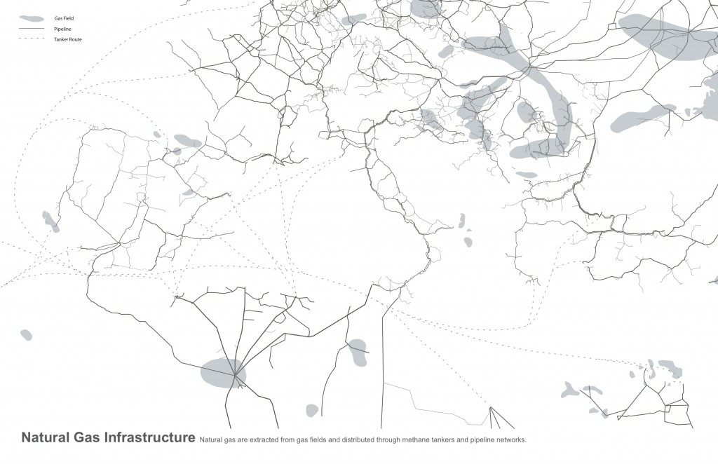
This project was intended to study natural gas network of continents around the Mediterranean sea and to investigate the undying logics with urbanism & infrastructure.
The network begins with the gas fields and ends with the end-users. Natural gas is transferred in liquid state on sea and in air state on pipework.
Juxtaposing the natural gas infrastructure with the city; the pipelines with the roads, the research questioned the interrelationship of urbanism, landscape & infrastructure.
Geographic Scale. Pyrenees Water Supply
A way of seeing the mapping interested in the geographic scale, thinking that not only the cities have the “urban” part, here we can see how the pyrenees bring more than a place to hang a round in the snow but also the energy obtained changing the course of the rivers and mapped here the obtainment of water if a major issue to take in noticed. In the map we can see how this urban approach crosses borders.
Cut-and-Fill Infrastructures
The mapping project looks closer into the process of waste management in the city of Barcelona specifically into cut-and-fill processes where resources are extracted (cut) and the “pit” and transportation infrastructure is recycled as landfills (fill). The map overlaps recent and old mining activities with municipal and construction landfills sites. The results reveal the reuse of what otherwise could be considered totally unrelated processes.


