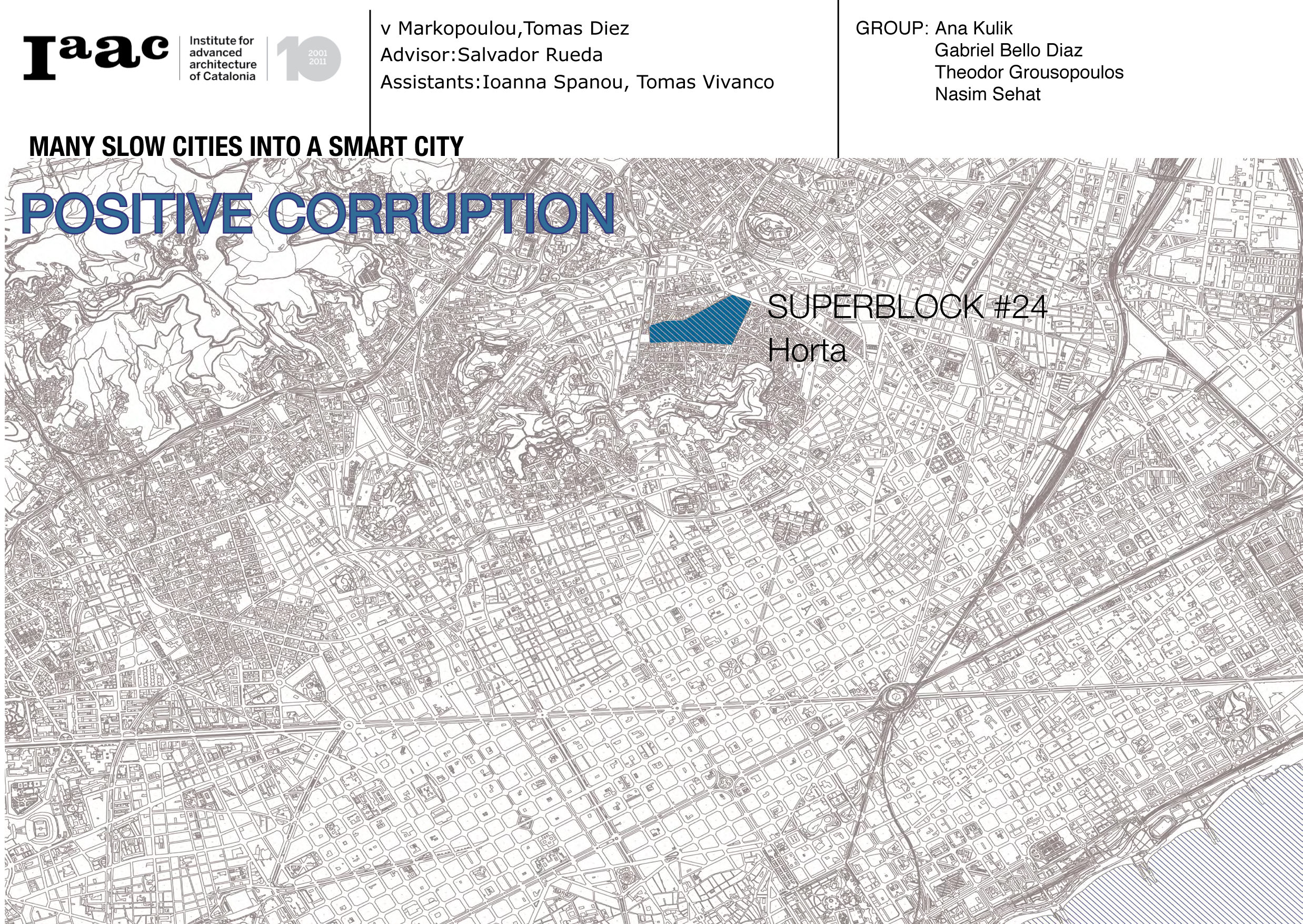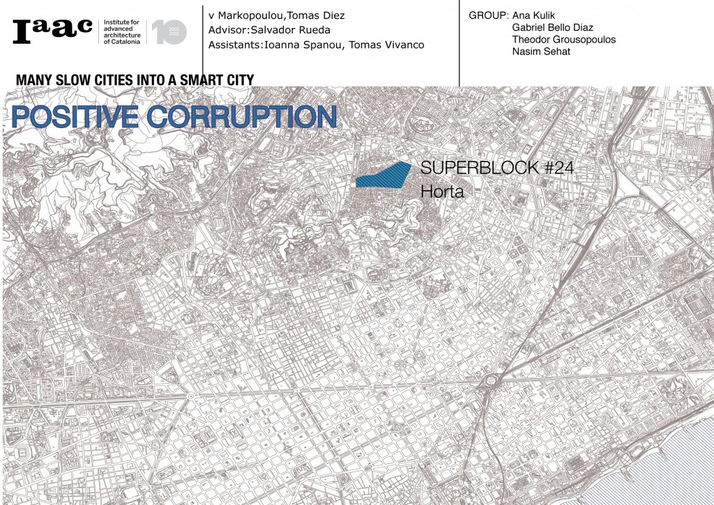
Meet Horta
This is Horta. Our Superblock is situated a way far from city center, and already on the first image you can understand the relationship between Horta and Barcelona. It will take you 40 minutes by metro to go from one of this spots to another. And this is first time when we mention disconnection between them, which is a very important thing in our project.
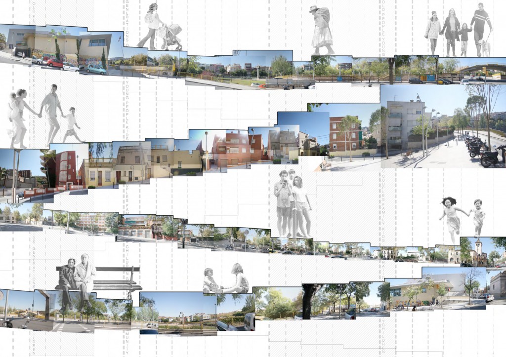
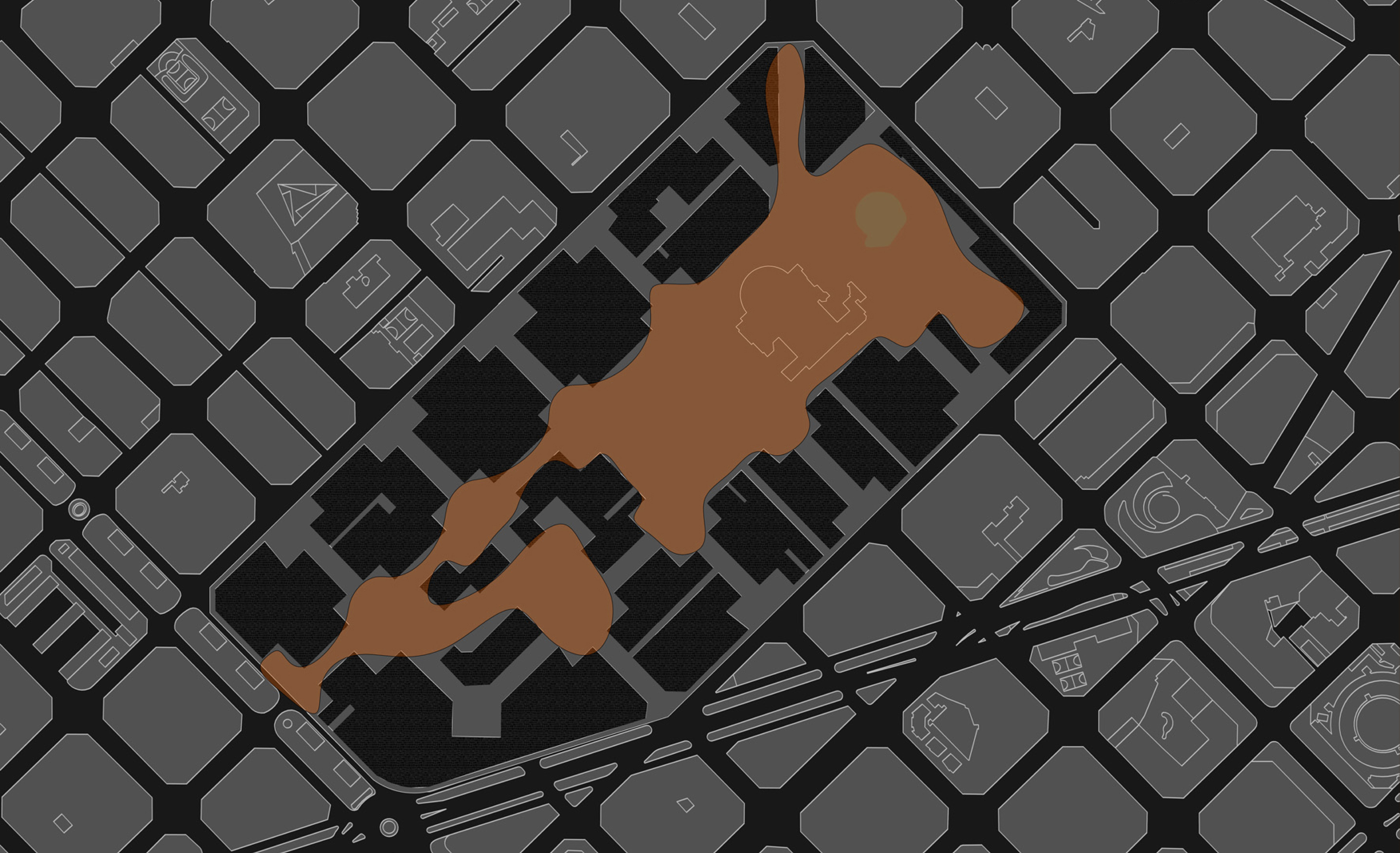
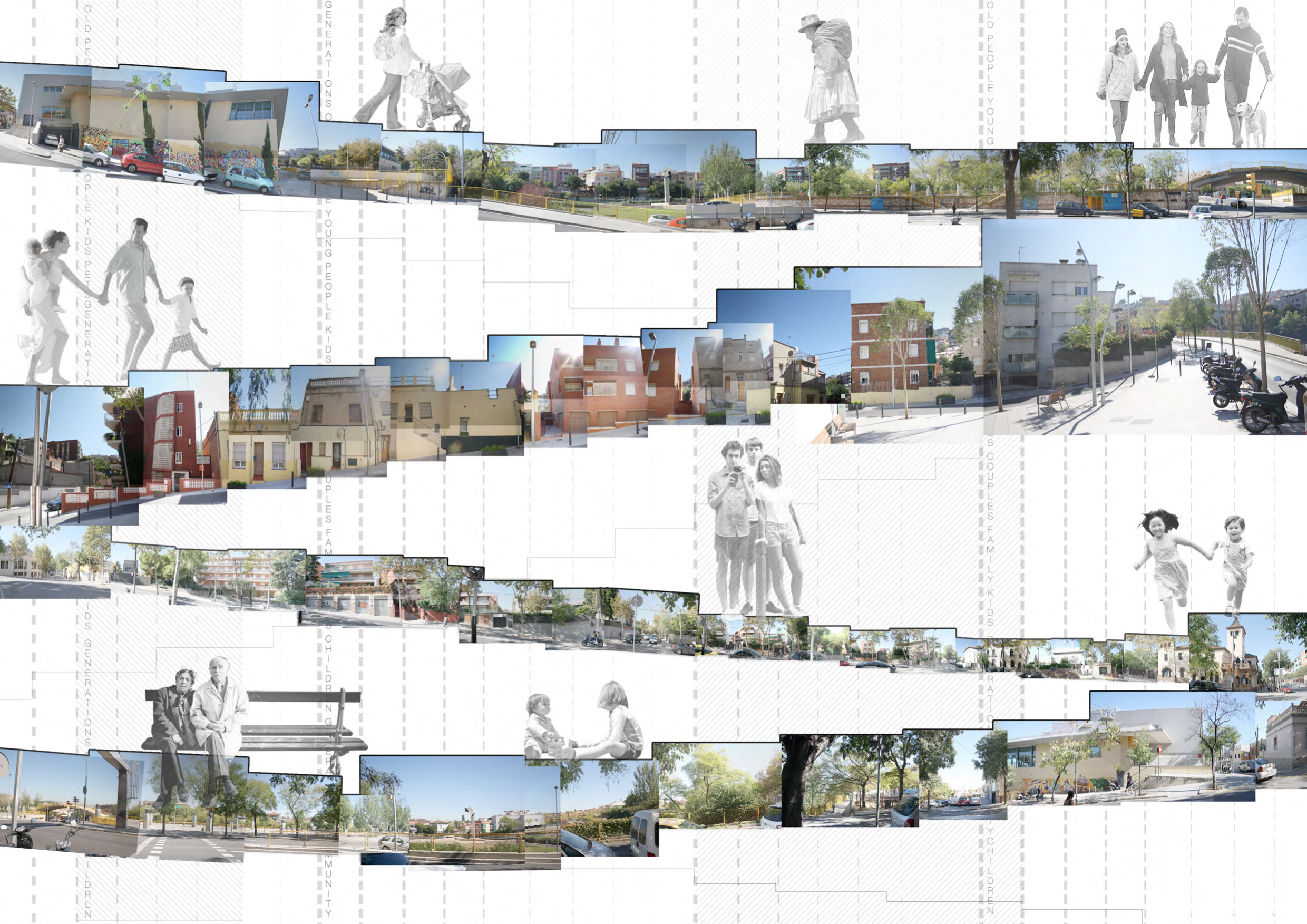
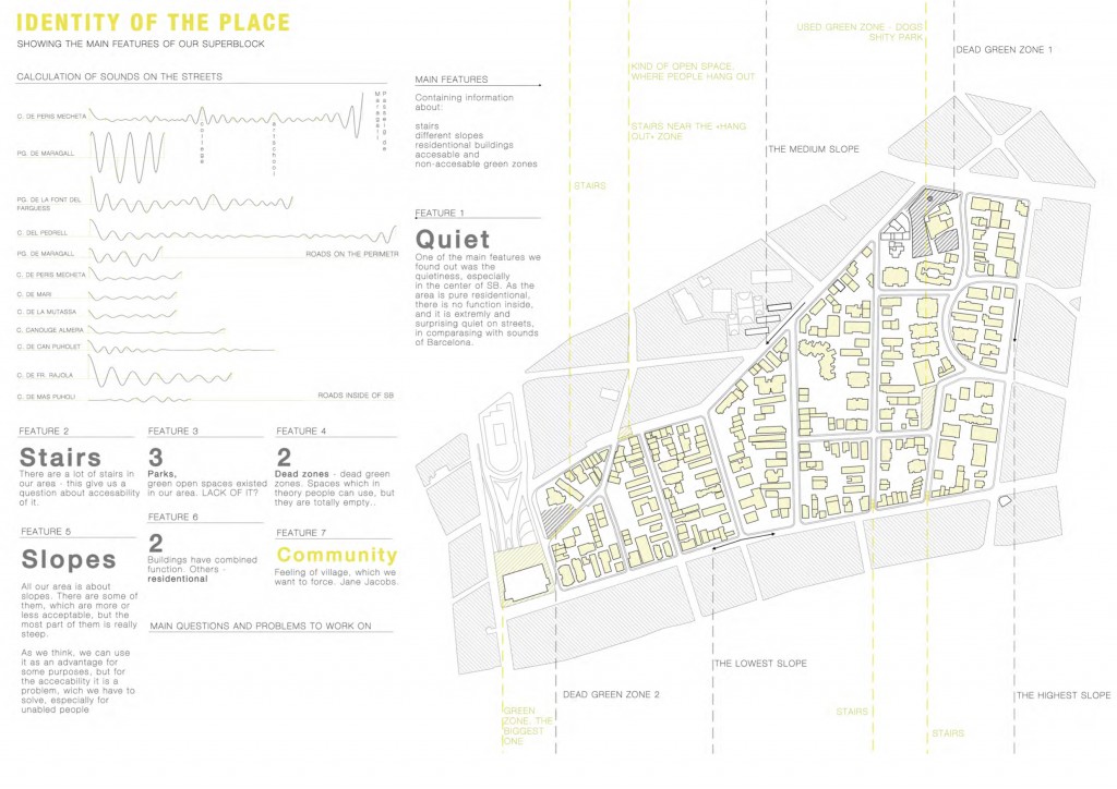
So meet Horta. From this collages you can get the first impression about topography in this place, we have a lot of slopes, and this images by themselves form stairs, which exist in Horta abundantly.
This place is very family orientated. You can see people, who live there, generations by generations. They dont want to leave this place, they always want to come back, want to work there and spend their time there. This is a village in a city. People are not afraid to walk at night alone with a fear of being robbed – they know everyone in this place, every single person, every family. This gives to our project very strong social aspect. But, as Jane Jacobs said, “families are pretty helpless without communities”.
We wanted to make this feeling of village even stronger, to bond people more, to take their existing community and enhance it.
Analysis and Diagnosis
We would like to start with a short analysis of our place (whole Analysis part you can find in /Positive Corruption. Horta. Superblock #24. /mid term presentation/), summing up important features and explaining the Diagnosis part, which is the most significant in the presentation, because it shows how all of our strategies are connected to each other subsequently.

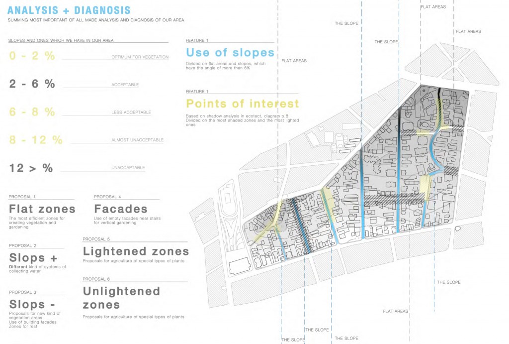
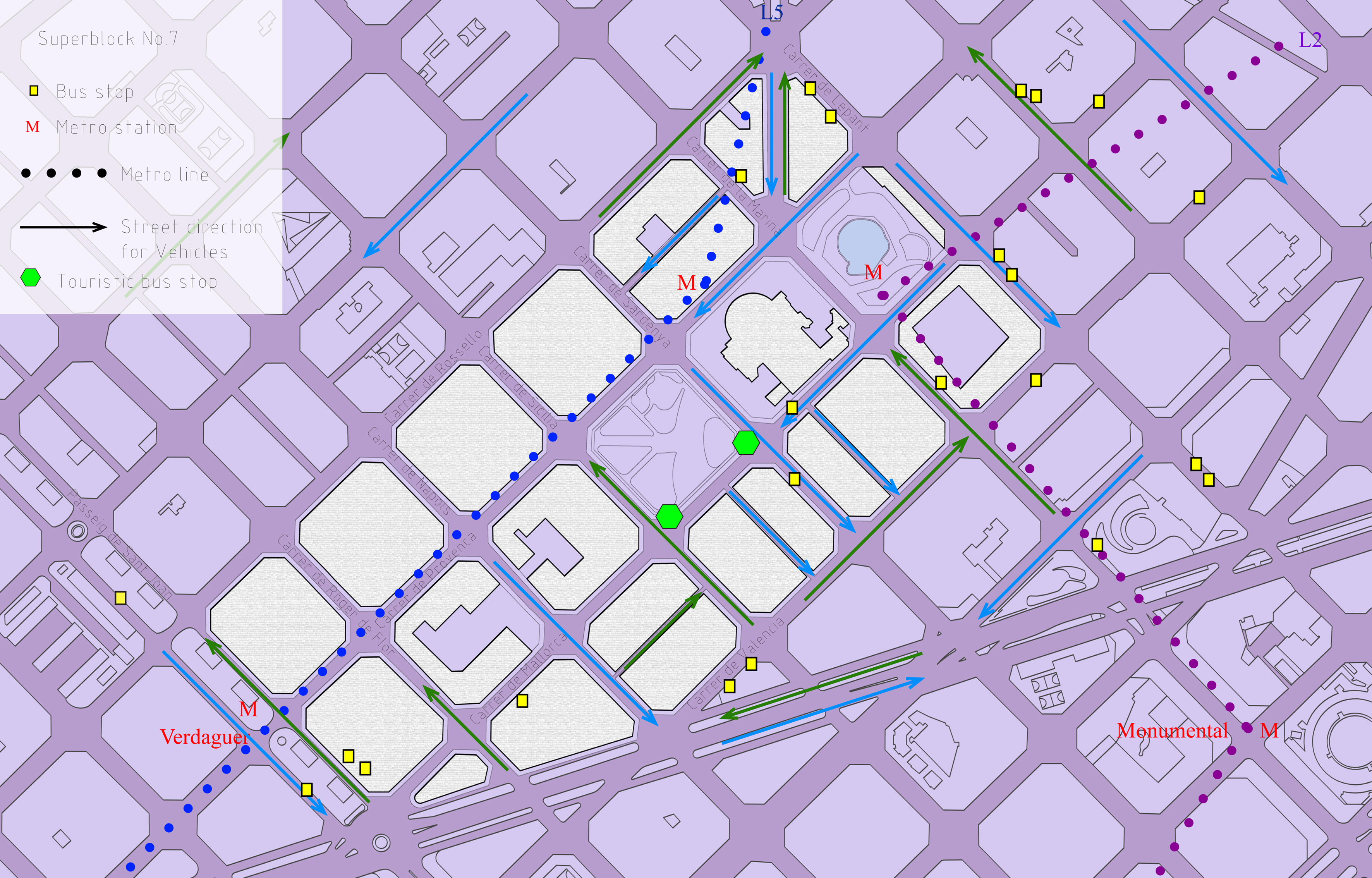
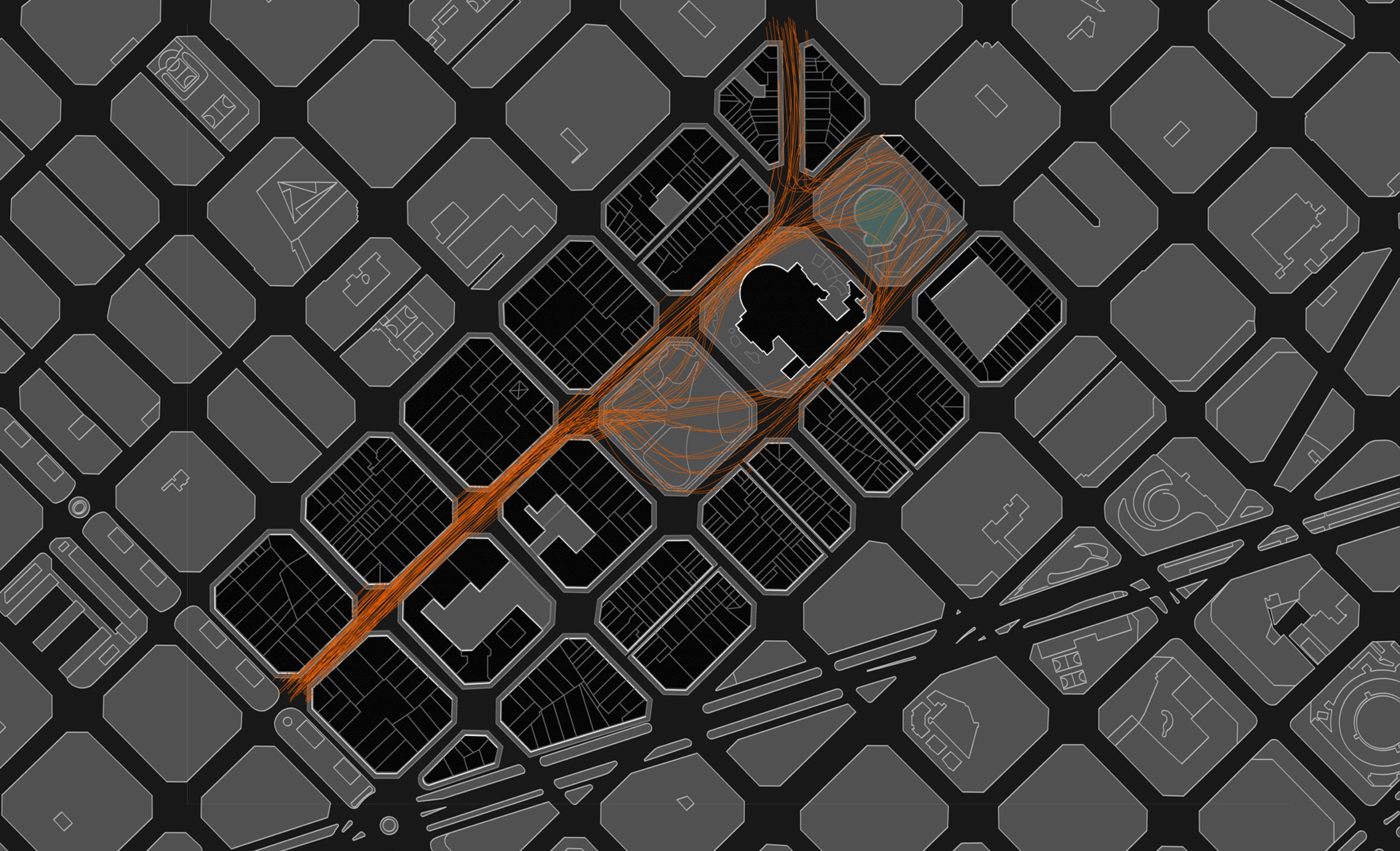
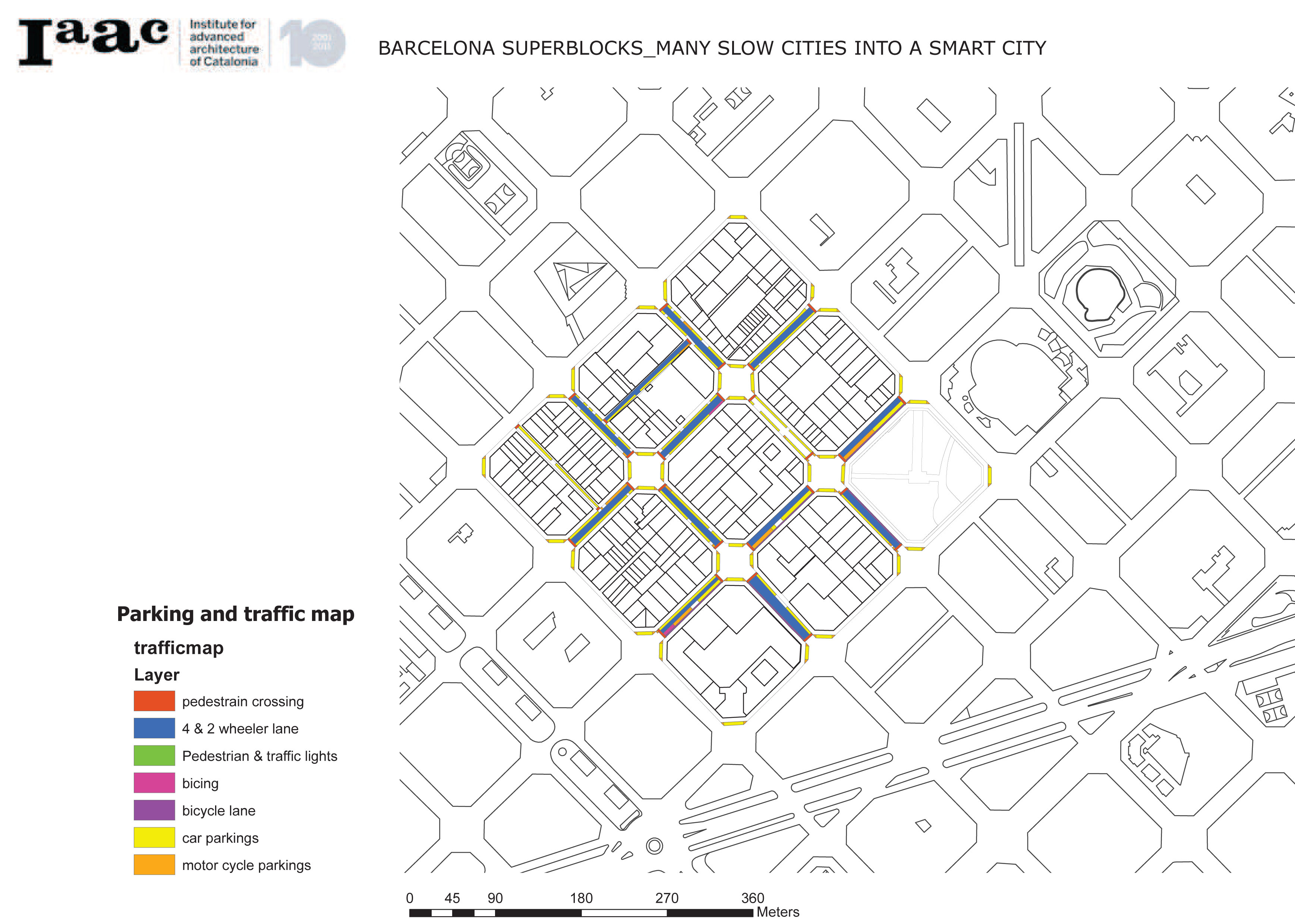
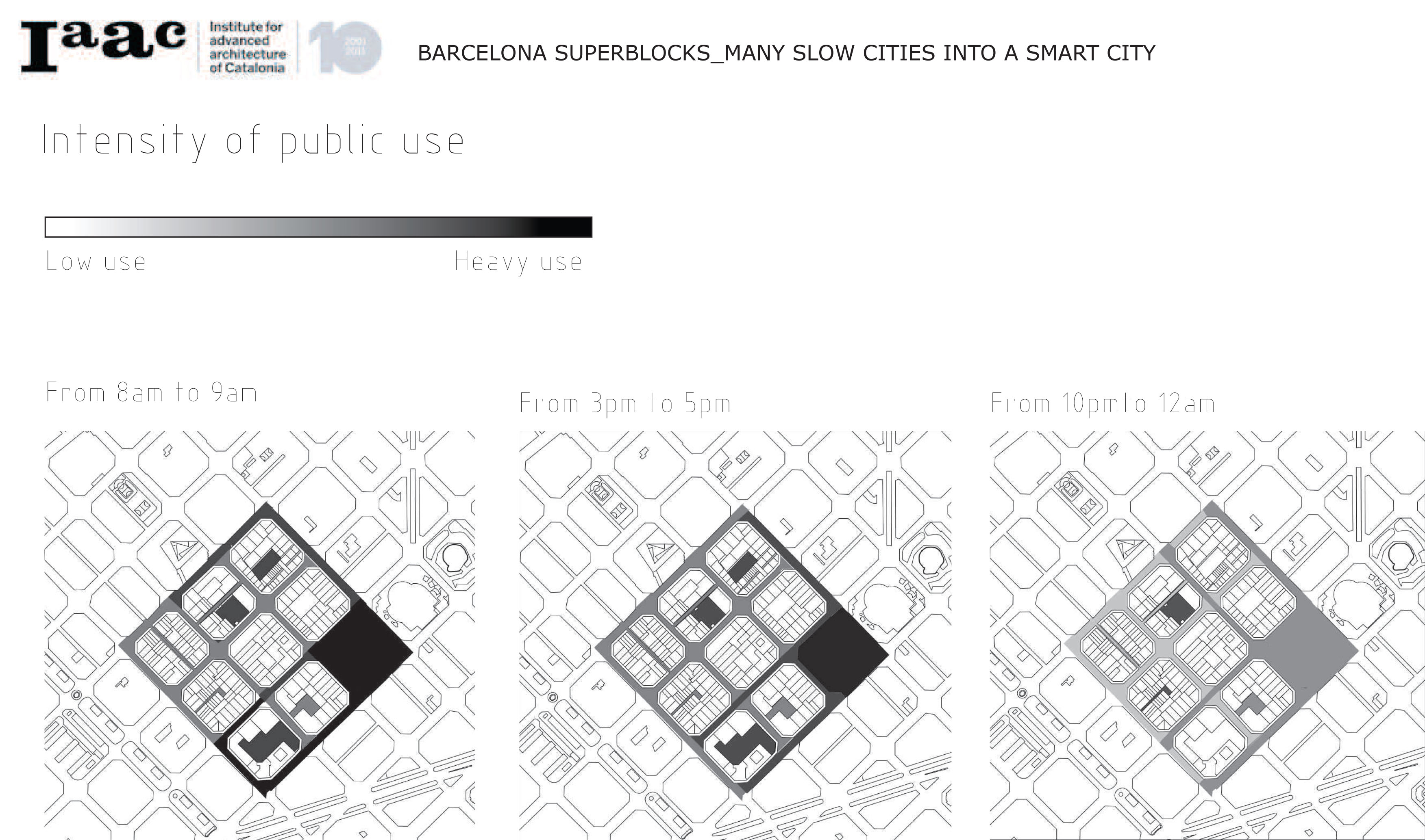
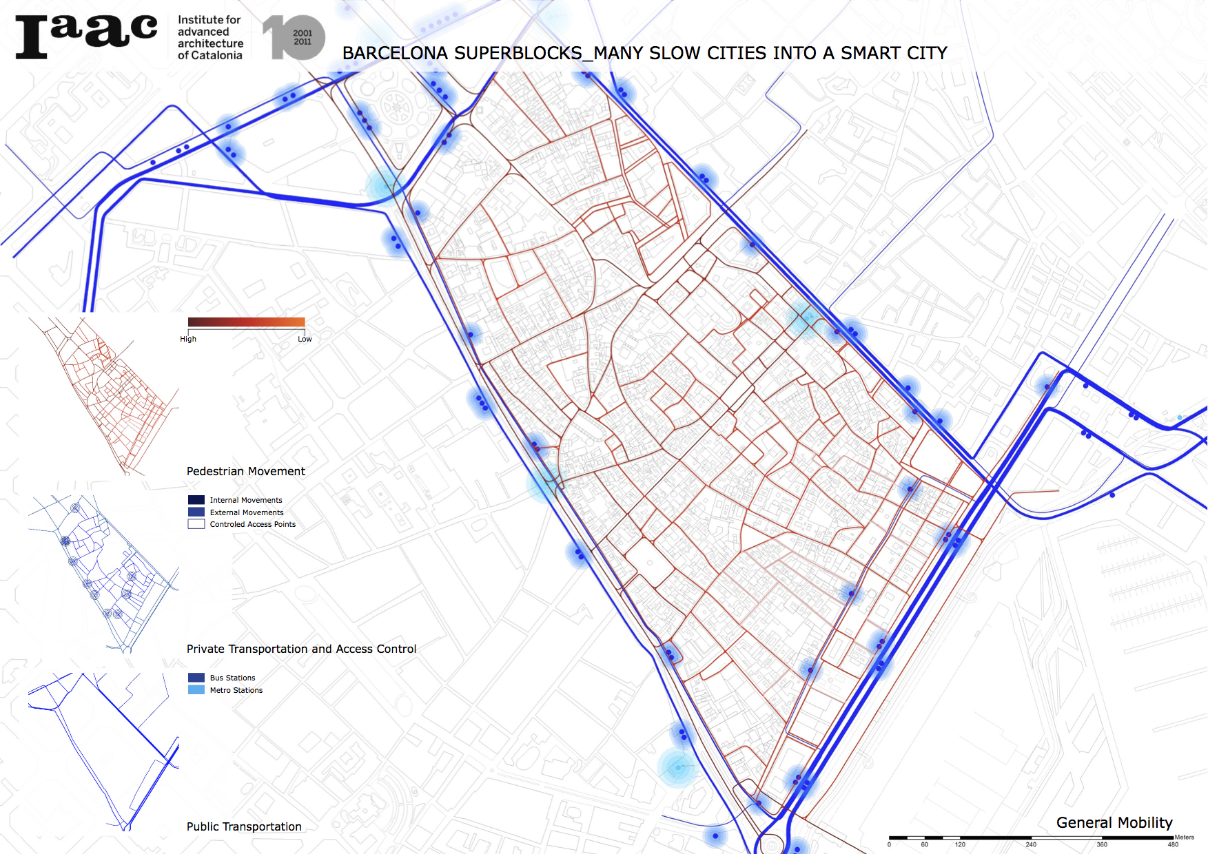
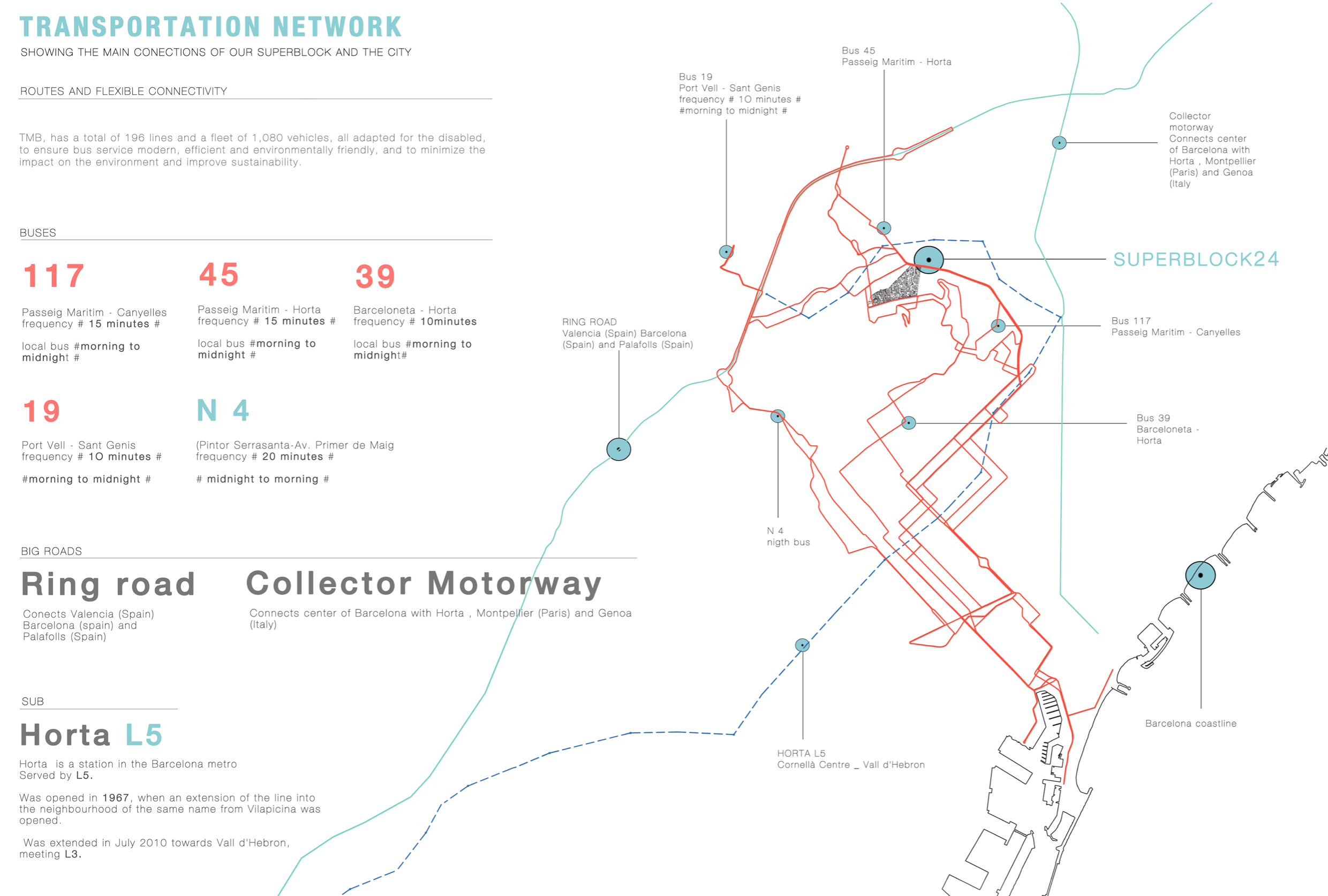
Let’s look at transportation system. Horta is situated far away from the city center, there is 1 sub-line (F5), which connects this superblock with Barcelona city, 4 buses and one night-bus. Also there are 2 big roads, which connect Barcelona with other cities and countries, running near Horta. (m. 1)
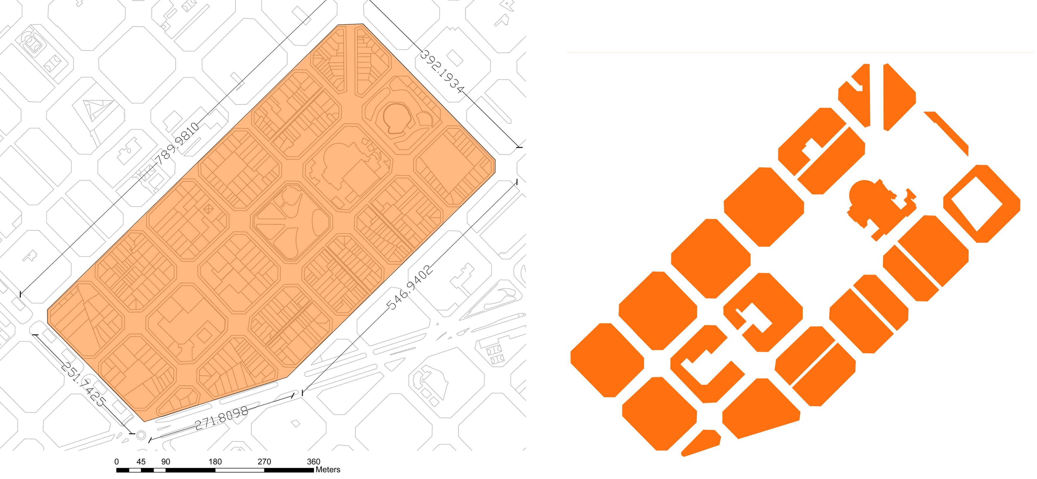
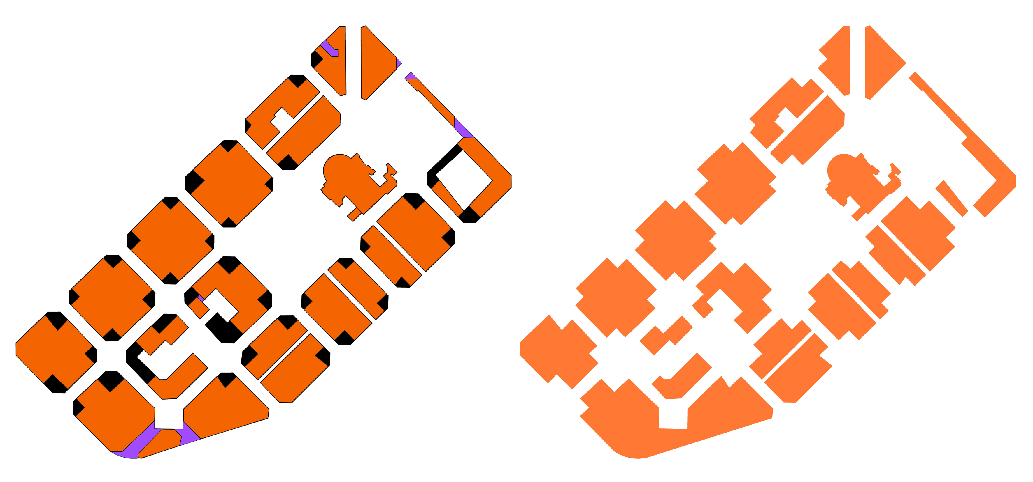
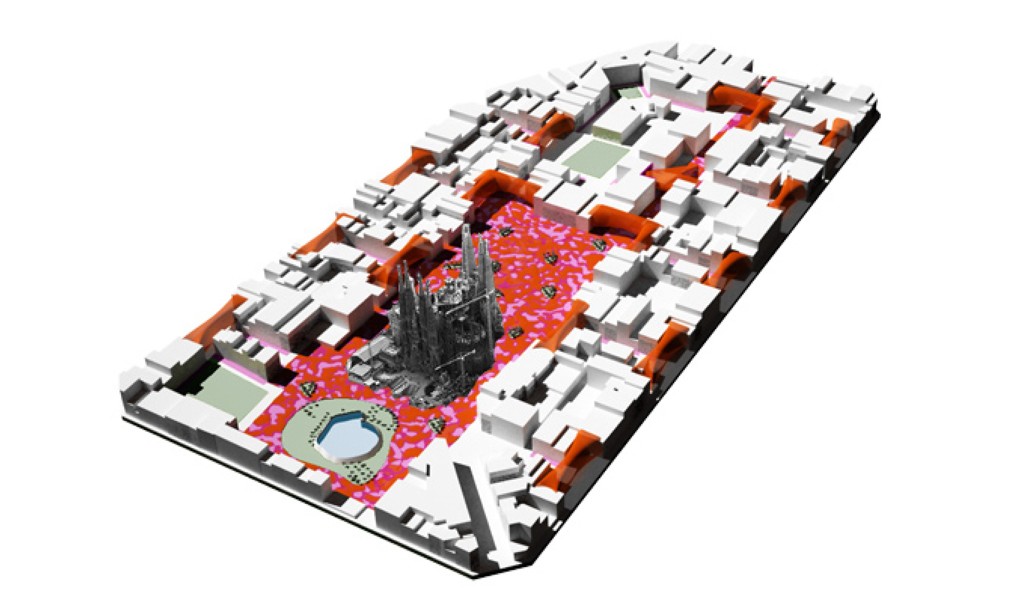
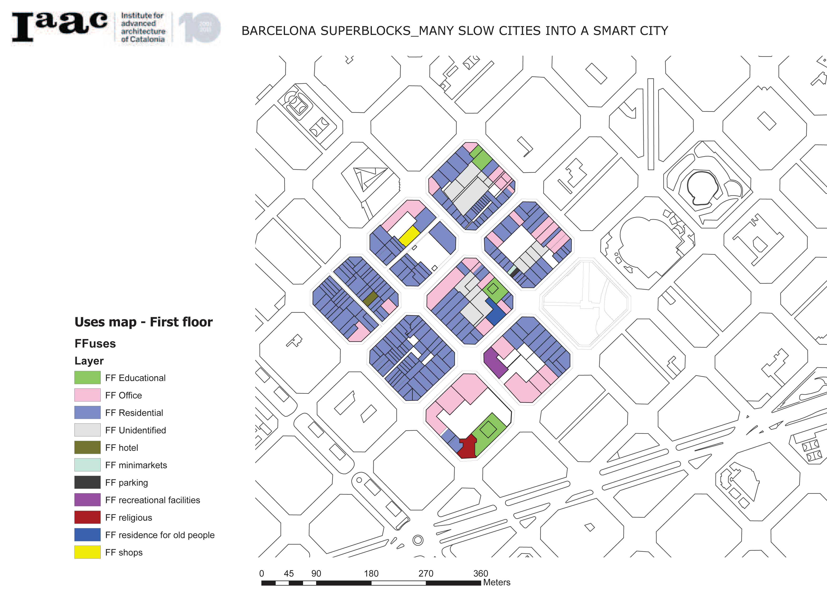
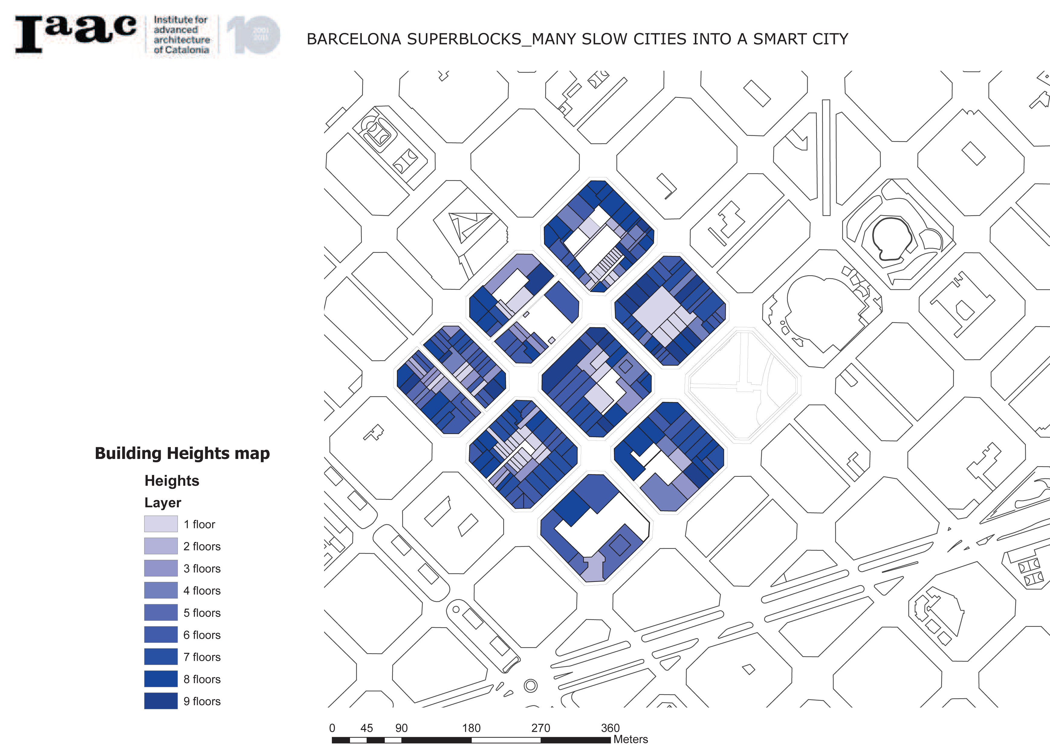
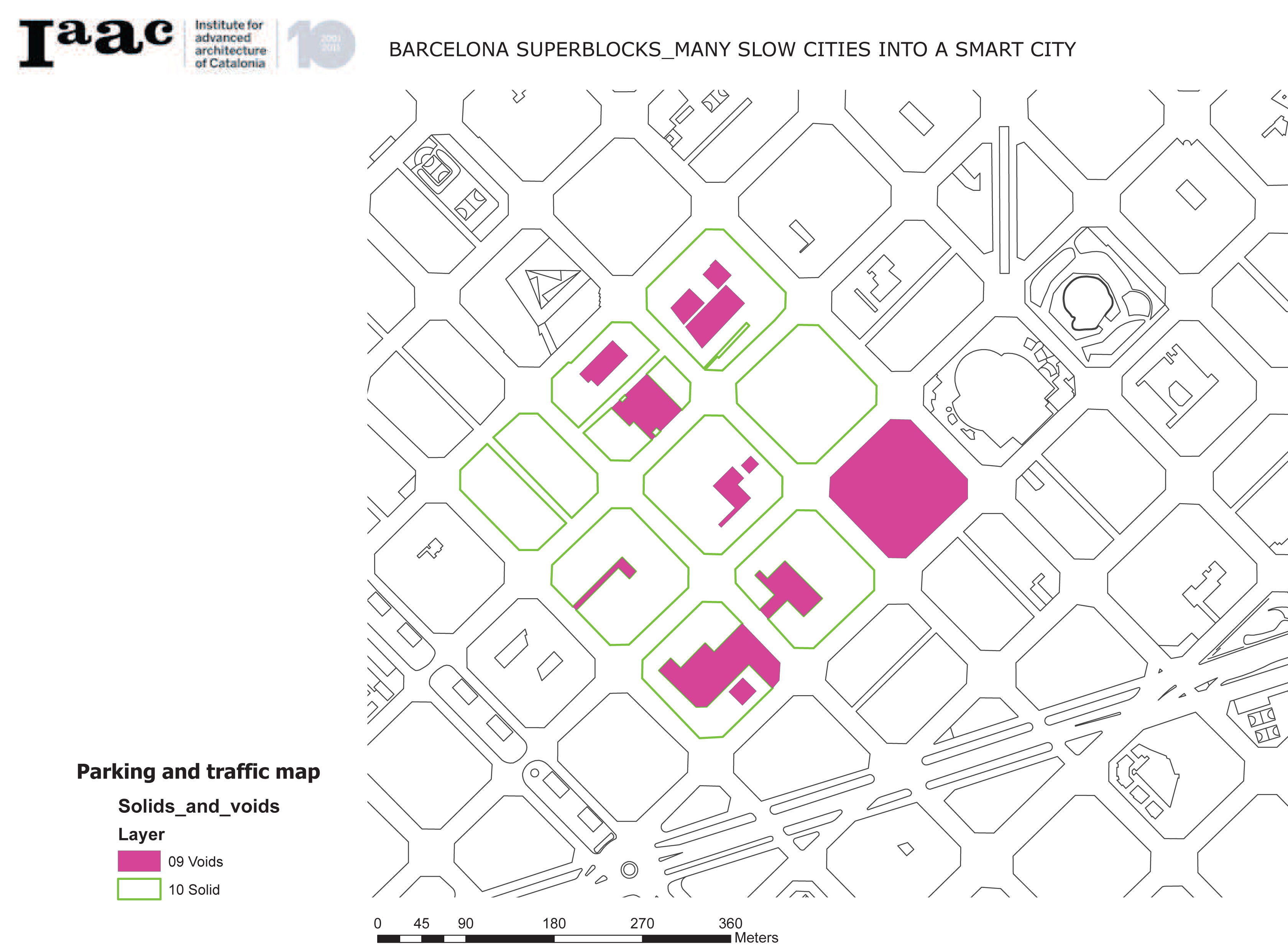
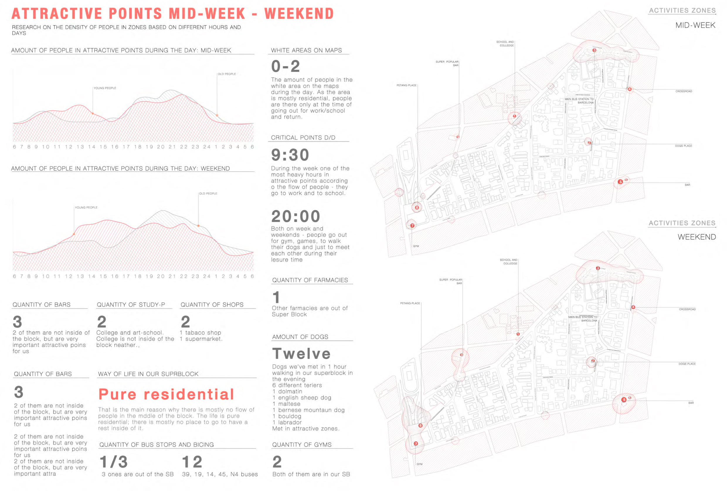
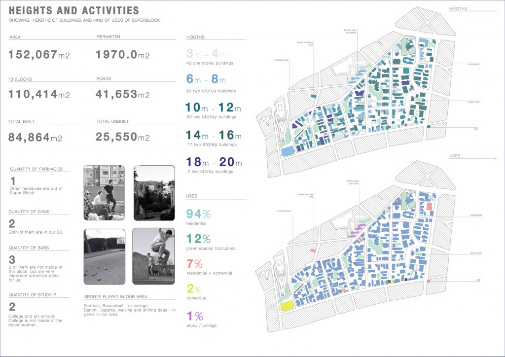
The area of the superblock is about 150,000 m2, it consist mostly of 3-4 levels buildings and it is pure residential area. (m. 2) As you can see, there is no activities in the center of the superblock, only on boarders. Center is almost abandoned in context of activities. There are some green zones, but somehow they are closed for people access.
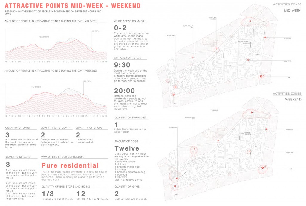
People don’t meet in the block, don’t spend their time there. Just live there – to meet each other they go to attractive points on the boarders. (m. 3)
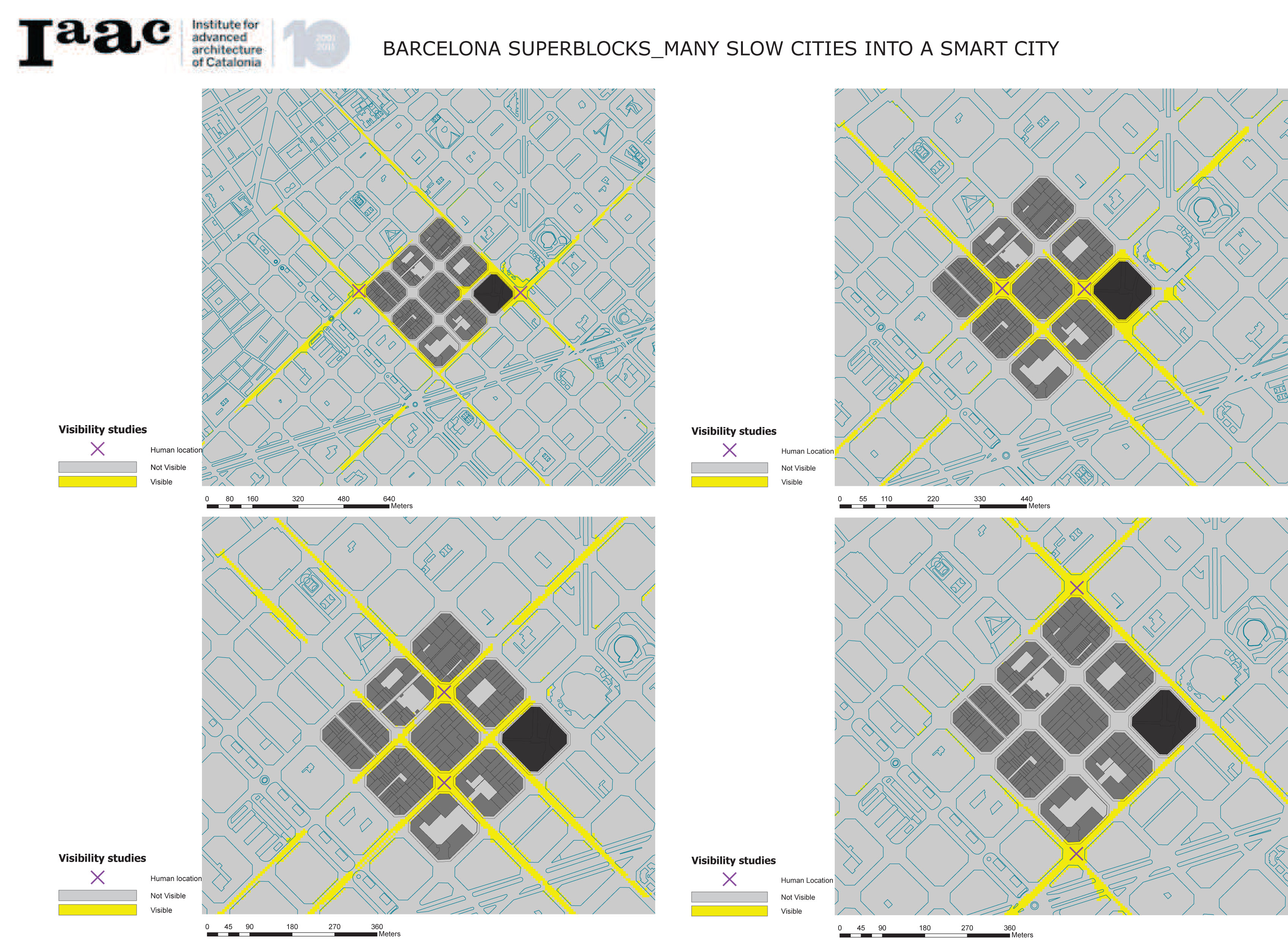
This gives us the first thoughts about mobility of people and accessibility of zones for them. We have big distances between our points of interest on the borders, where people meet, and a lot of slopes on the way to these attractors, which are unaccessible, even difficult for us and almost impossible for unable people. (m. 4)
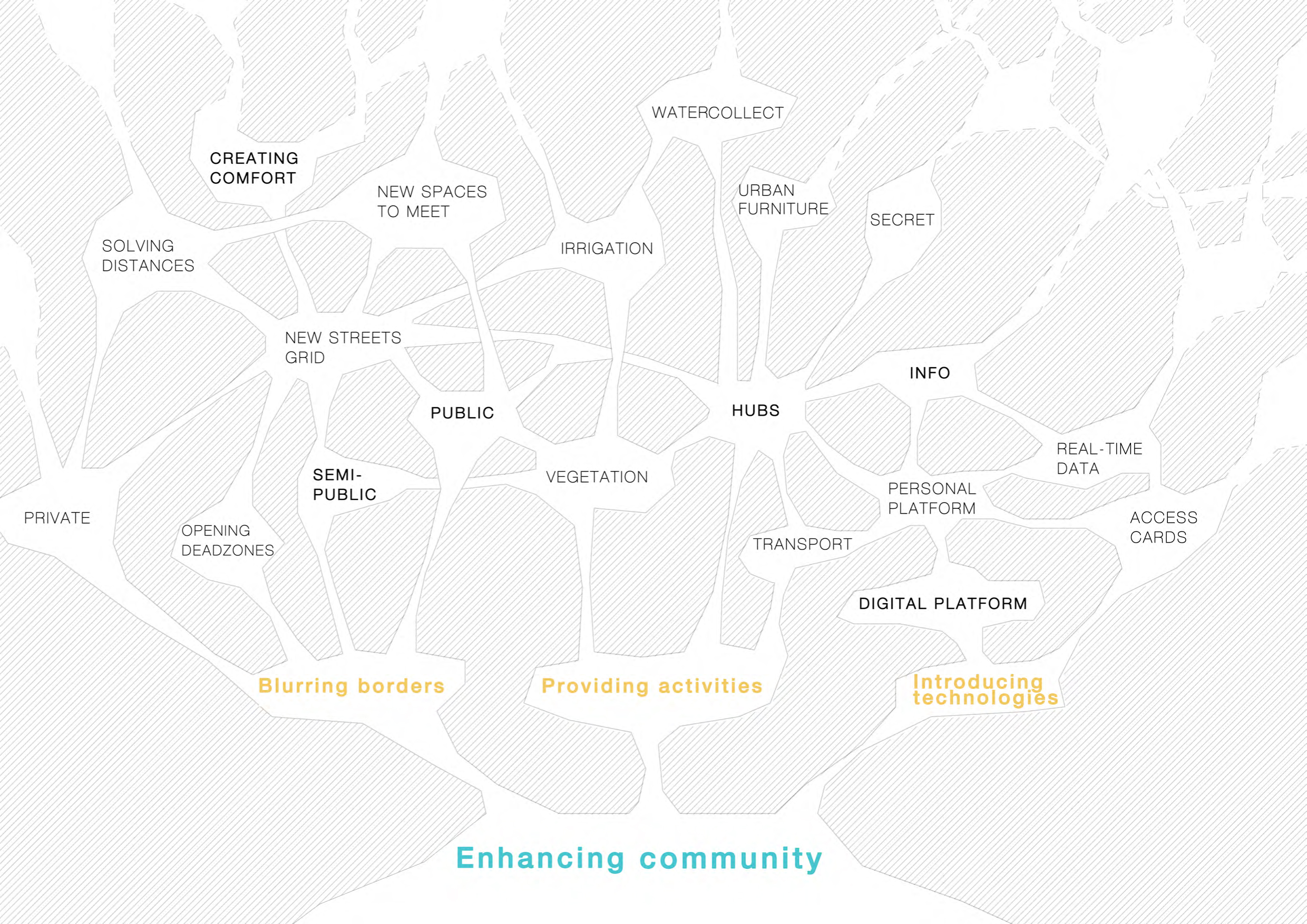
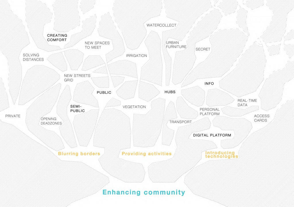
In this case, our proposal, where we are speaking about people and enhancing community, is growing and dividing by different strategies, which give people more space in the center of the block, solve distances, deal with mobility, bond people together, connect them through the main concern and so on. (m. 6)
Proposals
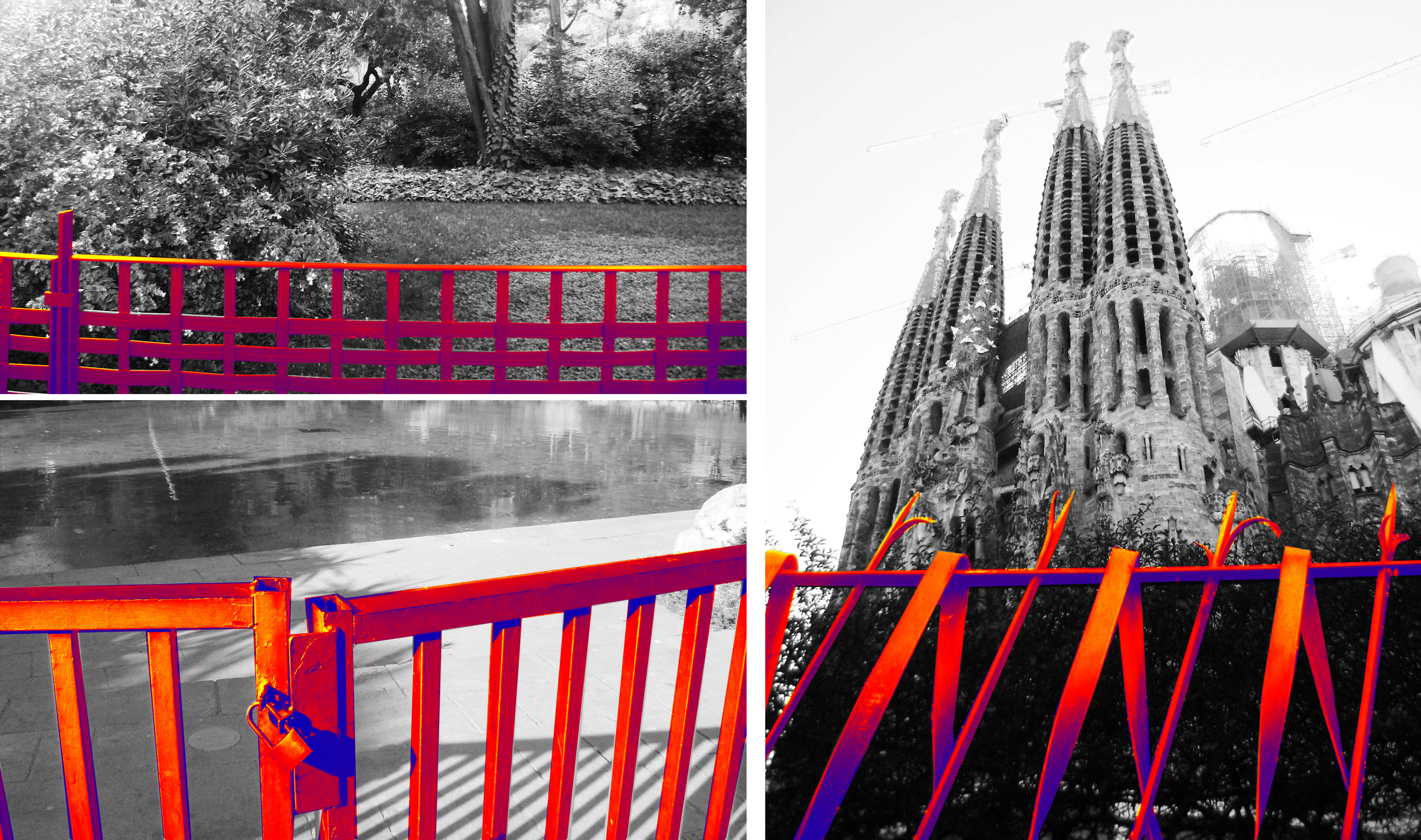
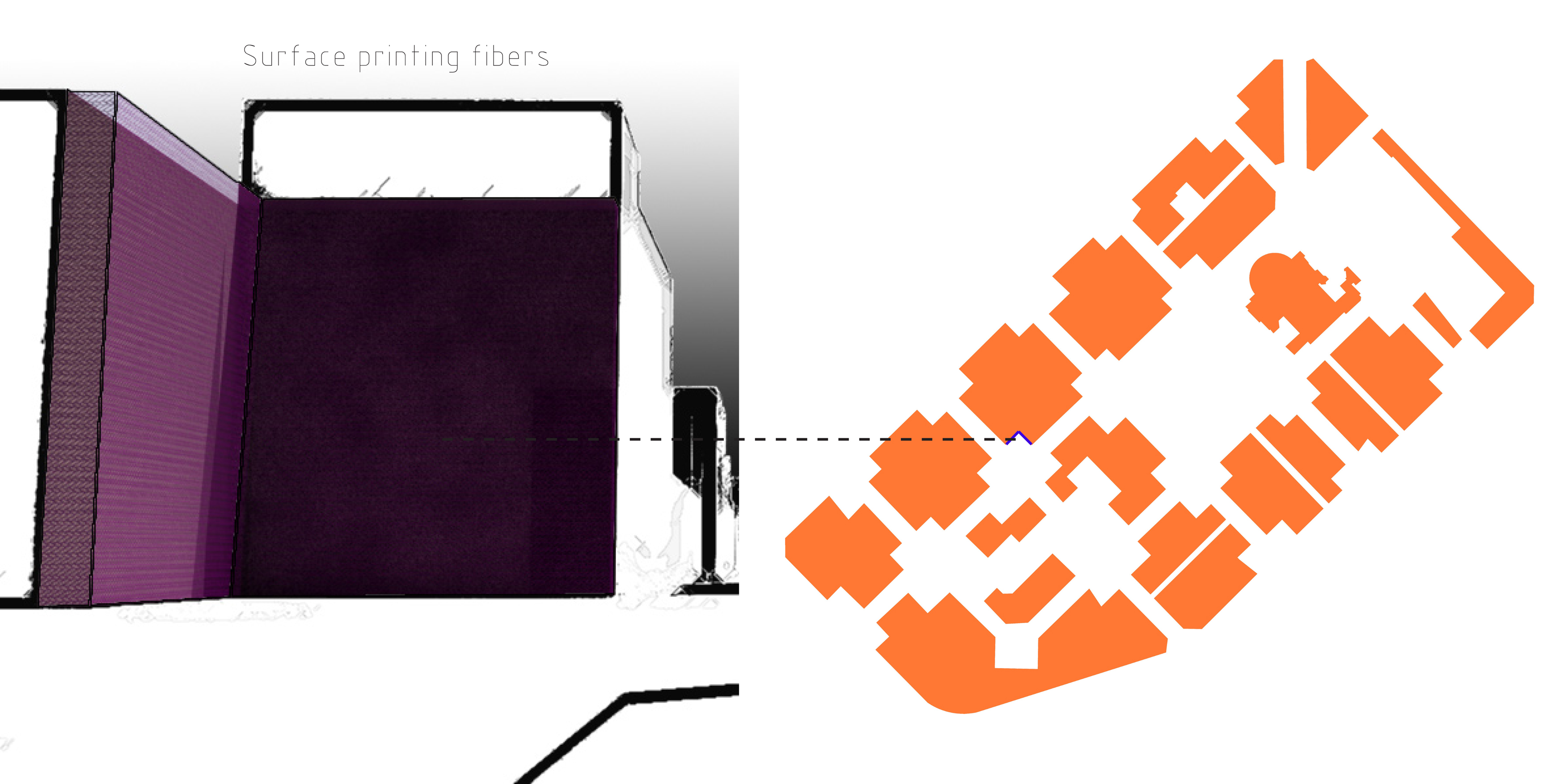
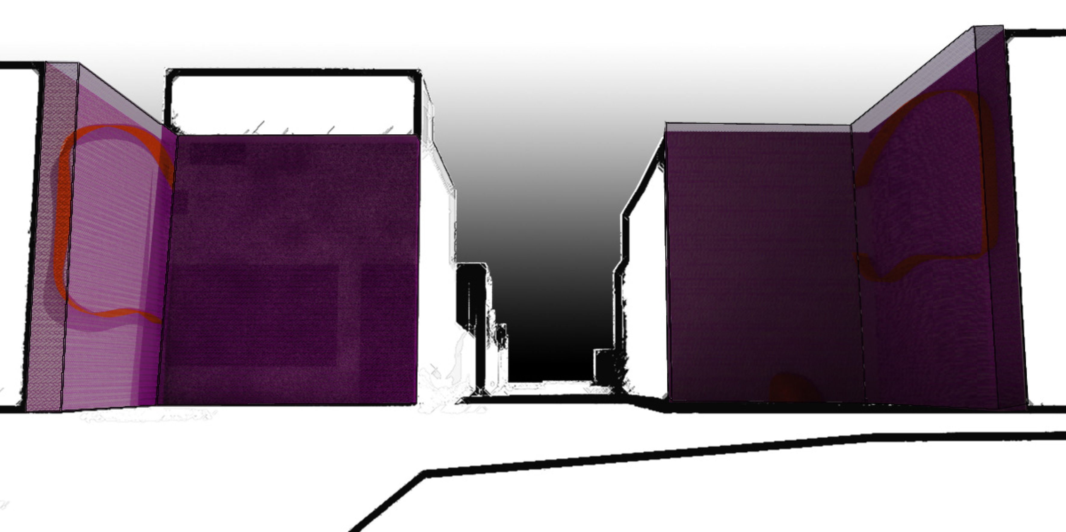
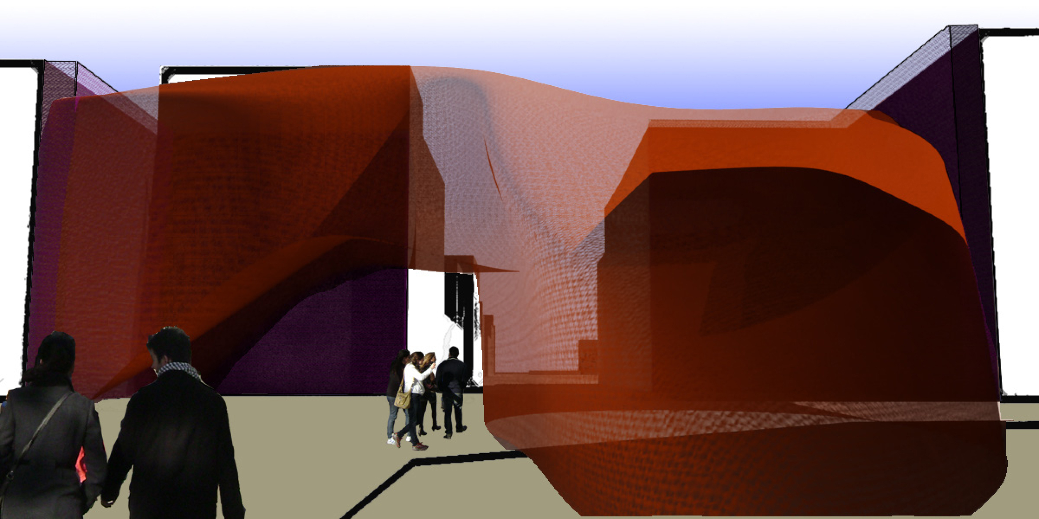
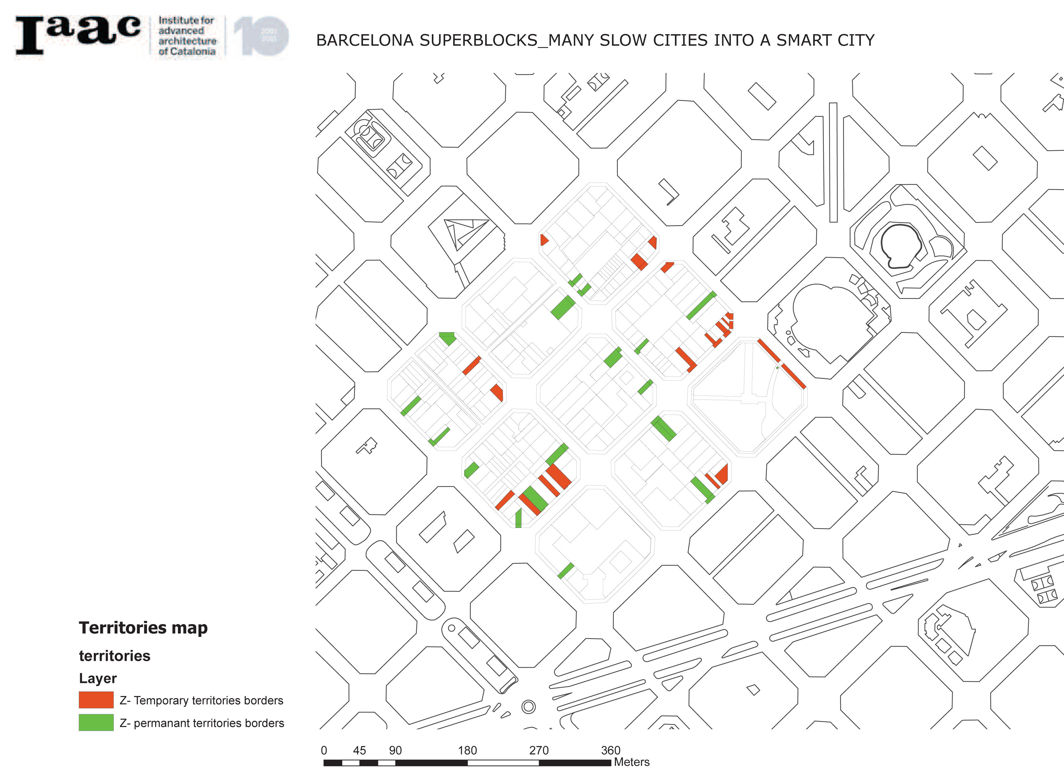
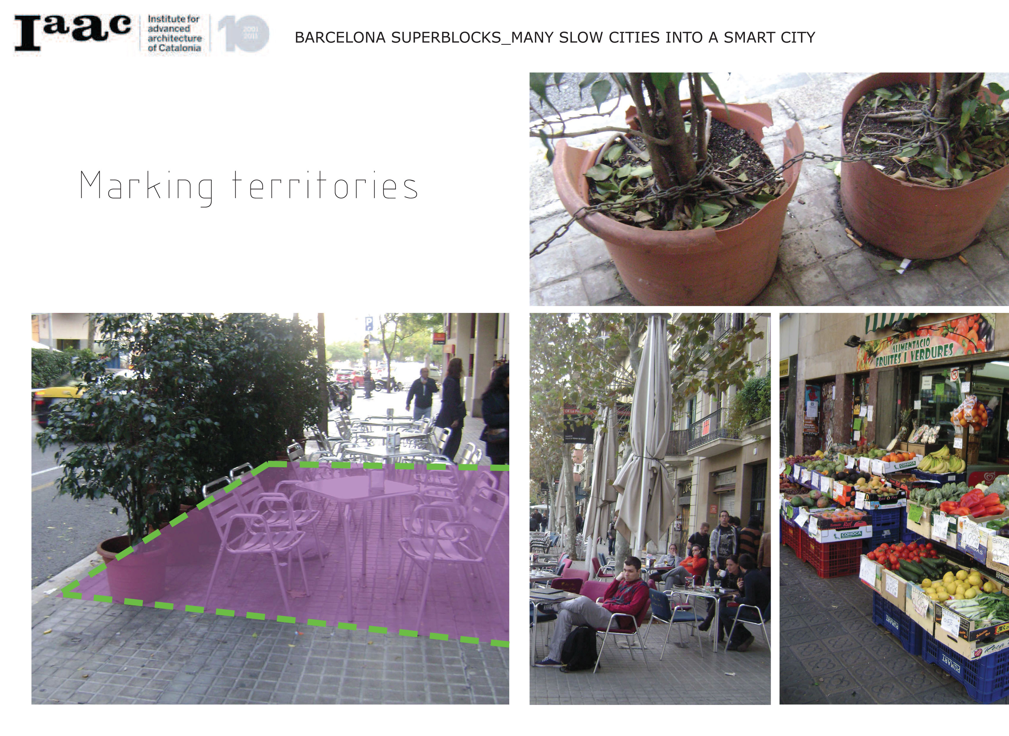
Let’s start with the concept of blurring of the lines. In Horta, existing borders are not needed for security or privacy and can be easily overstepped without any effort. Those are just the lines to separate place of where people can do any activities they want- grow something, drink coffee outside or others – and where they can not. As we close the car access to the block and give them all of this space, we decided to delete these unnecessary boarders.
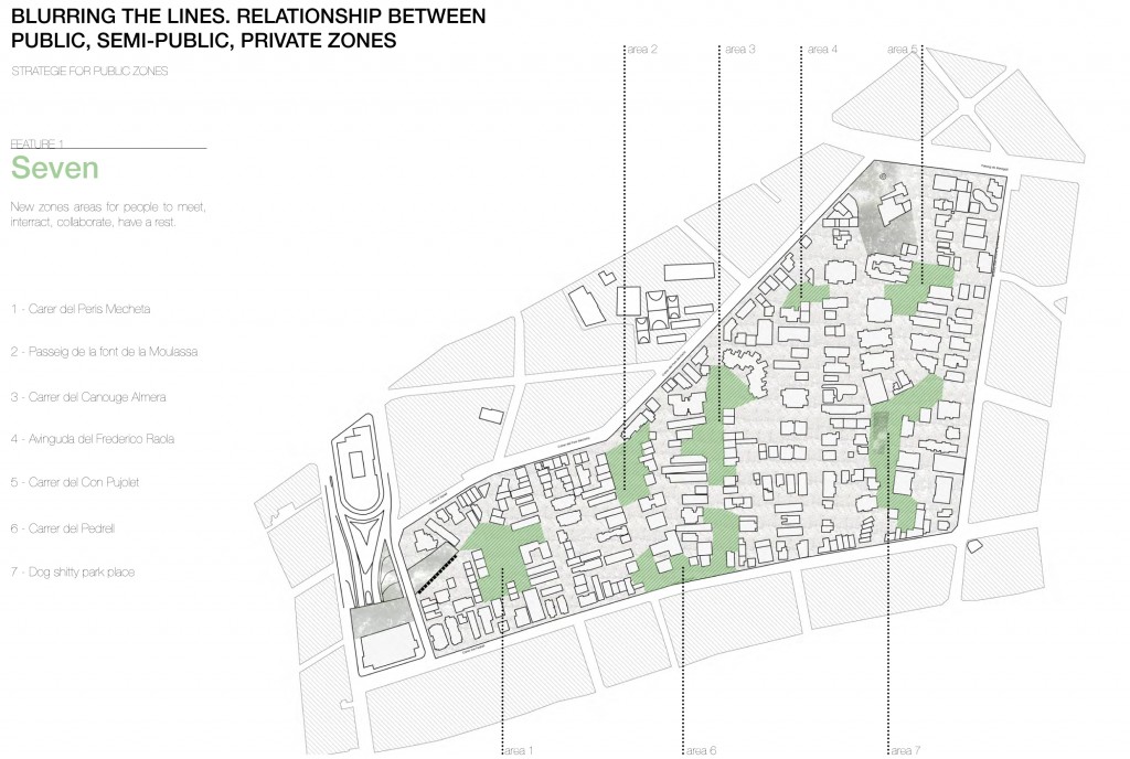

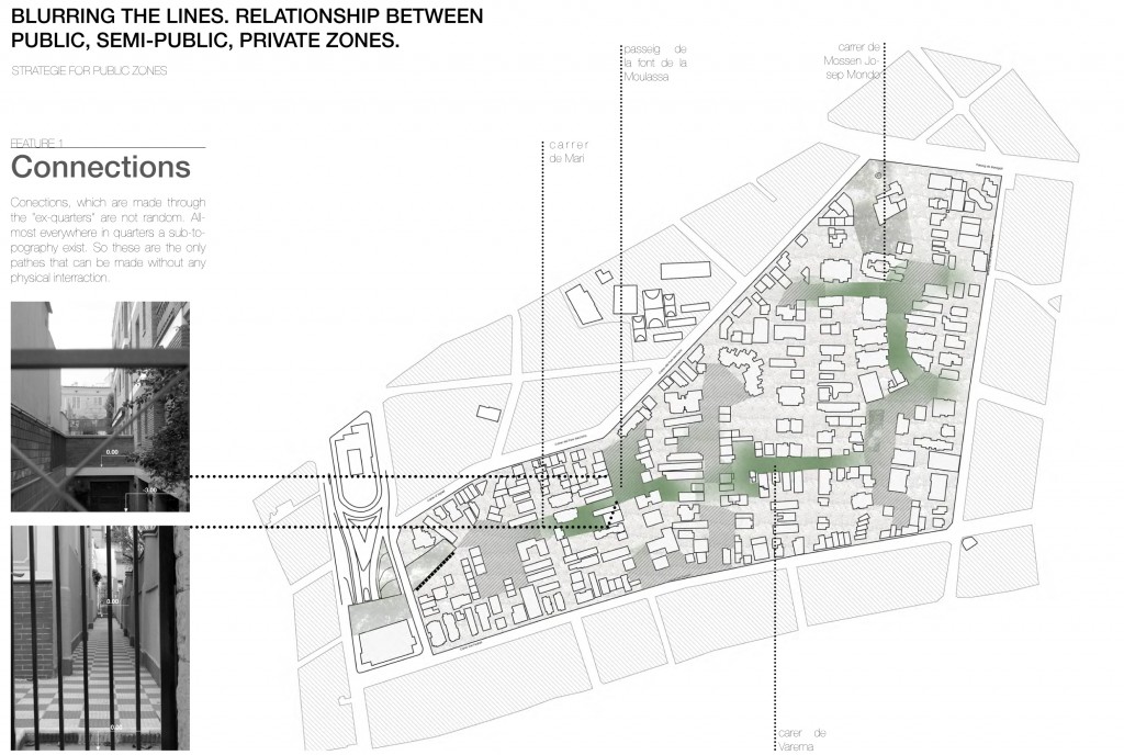
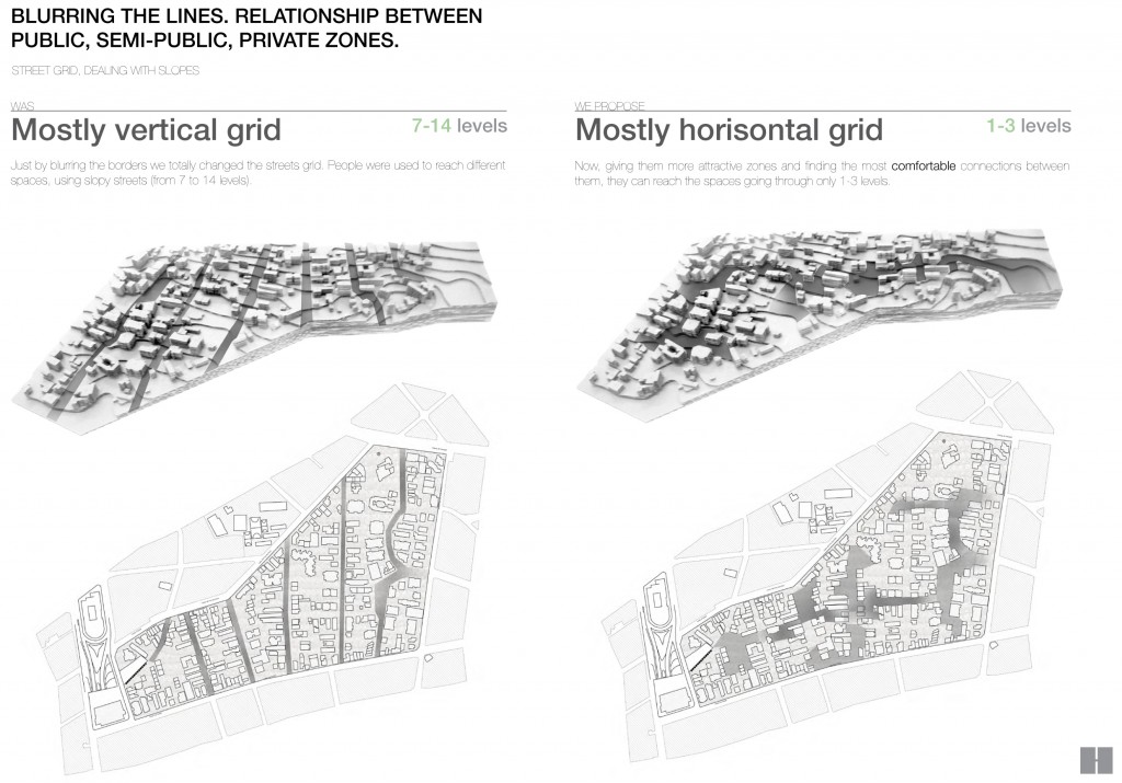
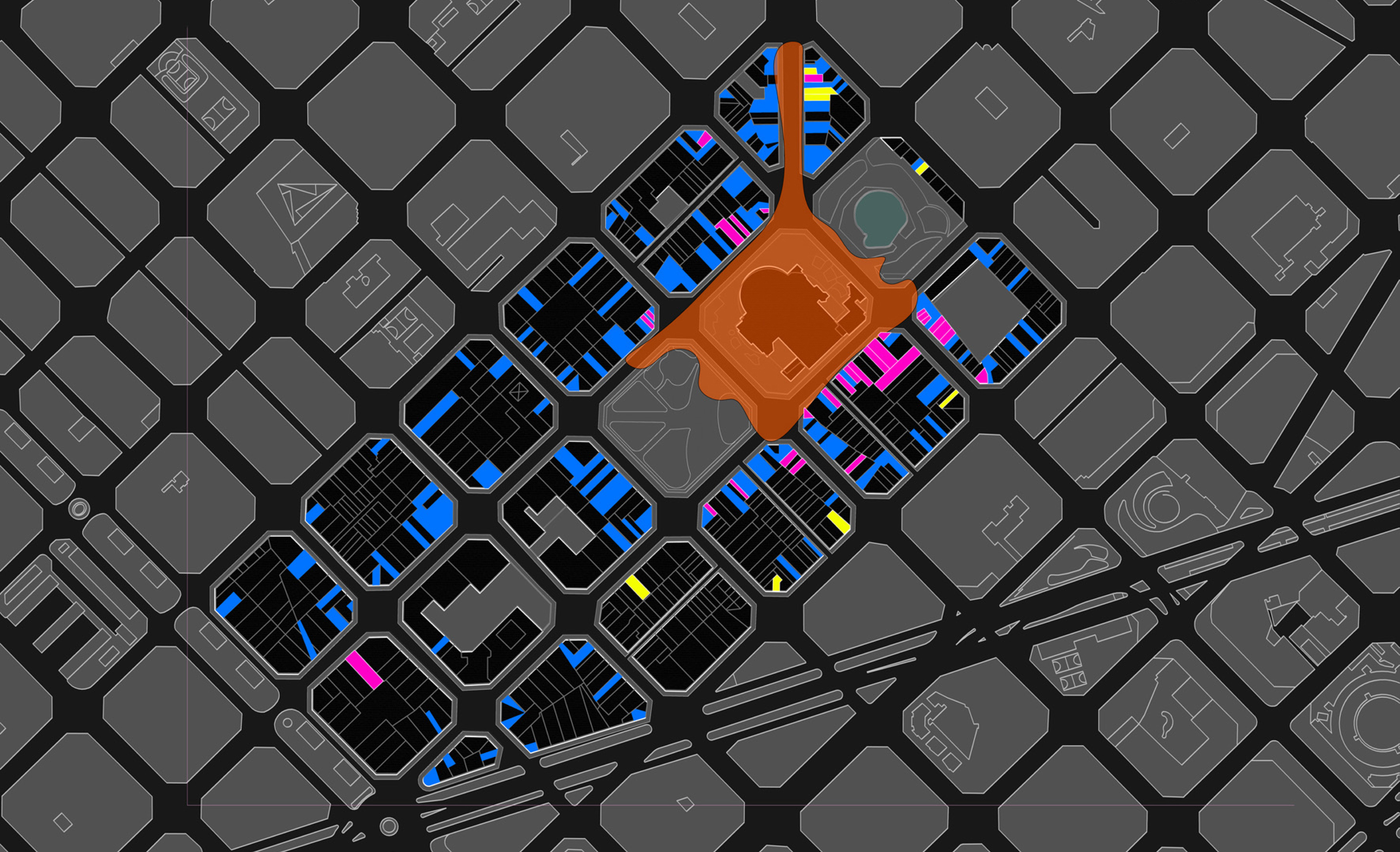
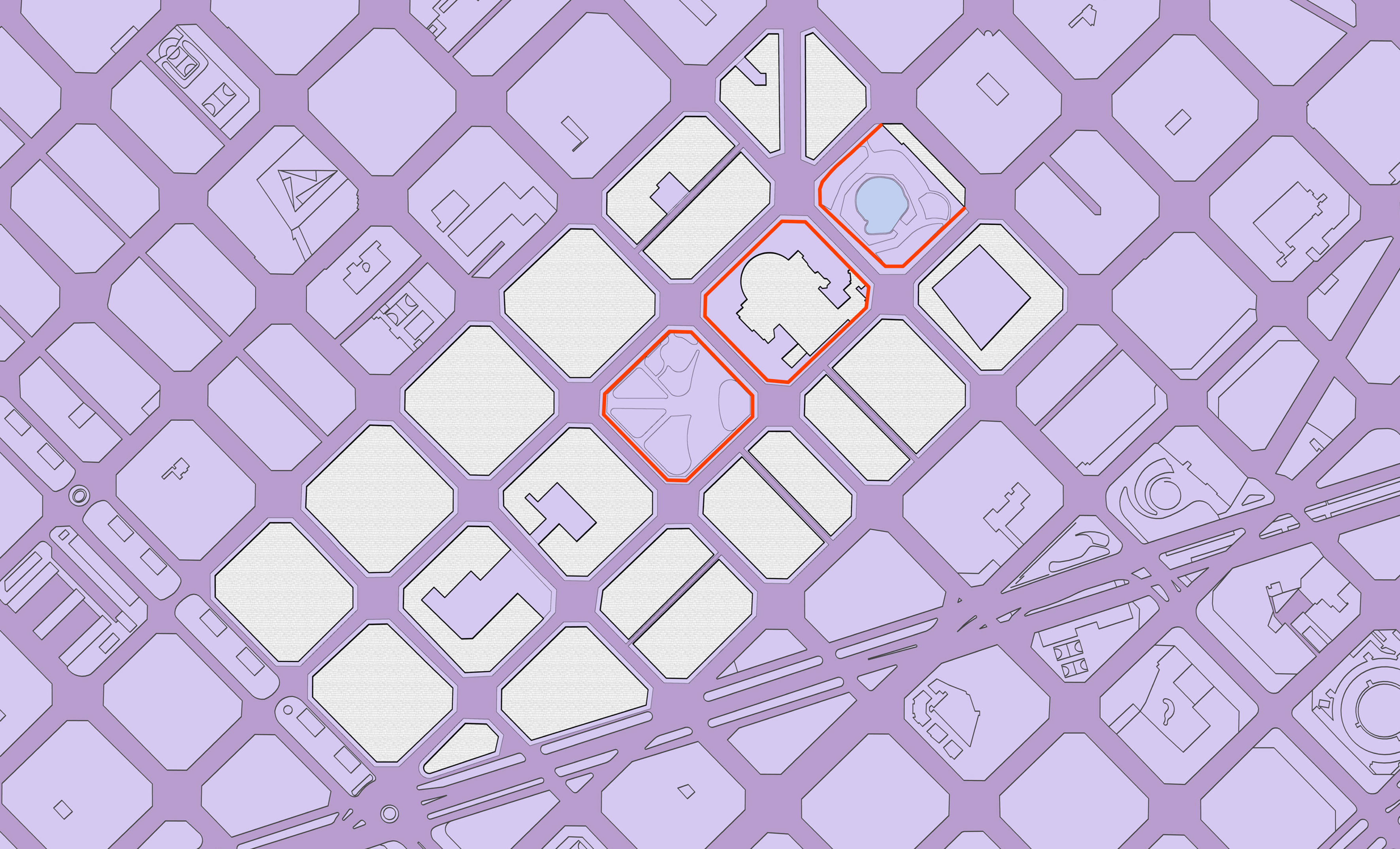
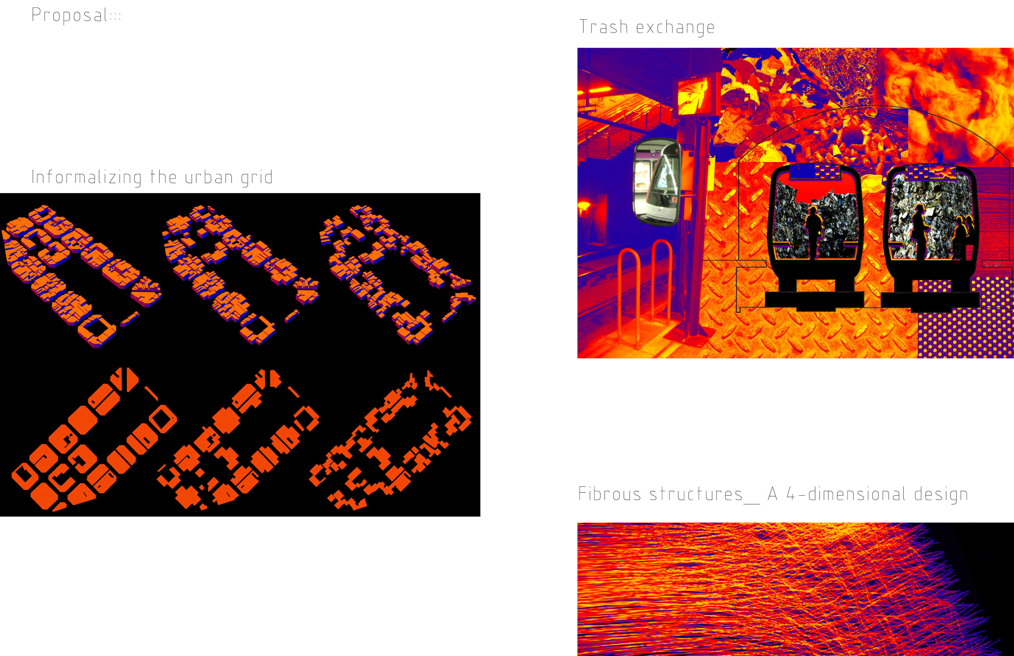
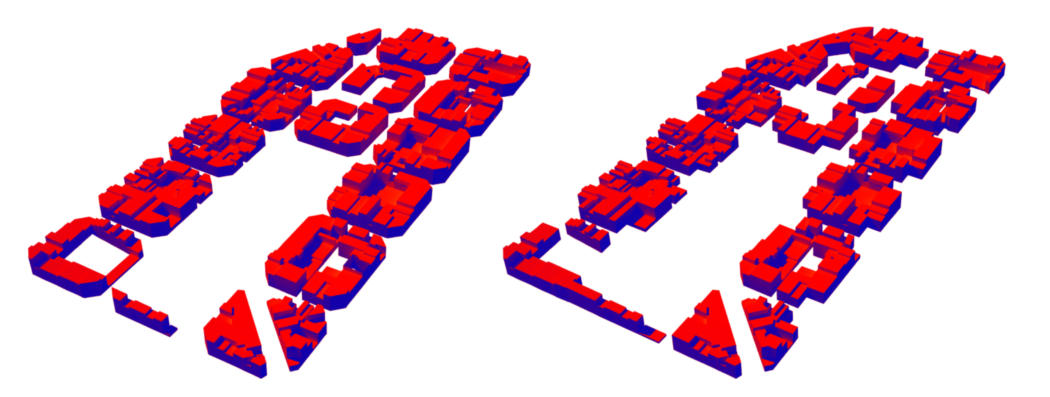
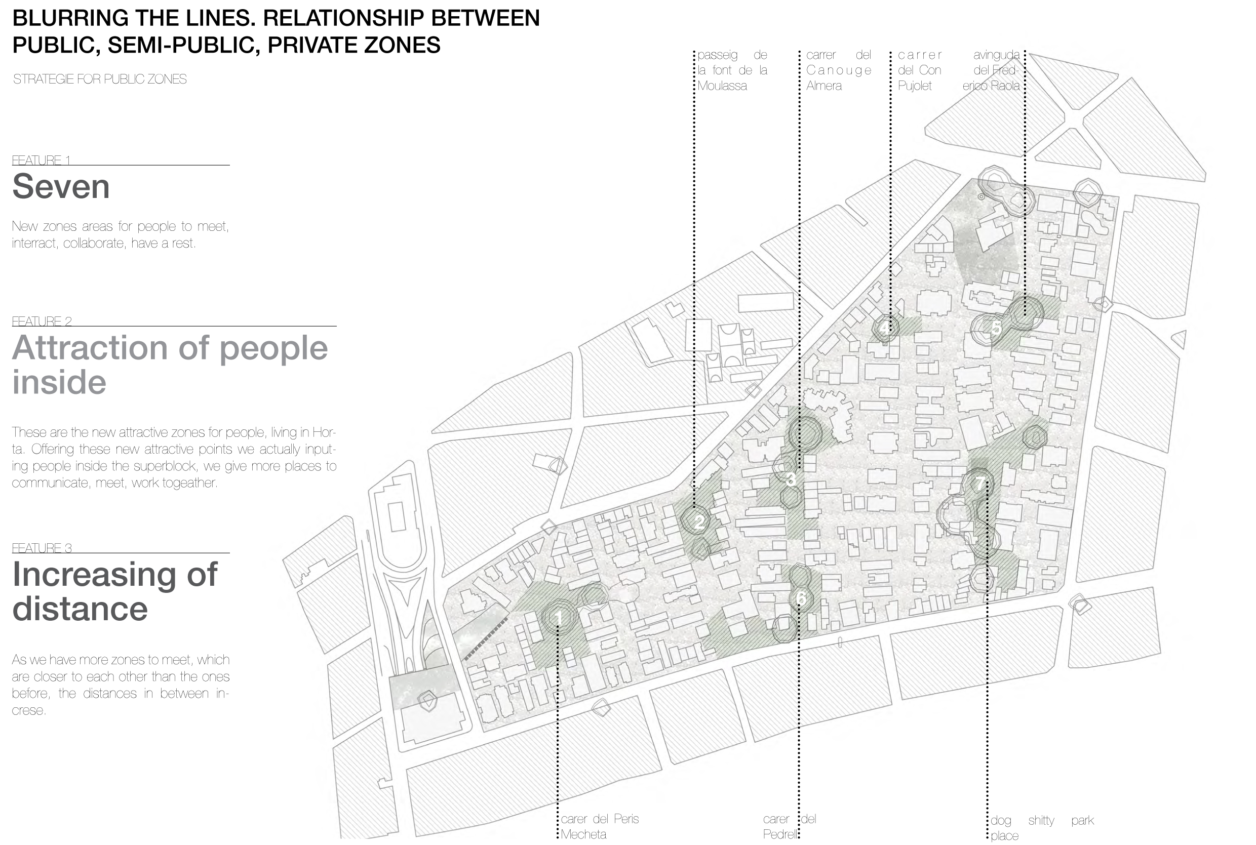
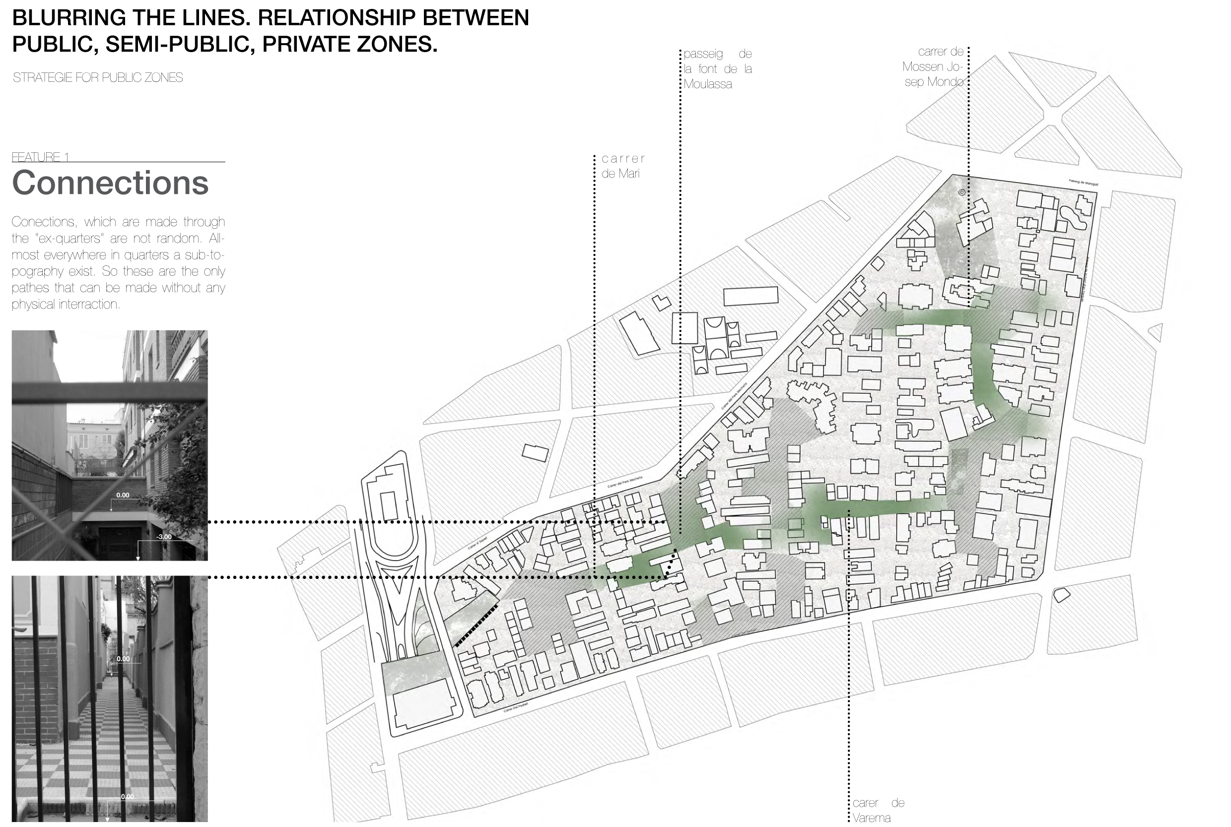
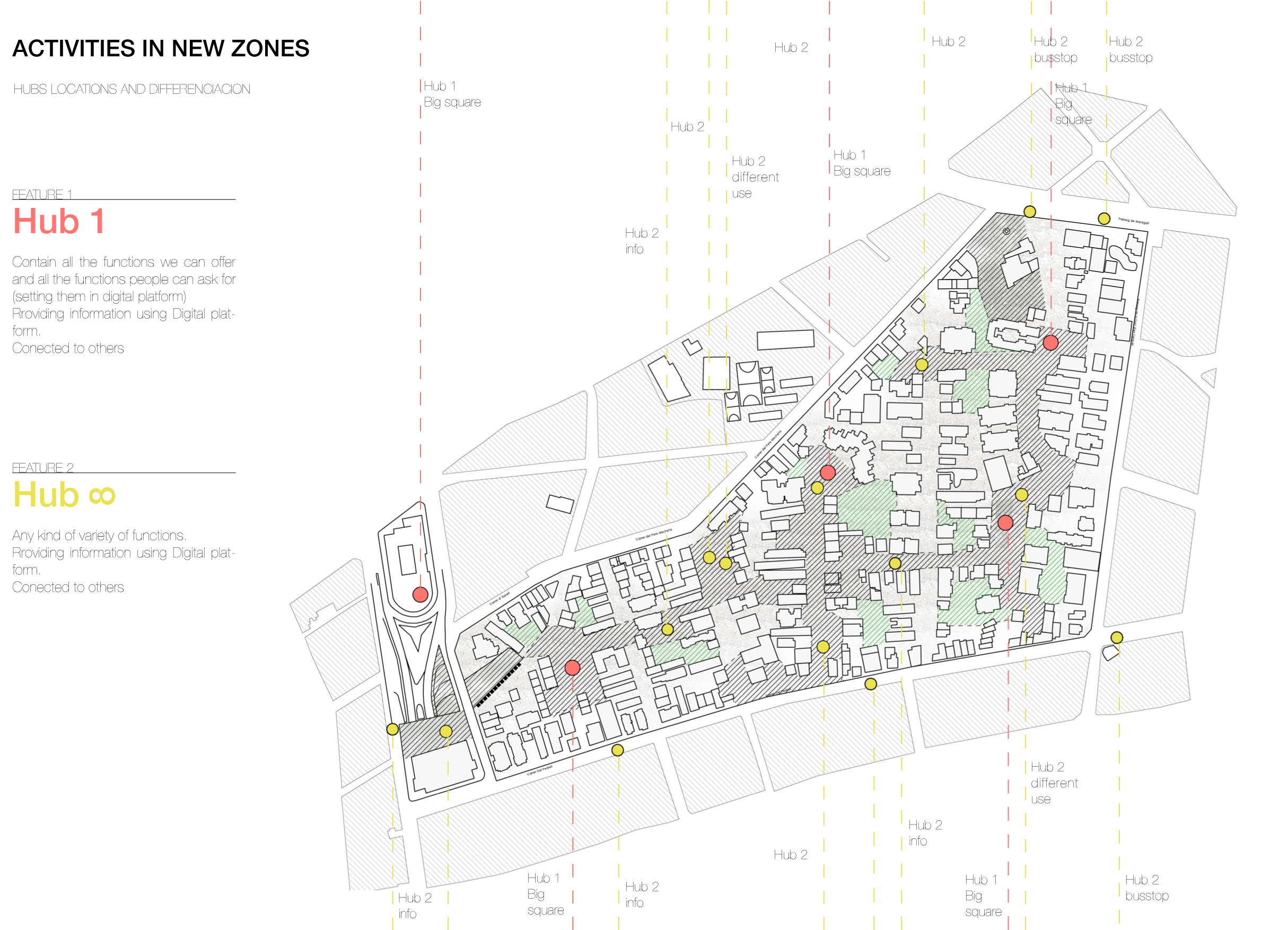
According to these new spaces, topography, our sun analysis, we get 7 new areas (m. 7), plazas, where we can offer any kind of activities for people. In this case, map of attractors will be changed from outside to the inner part of the superblock (m. 8). These zones are closer to each other and distances between them increase. Sub-topography, which exist in every quarter of block, and understanding of necessities of privacy for people give us a new kind of path, which connect these zones. (m. 9)
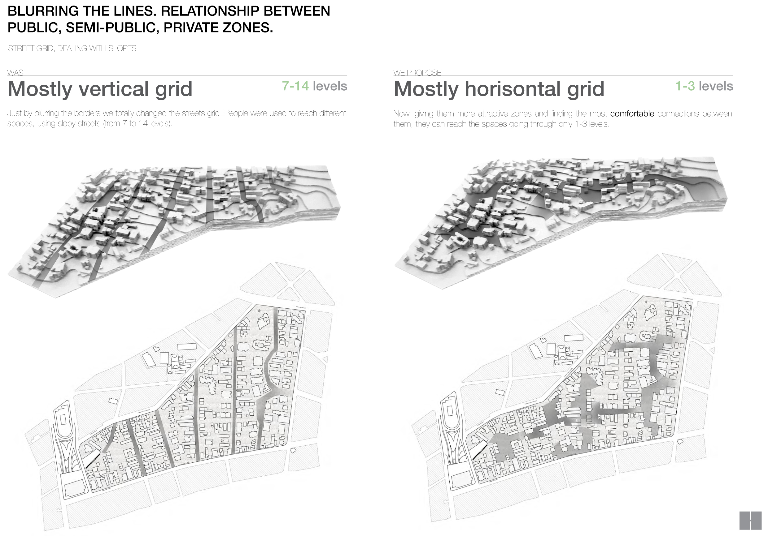
This connection becomes a new kind of streets grid. If before we had mostly vertical grid, now we have got almost horizontal one, which provides comfort, mobility and accessibility for people, they can easier and faster get from one place to another. (m. 10)
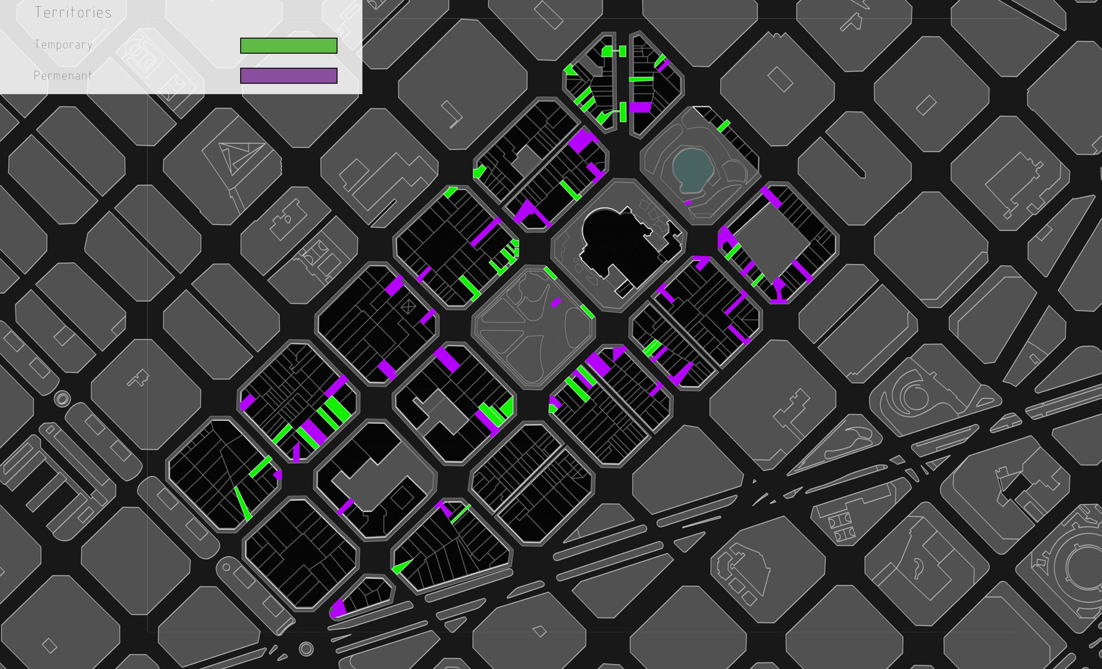
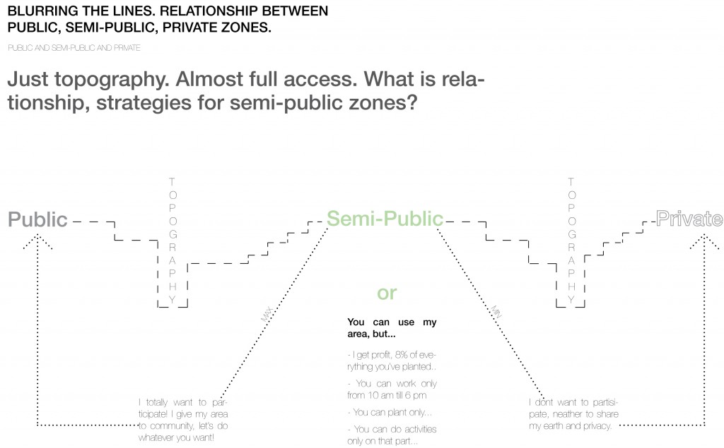
Just topography. Almost full access. What is the relationship between public, semi-public and private zones?..
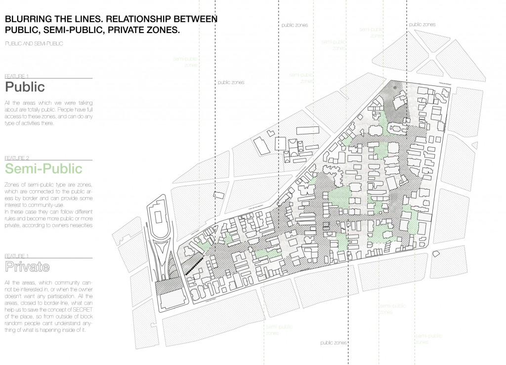
It is totally understandable what is public. People, who don’t want to participate in any changes for community needs, or are not interested somehow in profit from it, have their totally private zones. As well, we want to keep this concept of secret for Horta, so we leave all the zones, connected to the borders of the block private. In this case people outside of the block can not see anything happening inside, they are not interested in it and just pass by. Zones, which are connected to public ones and at the same time can be interesting for community nessesities, becomes semi-private. According to topography, people will understand, that they are not on totally public area anymore, they have an access to the zone, but they have to follow rules and laws, which owner of the place can set, [using a special Digital Platform (D.P.), which we are going to explain a bit after]. At least the activities, which people can do in any part of the block, are limited in these spaces.
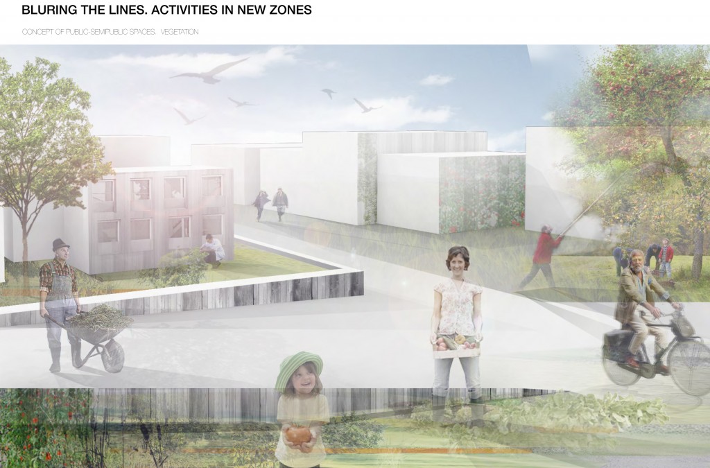
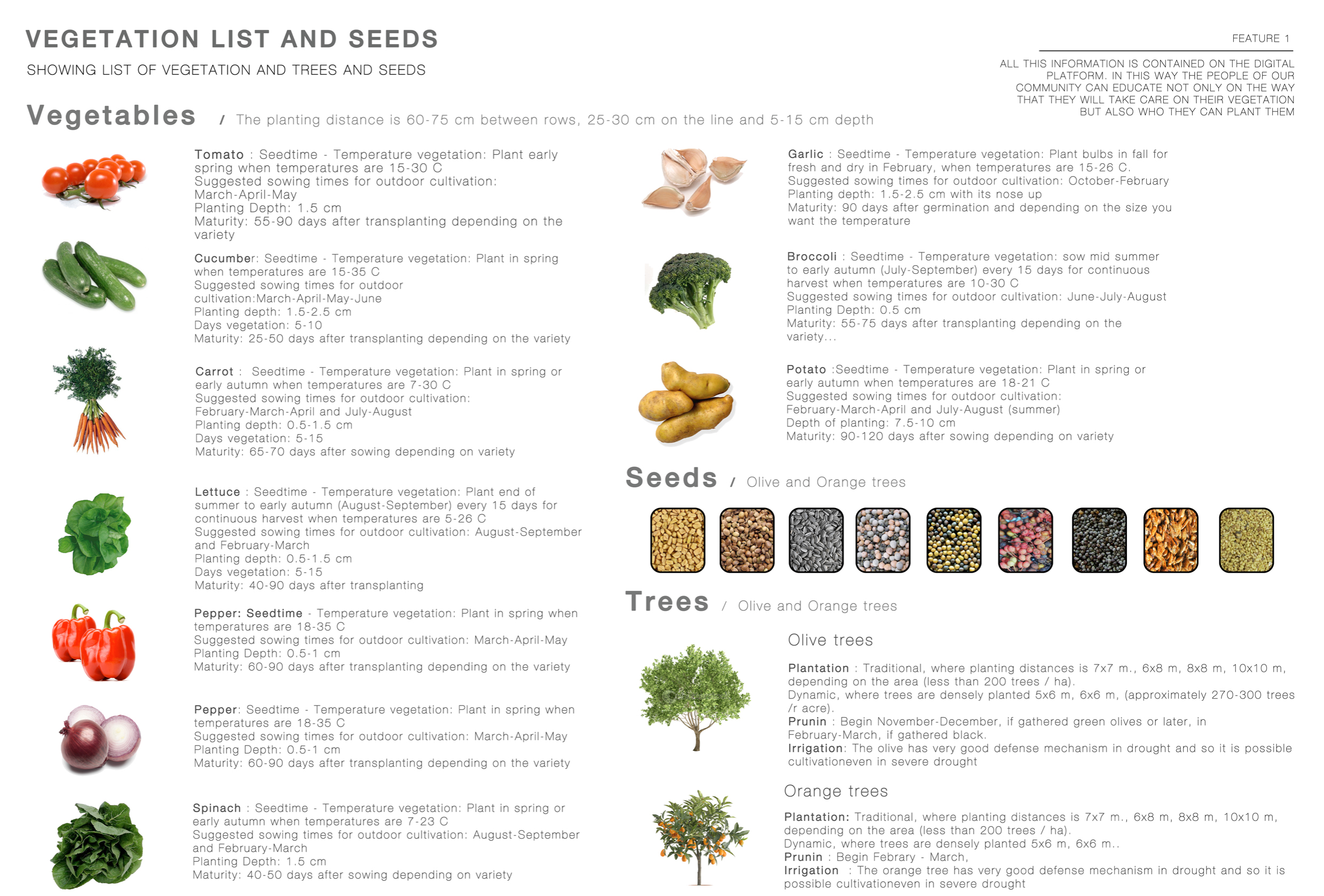
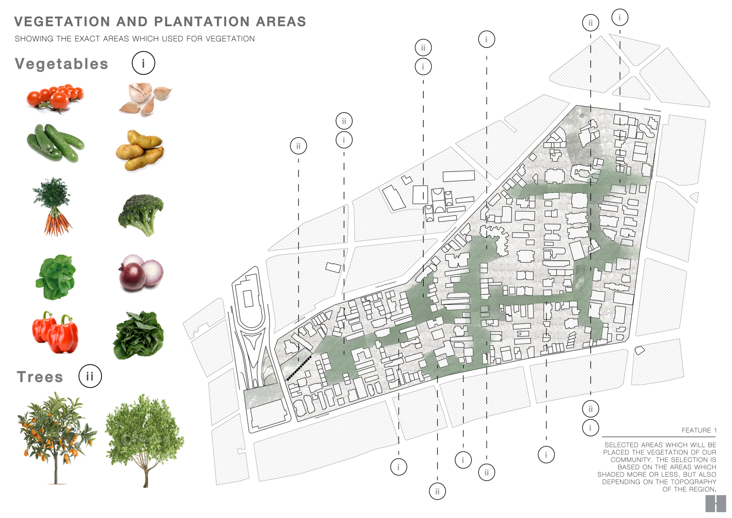
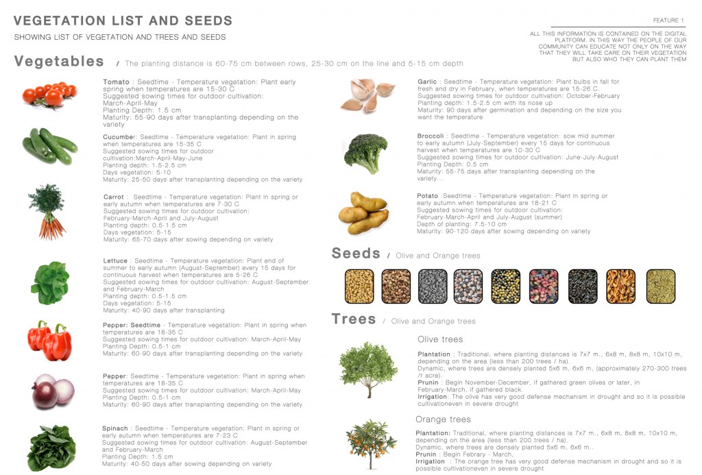
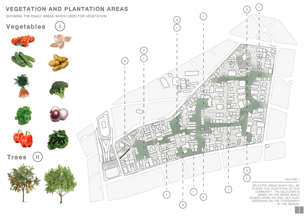
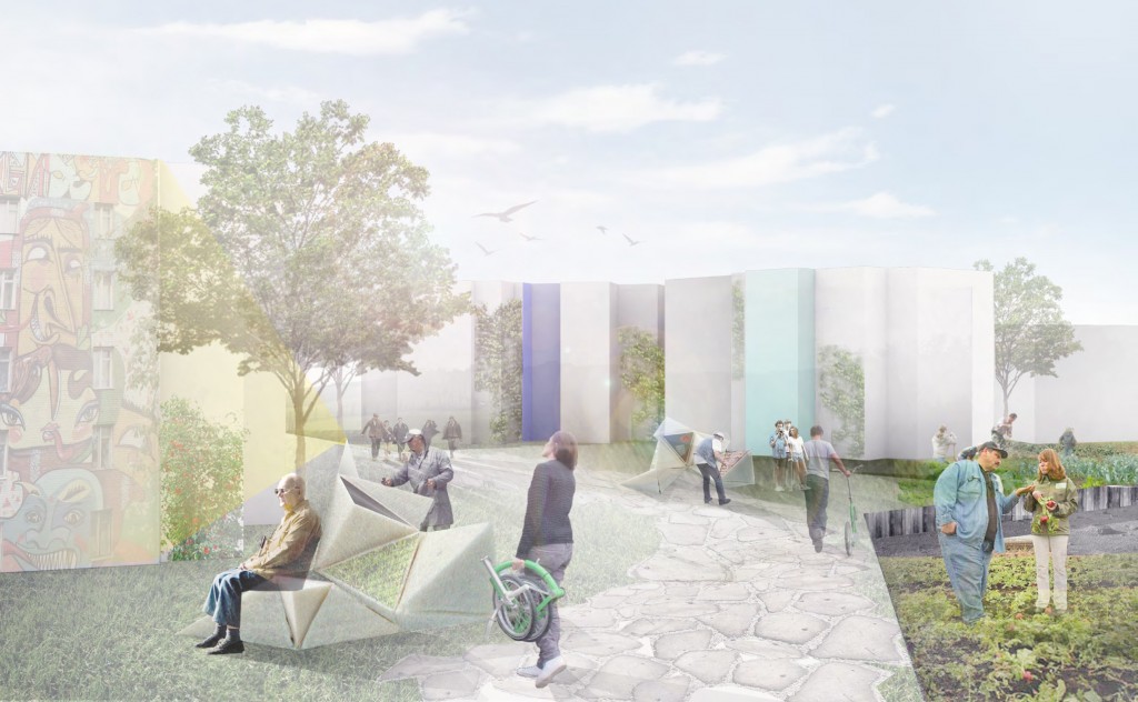
People can choose any activity to do in new zones. We wanted to offer the most obvious one for this place, which is a new vegetation system. People are already doing it, they like gardening, and we give them more space for this and possibility to work together as a team.
We can offer them types o vegetation and places where to do it according to the sun and shadow analysis, and they can vote and decide [on the D.P.] where and what exactly they want to plant.
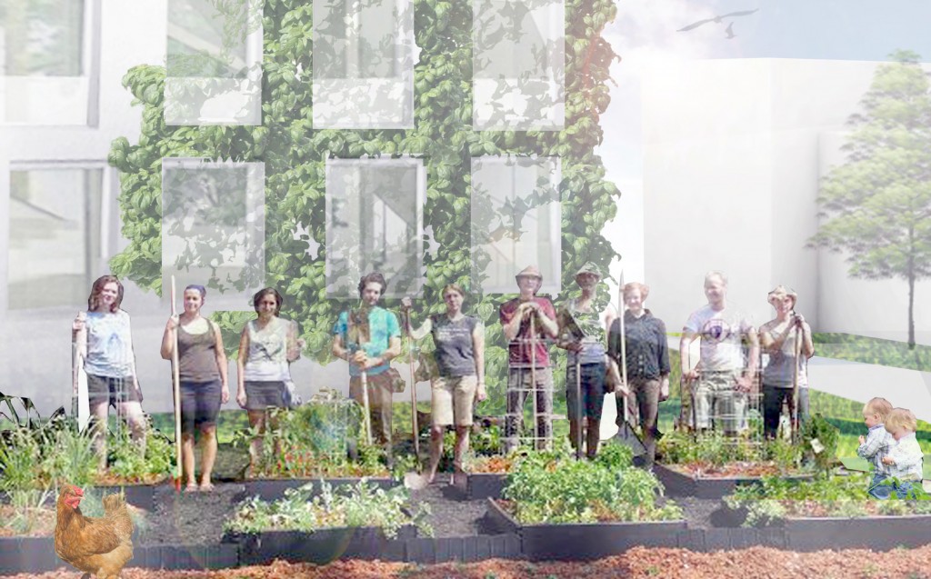
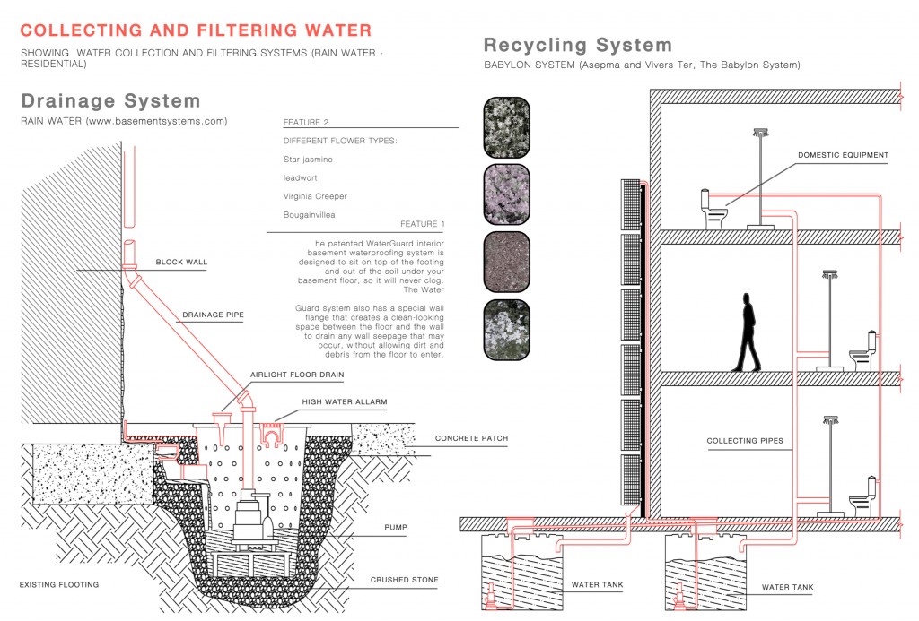

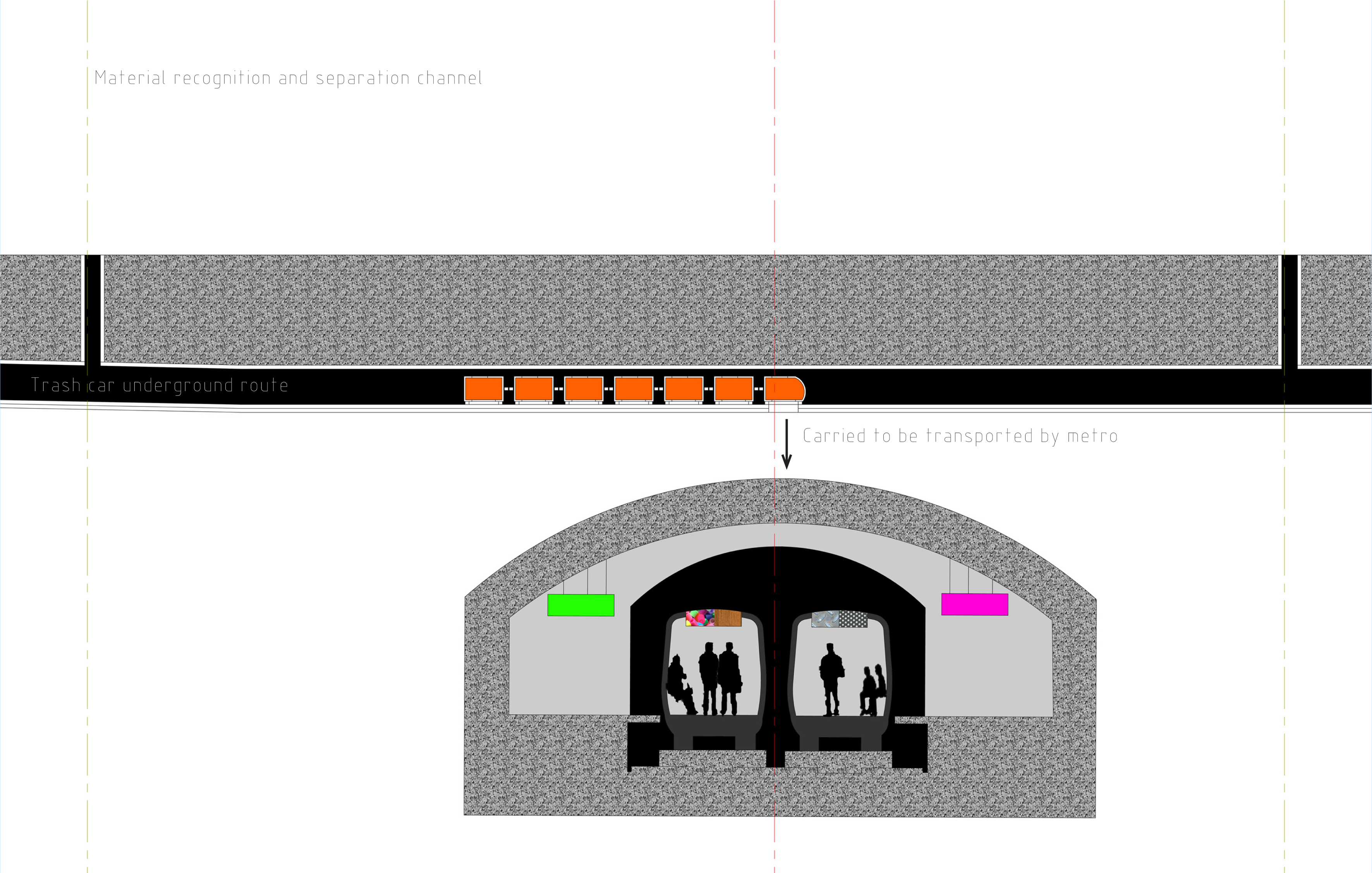
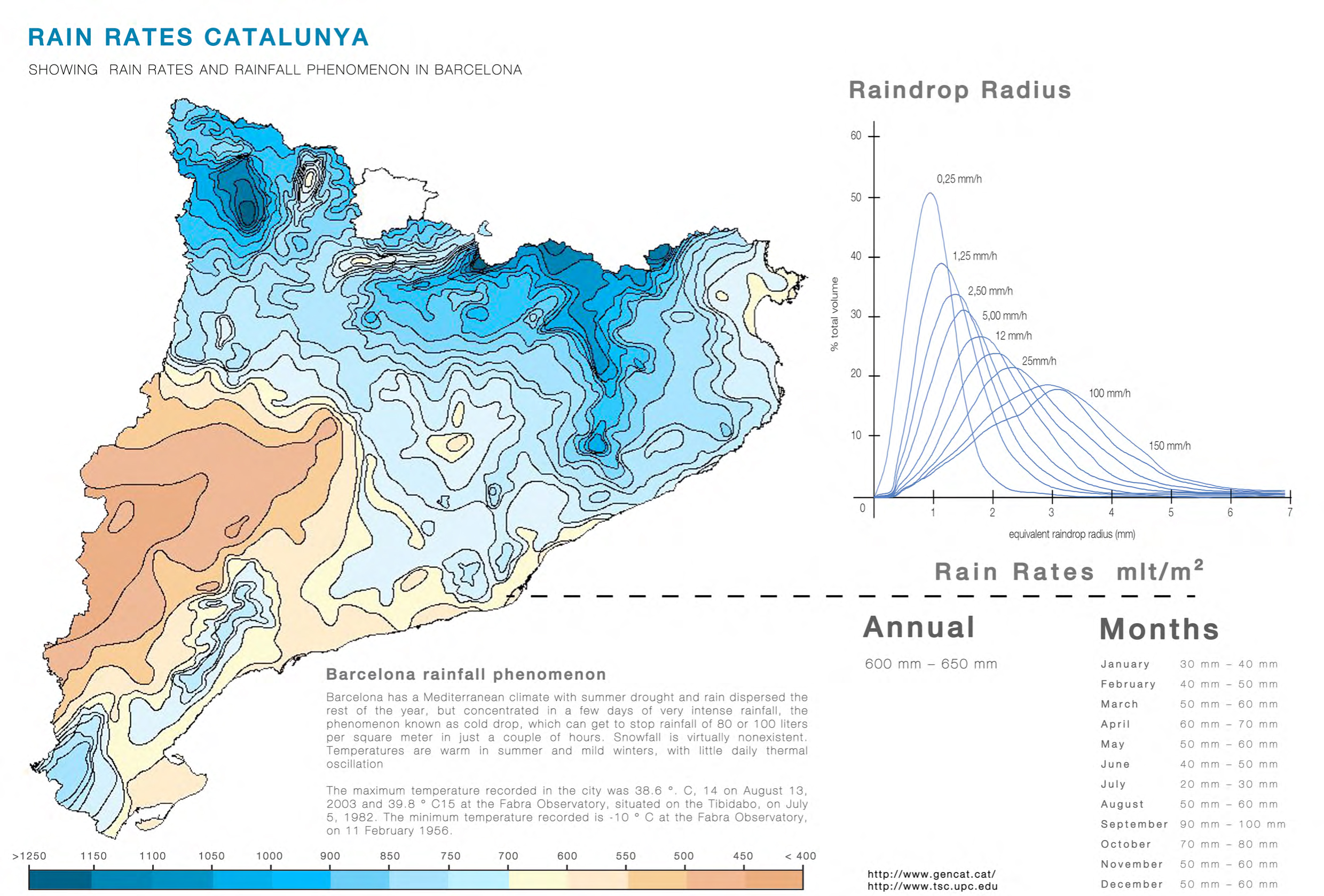
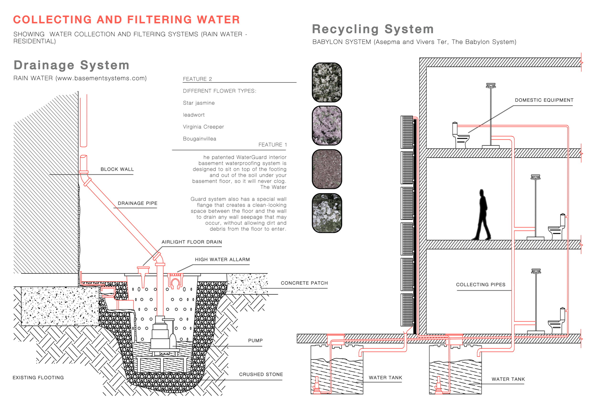
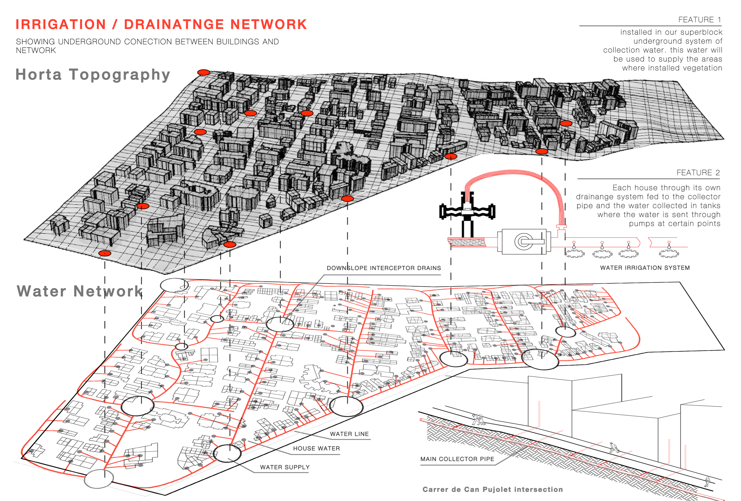
To support this proposal of new vegetation we implemented a new system of water collection, using the advantages of our slopes. We use drainage system to collect rain water and babylon system to filter and reuse water coming from houses – than we can employ water for the irrigation system.
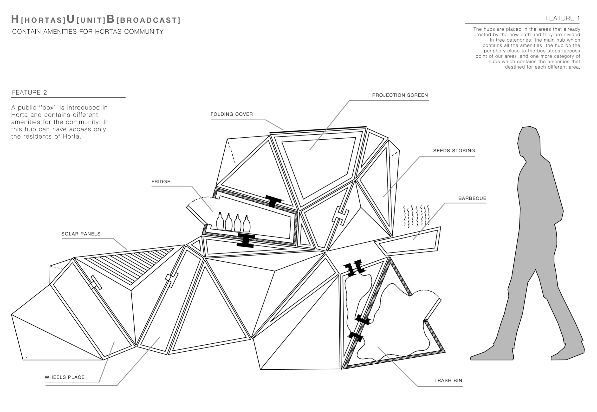
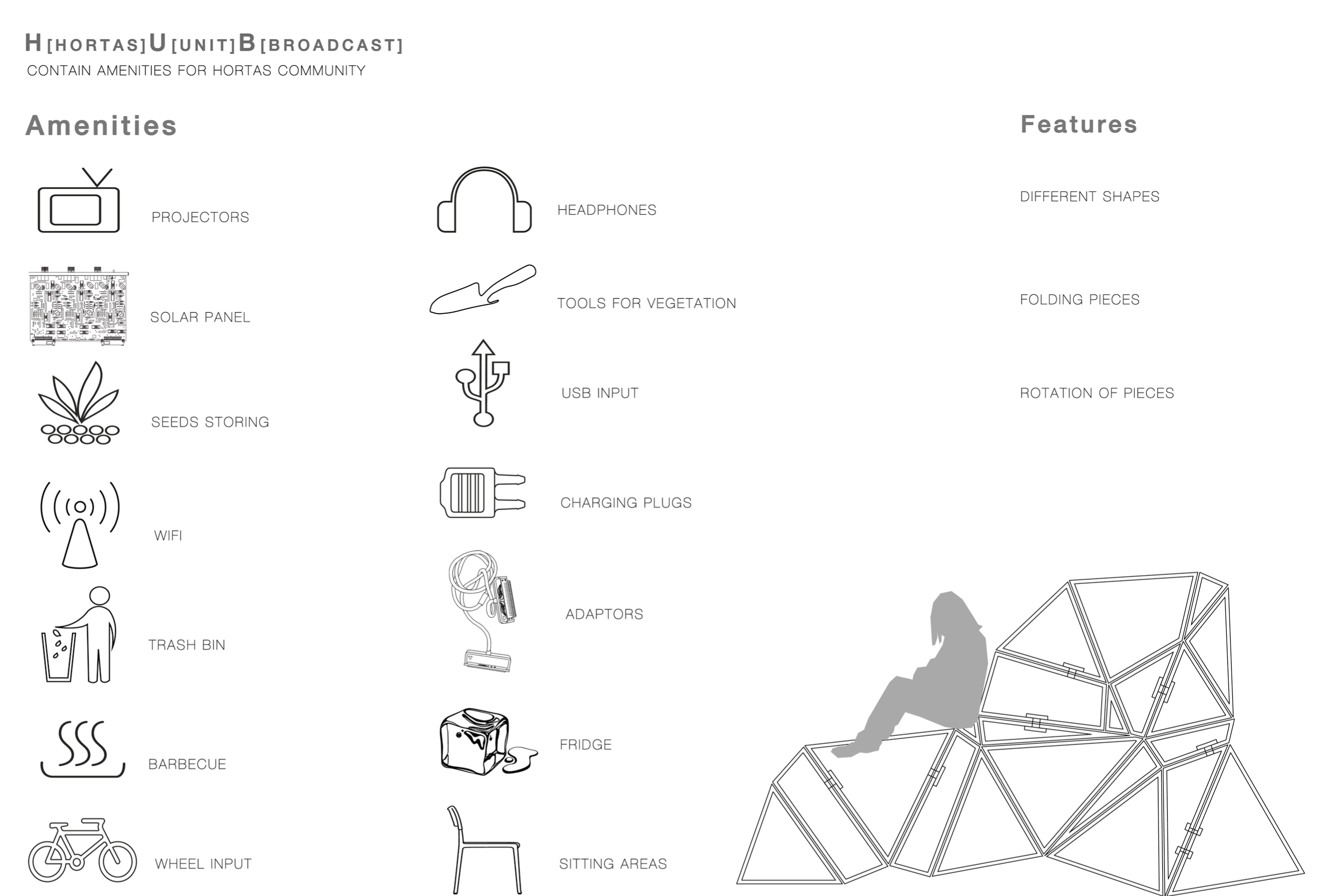
Vegetation is one of things, which we can offer for people because we can see that they do gardening, they like it, and it will give them one common work to pull them together more. But still it is just one proposal, which is stable and contains the same function. We wanted to introduce something more unstable, variable, in what people can actually “play”. We invented this kind of HUB – sort of container of different functions, which people can need, – which will be placed in different areas and, apart of digital topping, connected to D.P., will have a huge variative amount of different functions.
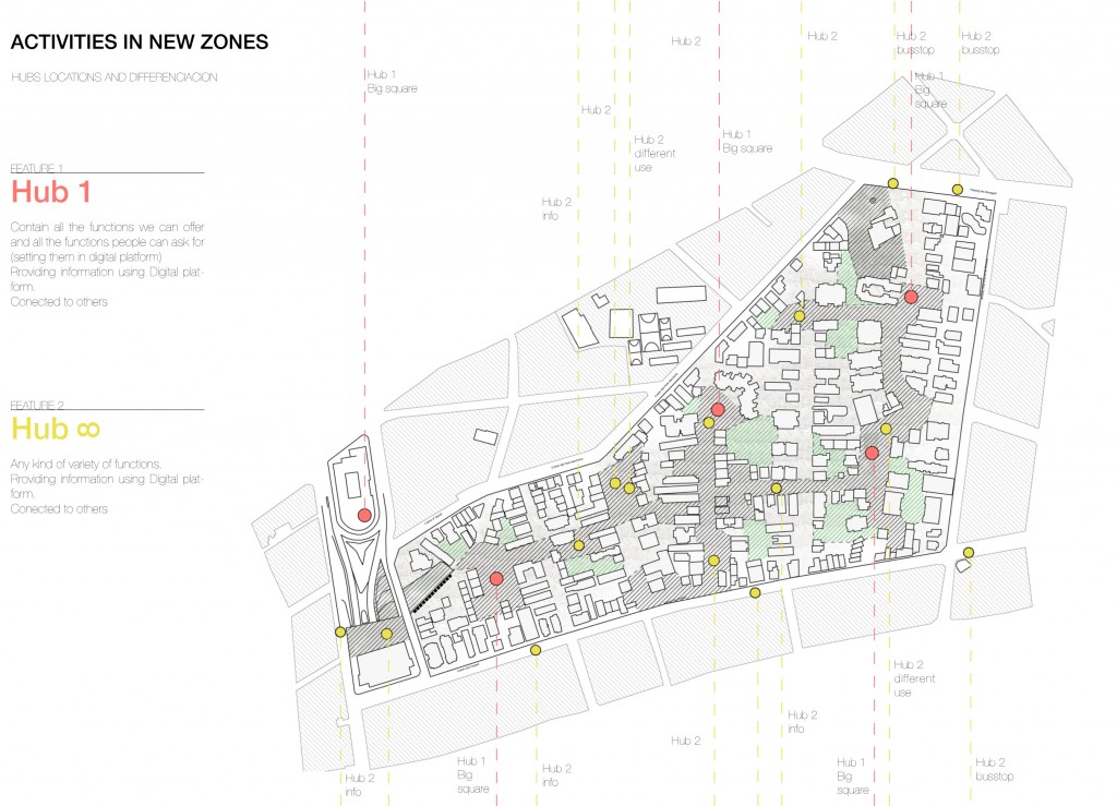


This hub is divided in two types. Hub 1 is the biggest hub, which contains inside all the functions we can imagine and people can need. (m. ) Hub 2 is an infinite quantity of variations of these functions, which can be collected in different ways. We have to add, as well, that design of the Hub, which we propose, is not exact – it is just an abstract. It can be anything, but it will have what people need in this space, this time.
This project is not about shape, but about content.
Hubs can be connected to each other by a Digital platform we implement to connect people more. It is sort of their social network, just for neighbors, where they have an access by a special card. With this card, as well, they can start using hubs, what enhance the concept of secret of this zone. These are hubs of the community, and other people won’t understand what is it.
From this hubs, or from the web-site people can collect information about vegetation life, they can educate and share their recipes and decide what they are going to do in that specific location, space. (m. ) They can learn and play with this platform, they can make new designs. This is the base which we give them. They can find out where their friends are and how to go to this location, where the new event is happening and who from their friends goes there. Many other possibilities, ways, which they can create by their own.
![]()
![]()
![]()
Becoming community, deciding what they want without interventions from any other people – that is the main purpose.