
The residents of Barcelona’s Bon Pastor neighborhood have a long history of displacement, originating from the routes of immigrant relocation from Montjuic and slum dwellers along the River Besos. The area has recently begun a dramatic and long-term transformation in order to gentrify and densify the area as the once-industrial sites surrounding the area are vacated. Intrinsic to this transition is the development of various social programs, river rejuvenation and improved infrastructure.
In analyzing the area as an emergent region for research line 1: Emergent Territories, a survey of the local population data, density, metro station locations and current state serve as a nice compliment. The following is a comparison of various statistics from the metro stations within 3km from the Bon Pastor neighborhood, in the district of Sant Andreu, using data collected from Barcelona and Badalona municipality 2005 census data, Wikipedia, and personal investigative research and data collection.

pictured: Metro stations radially according to distance from Bon Pastor site in geographical distance. size indicates actual walking distance to the centre of Bon Pastor, while the extruded height represents the year in which the station was inaugurated

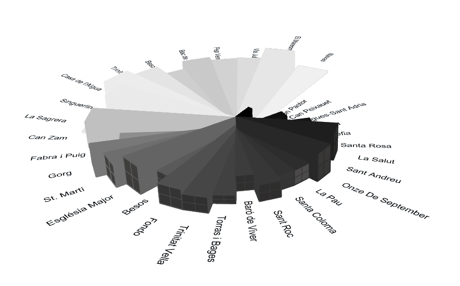
Comparison of distance on foot from Bon Pastor neighborhood to metro stations within a 3km radius to the station’s inauguration date. Correlation of this data can reveal information about the current demand of the residents, in addition to the long-term planning of the area’s development.
Sources:
Anuari de Població 2012 (in Catalan). Ajuntament de Sant Adrià de Besòs. 2012. Retrieved 11 July 2012.
Wikipedia. , http://en.wikipedia.org/wiki/Barcelona_Metro
Investigative data collection on site