![]()
![]()
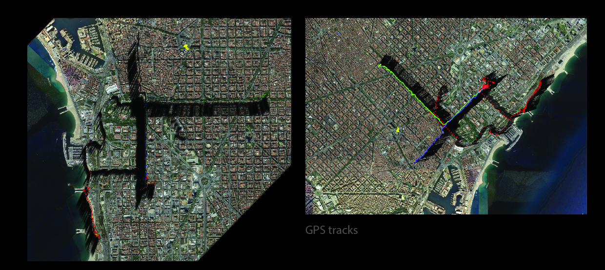
The goal of the GPS mapping here is to show how life of three people is intertwined over common paths, the GPS mapping shows prominent nodes of the city and some important paths common to all. The paths create some enclosed regions making very interesting divisions of the city. The 1st person is denoted by red, 2nd by green and 3rd by red. The concentration of the colors at certain spots is denoting the places where there was more time spent by the individual.
GPS tracking can be a great medium to extract information which can be used to make observations in various fields, it can be very handy to derive stats and data.
The grasshopper definition has an input of a .gpx file which is then converted to coordinated, these coordinates are then remapped on to an imported goggle map. The representation of each GPS tracked point is in the form of a extruded circles.
![]()
![]()