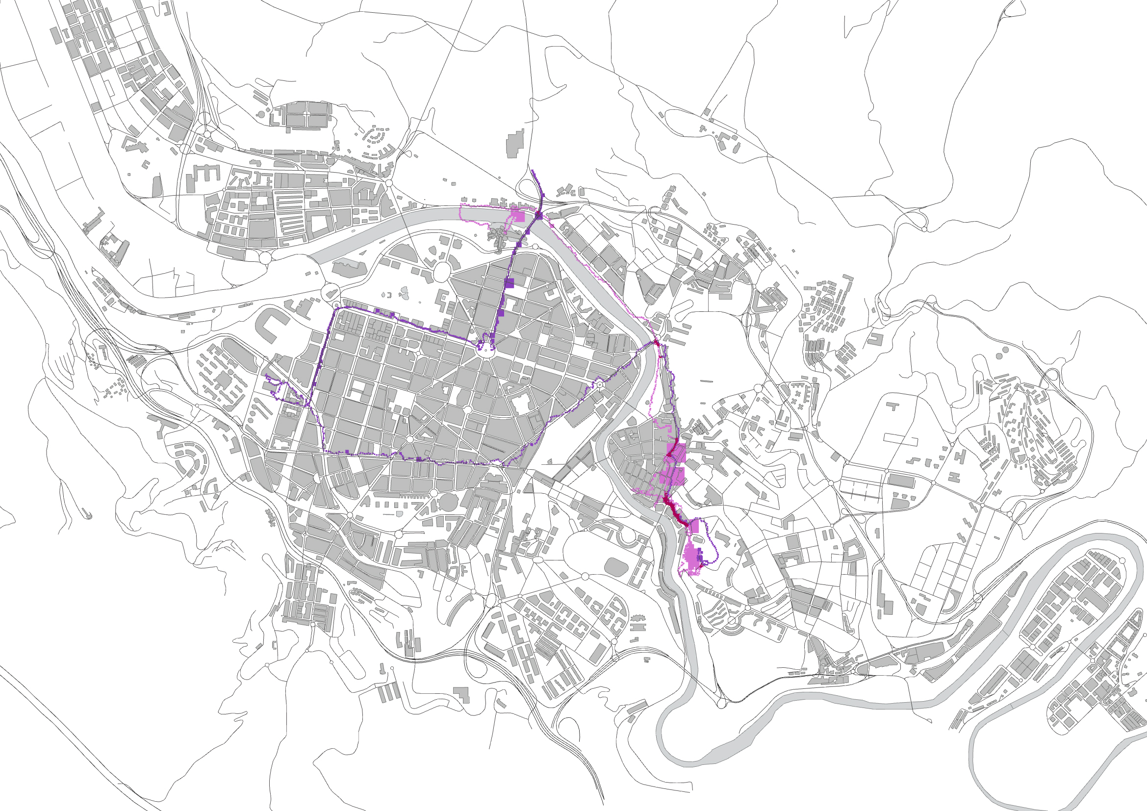
The Batman comic was out. This is the footprint of my hunt for the comic. I started with one track and then Continued on different days. The path shows my tracks for 4 days.
The Batman comic was out. This is the footprint of my hunt for the comic. I started with one track and then Continued on different days. The path shows my tracks for 4 days.
For this assignment two different tracks of two differerent users have been analysed in order to find out which are the most popular touristic spots in Bilbao (except for the Guggenheim Museum!). The evaluating parameter is the distance between the points of the two tracks, which can be changed accordingly via a numeric slider.
Abstract:
It is nowdays possible to track your own everyday movements through GPS technologies. This can be used to improve the efficiency of your transportation, saving you precious time. It is possible to compare several means of transport and perhaps, choose the ones that are healthier such as walking, bicycles, skate board, roller skaters, etc. This mean it is possible to turn your transportation into your own everyday gym, saving you even more time!
Preparation
Tracking App used: My Tracks, Android. This App tracks your movement and saves it as a KMZ file, which we turned to XML file to use it in Grasshopper.
Self-Stalking:
For this assignment, we decided to track our movement form our apartment to IAAC using three means of transportation: walking, long board and bicycle. The tracking was done between the corner of Napols and Pujades, to IAAC entrance in Pujades 102, Barcelona-Spain.
The distance between the apartment and IAAC is about 1km.
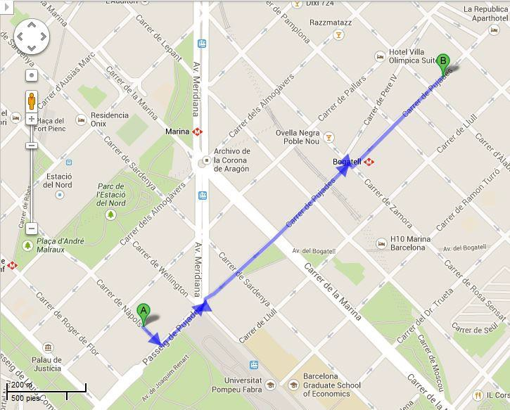
Image from Google Maps Direction: A- Carrer de Nàpols, 9-11, Barcelona
B- Institute for Advanced Architecture of Catalonia, Carrer de Pujades, Barcelona
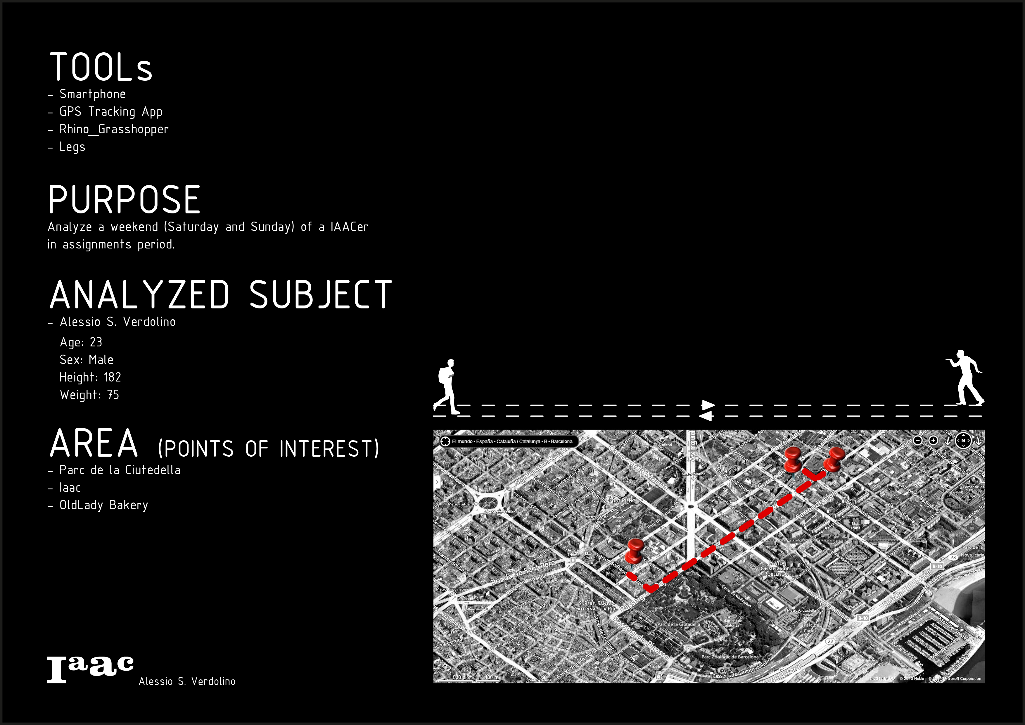
Through the use of any GPS-Tracking App (here: “Easy Trails” for iOS) and the following code in Gh, I mapped my weekend, which is considered as a normal day of study.
Three basic points: – Home
- IAAC
- Bakery
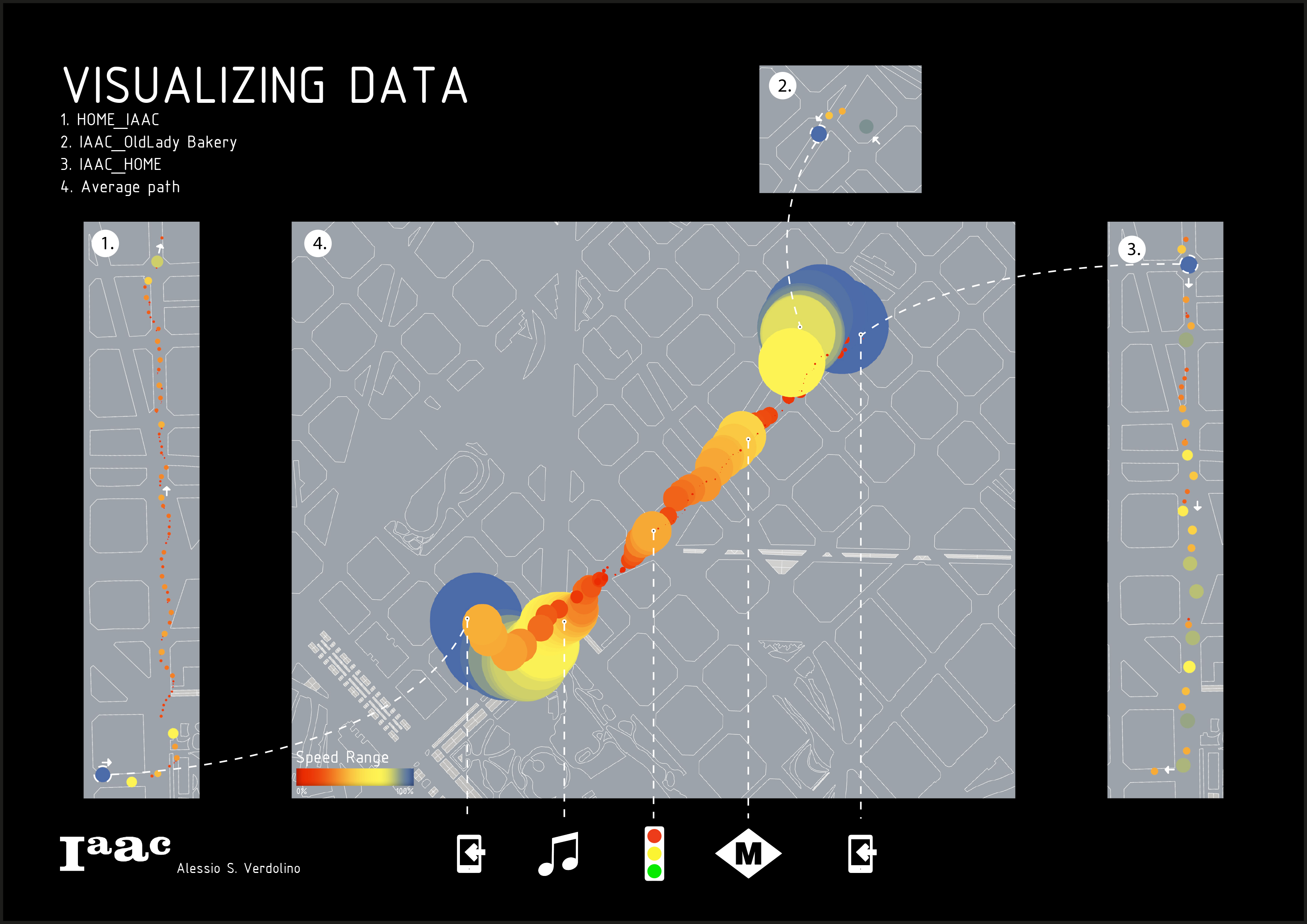
Analyzing, than, the different speeds during the tracking I underline particular event during the path, such as “StratingPoints”, “MusicOn”, “Metro-PathInCompany”, “TrafficLight”, that give us different visualization concerning the “Speed Range”.